
 United Kingdom
 France
 Germany
 Netherlands
 Sweden
 USA
USA
 Italy
Italy
 Spain
Spain
More From Contributor


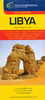

Libya
Waterproof and tear-resistant map, with a small plan of central Tripoli. Altitude colouring is used to convey the general relief, with different patterns representing sand, lava, dunes, hamada, etc. Hydrographic information shows numerous waterholes and wells. Communications network includes restricted private roads, as well as railways and ferry routes. Oil wells and pipelines are also marked. Tourist information includes beaches, oasis, parks and reserves, archaeological sites and other places of interest, plus selected hotels, campsites, rest houses, etc. The index of place names has a glossary of terms used in names of locations and geographical features. Latitude and longitude grid is drawn at intervals of 2
Product Description
Reviews/Comments
Add New
Intelligent Comparison
Archived Product

Libya Stanfords
£8.99
Archived Product
Libya Stanfords
£12.79
Archived Product

Libra Stanfords
£10.99
Archived Product

Lisboa Stanfords
£17.99
Archived Product

Lisboa Stanfords
£17.99
Archived Product

Lisboa Stanfords
£17.99
Vouchers
No voucher codes found.
Do you know a voucher code for this product or supplier? Add it to Insights for others to use.
Do you know a voucher code for this product or supplier? Add it to Insights for others to use.
 Denmark