More From Contributor
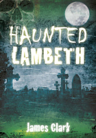
£9.99
Lamabagar, sheet no. 2786-01, in the topographic survey of Nepal at 1:50, 000 published by the Nepali Government in the late 1990s & early 2000s & produced from remote sensing data by Finnish cartographers as part of that country’s international aid program. The maps cover 15’ x 15’ quadrangles.IMPORTANT – PLEASE NOTE BEFORE ORDERING: AVAILABILITY: although, theoretically at least, still in print, these maps are very difficult to get locally in Nepal and/or from various suppliers elsewhere specializing in obtaining such maps. DELIVERIES MAY TAKE SEVERAL WEEKS OR EVEN MONTHS.PROBLEMS WITH PLACE NAMES: reports from previous users indicate that transliteration of place names differs from that used widely not only on other maps & in guide books but also on the ground itself, in road signs & in the tourist & trekking industry in general. Whilst most names are similar enough to be easily recognizable, e.g. Namche Bajar for Namche Bazar or Lantan for Langtang, we have been told of confusion & difficulties arising from different spellings appearing on these maps.TREKKING ROUTES & TOURIST INFORMATION: whilst the maps show foot trails & mark locations of temples, etc, they carry no specific trekking information. Major trekking routes & places of interest are not highlighted. There is no marking for base camps & other tourist facilities. Map specifications: Contours are at 40m intervals, with graphics and/or coloring to show various features of the terrain (glaciers with moraines & crevasses, quarries, gravel or clay pits, etc.) & vegetation (forests, bush, grass, orchards & plantations, etc). Additional comments such as “open mixed forest mainly bajh & pine” annotate many area. The maps have numerous spot heights, but relatively few peaks are named. Areas outside the country’s borders are left blank. Settlements in remote areas are indicated by markings for individual buildings & the placing of names does not always make it clear which group of buildings they refer to. Road network distinguishes between major & minor foot trails. Symbols mark features such as temples, schools & hospitals, police stations, etc. Also shown are the country’s administrative divisions. The maps have a 1-km UTM grid, plus latitude & longitude lines at intervals of 5’. Map legend & all the text is in English. Coverage: the whole country is now covered, with the north at 1:50, 000, plus central & southern Nepal at 1:25, 000. The two series are complementary, do not overlap & use the same grid & numbering system (apart from the Lumbini Zone, where a different grid & numbering are used). For areas not shown on our grid & titles not listed here, please contact us by e-mail, but please do bear in mind the problems with availability & the likely very long delivery time. ...
Archived Product
£12.99
Topographic survey of France at 1:25, 000 in IGN`s excellent TOP25 / Série Bleue series. All the maps are GPS compatible, with a 1km UTM grid plus latitude & longitude lines at 5’ intervals. Contours are at 5m intervals except for mountainous areas where the maps have contours at 10m intervals, vividly enhanced by hill shading & graphics for rocky terrain. Colouring with graphics indicates different types of vegetation or land use (deciduous or coniferous forests, moors, orchards, vineyards, etc). PLEASE NOTE: coverage of France at this scale is currently being revised – the format & the presentation of each title are indicated by the letters at the end of its Sheet Reference number (e.g. 0416ET, 3531ETR, 1923SB, etc.)MAPS WITH FULL TOURIST OVERPRINT & AN ENGLISH MAP LEGEND: all TOP25 maps & the SB editions of Série Bleue have an overprint highlighting waymarked walking trails including long-distance GR routes &, where appropriate, ski routes. Symbols indicate campsites, gîtes d’etape, refuges, equestrian centres & other recreational facilities or sites, tourist information centres, cultural heritage, etc. Towns & locations of particular interest are highlighted.- ET or OT = single-sided TOP25 map covering approx. 29x 21 km / 18x 13 miles.- ETR or OTR = waterproof & tear resistant TOP25 map covering the same area as the corresponding ET or OT number, but double-sided, printed on a smaller size sheet with a good overlap between the sides.- SB = Série Bleue map with full tourist overprint; these maps, first introduced in summer 2014, each cover approx. 29x 24km / 18x 15 miles.SÉRIE BLEUE maps with numbers ending in E (Est) or O (Ouest): most editions now indicate the GR routes, but do not show any other tourist information. Map legend is in French only. Each map covers approx. 14x 20km / 9x 12 miles. ...
Archived Product
£29.95
One of the titles in a series of maps of the administrative departments of Peru, with topography shown by altitude colouring & spot heights. Most maps also indicate cultivated areas. Scales vary considerably, given different sizes of the departments. Railways & four different types of roads & dirt tracks are shown, as well as local airports & aerodromes. The maps also show the subdivisions of the departments into provinces & districts, indicating administrative capital of each unit. Most sheets also include a panel with general information about the state (e.g. population distribution, climate, etc.). Latitude & longitude grid is drawn at 1º intervals, making this series very useful for identifying the locations of small places on the 1:100, 000 topographic survey of the country. Map legend is in Spanish only. Publication dates vary from mid-1980s to mid-1990s, with a handful of titles revised later. Each map shows one department only & no detail of any kind is given for the adjacent departments, beyond their names. ...
Archived Product
£3.50
Lamberhead Green & Orrell Mount in 1907 in a fascinating series of reproductions of old Ordnance Survey plans in the Alan Godfrey Editions, ideal for anyone interested in the history of their neighbourhood or family. The map covers the western part of Pemberton, including Lamberhead Green, & parts of Orrell & Winstanley. Coverage stretches from Enfield Street westward to Orrell station & from Orrell Mount southward to Rylance Mill. Features include a stretch of the Lancashire & Yorkshire Railway (Orrell station is split by the west margin), Winstanley Colliery Railway, Favourite Pony Dick inn, Rylance Mill, moat of Winstanley Hall, Orrell Brick Works, Edge Wood Hall, Orrell Mount, Orrell Council Offices, Orrell Lodge, St John`s church, Lamberhead Green area, St Matthew`s church Highfield (split by east margin), Rose Hill area, tramways & depot, Duke`s Woods, old shafts, Highfield Farm, Highfield House, Sumner`s Hall, Pingot House, etc. On the reverse is a directory of Orrell in 1918. About the Alan Godfrey Editions of the 25” OS Series: Selected towns in Great Britain & Ireland are covered by maps showing the extent of urban development in the last decades of the 19th & early 20th century. The plans have been taken from the Ordnance Survey mapping & reprinted at about 15 inches to one mile (1:4, 340). On the reverse most maps have historical notes & many also include extracts from contemporary directories. Most maps cover about one mile (1.6kms) north/south, one & a half miles (2.4kms) across; adjoining sheets can be combined to provide wider coverage.FOR MORE INFORMATION & A COMPLETE LIST OF ALL AVAILABLE TITLES PLEASE CLICK ON THE SERIES LINK. ...
Archived Product
£12.99
The world of the railways weaves a spell over many people. In this engaging book, railway expert Anthony Lambert presents some of the best stories. From the early days come tales of financial skulduggery & worries that sparks from locomotives might ignite sheep's fleeces. But as the railway transformed the modern world, attitudes changed, & railways were opened to great rejoicing & even religious blessing. The perennial appeal of the steam locomotive generated a pride amongst railwaymen & a fascination among the public. The romantic aspects of the railway were soon celebrated
- & not just the unexpected engagement that came from a snowbound train in the Highlands or the sexual shenanigans of the Orient Express. Here are stories of railway travel, from the palatial carriages of tsars & maharajahs to the open trucks of the 'lower orders', mishaps & faux pas, & tales of how ticket inspectors used to have to hold on to the outside of carriages while clipping tickets. From tales of lonely stations & signal-boxes in Scotl&, to the unlucky engineer eaten by a lion in a carriage in Kenya, Lambert casts his net across railways worldwide to gather the most entertaining material. There are stories here that would enliven even a cheerless commute on the 18.01, & remind you that our railways really were
- & occasionally still are
- full of derring-do, romance & character.


...
Archived Product
£15.95
Lambeth & its Palace, the London residence of the Archbishop of Canterbury, have a long history. Lambeth was also the home of a famous pottery, Vauxhall Motors, & a reviving Festival. On the Lambeth bank of the Thames, the Gunpowder Plot was hatched. & in humdrum Lambeth, the National Theatre was born at the Old Vic, & London`s County Hall built. The new importance of London`s Thames-side South Bank complex, its renovations & the allure of the London Eye have left this area ripe for redevelopment. ...
Archived Product
£12.99
This book aims to give a visual impression of the northern & western parts of the borough of Lambeth as they appeared in the late nineteenth & early twentieth centuries. Starting from the riverside area at the northern end, historically known as Lambeth (as distinct from the much greater extent of the modern borough), the districts covered include also Vauxhall, South Lambeth, Kennington, Stockwell & Clapham. Strictly speaking, the last-mentioned of these is an odd one out, since only with the local government reorganisation of 1964 did Clapham become part of Lambeth, having always previously been in Wandsworth. The photographs range in date through several generations from the mid-1860s to the Second World War. This book is a must-have for any visitor or resident wanting to understand the origins of Lambeth. ...
Archived Product
£17.99
Topographic survey of Portugal at 1:50, 000 from the Instituto Geográfico do Exército, the country’s military survey organisation. The maps have contours at 20m intervals & in addition to the standard features shown on topographic mapping at this scale also indicate various types of terrain or vegetation (s&, terraces, rocks, woodlands, vineyards, etc). Each sheet covers an area of 32 x 20km (20 x 12.5 miles approx). The maps have a 1-km UTM grid plus latitude & longitude coordinates for the map corners. Map legend & a glossary of terms used on the maps include English.EDITION DATES: most titles in this series date from 1990s or later. To see all the titles in this series please click on the series link. ...
Archived Product
£17.99
Topographic survey of Portugal at 1:100, 000 from the Instituto Geográfico Português, the country’s civilian survey organisation. The maps have contours at 50m intervals & in addition to the standard features shown on topographic mapping at this scale also indicate various types of vegetation (vineyards, olive groves, etc). Each sheet covers an area of 64 x 40km (40 x 25 miles approx). The maps have latitude & longitude margin ticks at 1’ intervals, plus show UTM coordinates for the map corners. Map legend is in Portuguese only.PLEASE NOTE
- EDITION DATES: some sheets at this scale date back to the 1950s or 1960s. For more recent editions please see IGP’s 1:25, 000 series where each 50K map is divided into four quarters. To see all the titles in the 1:100, 000 series please click on the series link.
...
Archived Product
£17.99
Topographic survey of Portugal at 1:50, 000 from the Instituto Geográfico Português, the country’s civilian survey organisation. The maps have contours at 25m intervals & in addition to the standard features shown on topographic mapping at this scale also indicate various types of vegetation (vineyards, olive groves, etc). Each sheet covers an area of 32 x 20km (20 x 12.5miles approx). The maps have latitude & longitude margin ticks at 1’ intervals & UTM coordinates for the map corners – each sheet also shows conversion details from BBLx (Bessel-Bonnie system, Datum Lisbon) to UTM. Map legend is in Portuguese only.EDITION DATES: most titles in this series have now been updated in the 1990s or later. To see all the titles in this series please click on the series link. ...
Archived Product

Lambeth - Haunted

Haunted Lambeth is a collection of real-life stories of apparitions and poltergeists from all across the London Borough of Lambeth. Included are the ghost stories of Lambeth Palace, the terrifying tradition of the `Tomb of the Tradescants`, a ghost at The Old Vic Theatre, the dream house that haunted the entertainer Roy Hudd, supernatural echoes of Waterloo`s Necropolis Railway, the ghosts of Ruth Ellis and others at Streatham`s Caesar`s Nightclub. These stories have been collected and researched over many years, and come from a variety of sources including original newspaper articles, books and, as often as possible, personal communication with people directly involved.
RIP - This product is no longer available on our network. It was last seen on 25.09.2019

This page now acts as a permanent archive for this product. Add more information using the comments box below to ensure it can still be found by future generations.

Use our search facility to see if it is available from an alternative contributor.
  • Availability: Out Of Stock
  • Supplier: Stanfords
  • SKU: 9780752485775
Availability: In Stock
£9.99

Product Description

Haunted Lambeth is a collection of real-life stories of apparitions & poltergeists from all across the London Borough of Lambeth. Included are the ghost stories of Lambeth Palace, the terrifying tradition of the ` Tomb of the Tradescants`, a ghost at The Old Vic Theatre, the dream house that haunted the entertainer Roy Hudd, supernatural echoes of Waterloo`s Necropolis Railway, the ghosts of Ruth Ellis & others at Streatham`s Caesar`s Nightclub. These stories have been collected & researched over many years, & come from a variety of sources including original newspaper articles, books &, as often as possible, personal communication with people directly involved.

Reviews/Comments

Add New

Intelligent Comparison

Oooops!
We couldn't find anything!
Perhaps this product's unique.... Or perhaps we are still looking for comparisons!
Click to bump this page and we'll hurry up.

Price History

Vouchers

No voucher codes found.
Do you know a voucher code for this product or supplier? Add it to Insights for others to use.

Facebook

Jargon Buster

Personal - Something that belongs more to an individual due to it affecting them more by relating to them.

Supplier Information

Stanfords
Stanfords was established in 1853 and opened their iconic Covent Garden flagship store in 1901. They have become the top retailer of maps, travel books and accessories in the UK and arguably offer the largest selection of maps and travel books worldwide. Famous names such as Captain Robert Falcon Scott, Ranulph Fiennes and Michael Palin have purchased from Stanfords. They now have a shop in Bristol and both stores together with other venues operate a calendar of events including talks, book signings and exhibitions. As a specialist map retailer, the map selection is comprehensive and includes road maps, street maps and walking maps from worldwide destinations, as well as a selection of world atlases and wall maps. Books include travel guides and travel literature. Stanfords also stock globes, from miniatures made of blue marble to magnificent floor-standing globes. The website features a selection of interesting articles on travel topics.
Page Updated: 2023-11-12 20:15:36

Community Generated Product Tags

Oh No! The productWIKI community hasn't generated any tags for this product yet!
Menu