
 United Kingdom
 France
 Germany
 Netherlands
 Sweden
 USA
USA
 Italy
Italy
 Spain
Spain
More From Contributor


Kenya ITMB
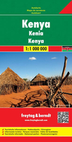
Kenya at 1:920, 000 on a waterproof and tear-resistant, double-sided indexed road map from ITMB, with a street plan of central Nairobi. The map divides the country north/south along the equator, with generous overlap on both sides. Topography is shown by bright altitude colouring with contours at 500 feet intervals; heights of most peaks are given in metres, with some in feet and others in both metres and feet. Many other geographical features also marked: lava fields, dry lakes and salt flats, wetland or marshes, areas of seasonal inundation, sot springs, wells and waterfalls, coral reefs, etc. National park and other protected areas are highlighted.Road information includes unsurfaced tracks and location of petrol stations. Driving distances are shown on selected main routes.
Railway lines are included and local airports are marked. A range of symbols indicate various places of interest, including UNESCO cultural and natural heritage sites. The maps has an index of place names and shows latitude and longitude at 1º intervals. The street plan of central Nairobi shows locations of several hotels, as well as various places of interest and facilities.
Railway lines are included and local airports are marked. A range of symbols indicate various places of interest, including UNESCO cultural and natural heritage sites. The maps has an index of place names and shows latitude and longitude at 1º intervals. The street plan of central Nairobi shows locations of several hotels, as well as various places of interest and facilities.

Product Description
Reviews/Comments
Add New
Intelligent Comparison
Archived Product
Kenya F&B Stanfords
£10.99
Archived Product

Vietnam ITMB Stanfords
£9.99
Vouchers
No voucher codes found.
Do you know a voucher code for this product or supplier? Add it to Insights for others to use.
Do you know a voucher code for this product or supplier? Add it to Insights for others to use.
 Denmark