More From Contributor
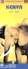
£7.99
Kenya in the Pocket Guide series from Insight provides detailed commentary on a collection of itinerary based trips in a handy pocket format. The guide has an historical & cultural introduction, profiling the growth of the country. There is also a large selection of localised & pedestrian friendly tour itineraries & excursions designed to take in the major sites. Further sections detail leisure activities including shopping, eating out, nightlife, festivals & local events with accompanying addresses & contact details where relevant. There is also practical guidance on transport, local services, language & accommodation. Each guide also has a large selection of colour photographs & a pull-out pocket map. ...
Archived Product
£9.99
Kenya at 1:920, 000 on a waterproof & tear-resistant, double-sided indexed road map from ITMB, with a street plan of central Nairobi. The map divides the country north/south along the equator, with generous overlap on both sides. Topography is shown by bright altitude colouring with contours at 500 feet intervals; heights of most peaks are given in metres, with some in feet & others in both metres & feet. Many other geographical features also marked: lava fields, dry lakes & salt flats, wetland or marshes, areas of seasonal inundation, sot springs, wells & waterfalls, coral reefs, etc. National park & other protected areas are highlighted. Road information

Includes::
unsurfaced tracks & location of petrol stations. Driving distances are shown on selected main routes. Railway lines are included & local airports are marked. A range of symbols indicate various places of interest, including UNESCO cultural & natural heritage sites. The maps has an index of place names & shows latitude & longitude at 1º intervals. The street plan of central Nairobi shows locations of several hotels, as well as various places of interest & facilities.

...
Archived Product
£4.99
Kenya in the Pocket Guide series from Berlitz; a collection of handy, pocket-sized guides dedicated to an extensive range of cities, regions & countries worldwide. Written in narrative form, individual guides explore the history, main sights & attractions, food & drink, accommodation & local culture of the destination in detail. Each Berlitz pocket guide has a similar format, with colour-coded sections helping readers locate information quickly in addition to distinctive chapters exploring the city or region. An introduction outlines the destination for visitors & a section dedicated to 'A Brief History' actually explores the area in relative depth. A where to go chapter is organized by region & city & is written in prose form with references to individual sites highlighted in bold for clarity. There are also further suggestions on where & when to eat. Recommendations for leisure activities in the region, including sport, nightlife & shopping, are also provided & tailored accordingly for each destination. Handy travel tips are listed alphabetically in a dedicated section, providing practical guidance & helping visitors make the most of their stay. The main hotels, particularly for cities, are also listed in an accommodation section, offering a brief overview with approximate price bandings & relevant contact details. ...
Archived Product
£5.99
Kenya in the Pocket Guide series from Berlitz; a collection of handy, pocket-sized guides dedicated to an extensive range of cities, regions & countries worldwide. Written in narrative form, individual guides explore the history, main sights & attractions, food & drink, accommodation & local culture of the destination in detail. Each Berlitz pocket guide has a similar format, with colour-coded sections helping readers locate information quickly in addition to distinctive chapters exploring the city or region. An introduction outlines the destination for visitors & a section dedicated to 'A Brief History' actually explores the area in relative depth. A where to go chapter is organized by region & city & is written in prose form with references to individual sites highlighted in bold for clarity. There are also further suggestions on where & when to eat. Recommendations for leisure activities in the region, including sport, nightlife & shopping, are also provided & tailored accordingly for each destination. Handy travel tips are listed alphabetically in a dedicated section, providing practical guidance & helping visitors make the most of their stay. The main hotels, particularly for cities, are also listed in an accommodation section, offering a brief overview with approximate price bandings & relevant contact details. ...
Archived Product
£11.50
Reise Know-How maps (world mapping project series) are easy-to-read, waterproof & highly durable travel maps specifically designed for everyday use on the road. The maps combine state-of-the-art, GPS-compatible cartography (including hypsometric tints & contour lines) with a detailed rendering of road networks & touristic information. They offer the best possible scale, level of detail & readability, be it a map of a small island or half a continent. The maps feature a detachable paper sleeve so that the maps can be folded easily & fit in every pocket. Although printed on plastic, a special coating makes sure the maps retain a paper-like feel & can even be written on with a pencil. This is the 5th edition of this publication & it covers the whole of Kenya. ...
Archived Product
£14.95
Map No. M-5B in the TPC series: military topographic survey mapping covering the world's land masses & significant islands at 1:500, 000. The maps are useful as general topographical coverage where nothing else is available, although they are designed primarily as flying charts for military aircraft. TPC stands for Tactical Pilotage Chart. Relief is portrayed by a combination of contours (basic interval 500ft, intermediate contours shown where appropriate), elevation tinting & relief shading, plus spot heights. Towns, villages, major roads, railways & airports are shown but please note that many of the smaller settlements are not named & the road information is not necessarily up to date, as compilation & revision dates vary. Some air navigation information also appears on the map, such as radio beacons & restricted flying zones. Each TPC chart has both UTM & latitude/longitude grids overprinted on it, with additional margin ticks. IMPORTANT
- PLEASE NOTE: The series is gradually being withdrawn from sale to the general public & some sheets may no longer be available when ordered by us. Due to the nature of the map projection assembling these sheets to make a larger map is not recommended. in addition, colours used for relief are not constant throughout the series. In some areas of central Africa & South America the maps have blank spaces, reflecting localized deficiencies or inconsistencies in the survey data.
...
Archived Product
£14.95
Map No. M-5A in the TPC series: military topographic survey mapping covering the world's land masses & significant islands at 1:500, 000. The maps are useful as general topographical coverage where nothing else is available, although they are designed primarily as flying charts for military aircraft. TPC stands for Tactical Pilotage Chart. Relief is portrayed by a combination of contours (basic interval 500ft, intermediate contours shown where appropriate), elevation tinting & relief shading, plus spot heights. Towns, villages, major roads, railways & airports are shown but please note that many of the smaller settlements are not named & the road information is not necessarily up to date, as compilation & revision dates vary. Some air navigation information also appears on the map, such as radio beacons & restricted flying zones. Each TPC chart has both UTM & latitude/longitude grids overprinted on it, with additional margin ticks. IMPORTANT
- PLEASE NOTE: The series is gradually being withdrawn from sale to the general public & some sheets may no longer be available when ordered by us. Due to the nature of the map projection assembling these sheets to make a larger map is not recommended. in addition, colours used for relief are not constant throughout the series. In some areas of central Africa & South America the maps have blank spaces, reflecting localized deficiencies or inconsistencies in the survey data.
...
Archived Product
£8.99
Kenya`s Beaches in the Footprint Focus Guides, which are targeted at cities, regions & countries worldwide that have no, or very limited, coverage from other publishers. Widely recognised for their reliability & independent writing style, Footprint Focus guides all have the same layout. Smaller than their sister Handbooks, the Focus guides are intended to streamline the information contained so that you have more of what you need, without losing Footprint’s signature unrestrictive editorial style that gives authors the freedom to capture & explore local cultures, sights & areas that are often not covered in other guides. An introductory section introduces the reader to the destination, with chapters on planning on your trip & essentials, including practical information & guidance on subjects such as when & where to go, itineraries, sport & activities, arts, getting there & around, eating & drinks, sleeping & a dedicated section on the anticipated carbon footprint involved in travelling to the destination. Essentially a condensed, straight-to-the-point version of their Handbook series. “ Sets the pace for all the rest to follow” Michael Palin ...
Archived Product
£7.99
The 76-km long Kepler Track in the Fiordland National Park on New Zealand’s South Island at 1:55, 000 in a series of contoured & GPS compatible maps from New Topo NZ Ltd, with exceptionally vivid presentation of the terrain, routes clearly highlighted, & symbols to show locations of various facilities. Contour interval is 20m. Maps in the series from New Topo NZ Ltd cover the country’s popular hiking & tramping areas. The maps have contours (20m in most titles
- please confirm in the individual description) enhanced by relief shading, plus colouring and/or graphics to indicate various types of the terrain & vegetation: glaciers, scree, lava flows, shingle, s&, swamps, exotic forest, scrub, native bush, etc. The overprint for the routes distinguishes, as appropriate, between tramping tracks & routes, walking tracks, & waymarked or unmarked trails. Symbols show facilities such huts, campsites, public toilets, viewpoints, car parks, etc. Where useful, the maps also have brief notes about hut reservations. All the titles are GPS compatible, most with a 1-km NZ national grid (GPS users can uses WGS84). To see all the titles in this series please click on the series link.
...
Archived Product
£10.39
Kerala in the Countries, Regions & Cities series from Rough Guides; comprehensively detailed guidebooks specifically designed for independent travellers & serving a range of worldwide destinations. Widely recognised for their free editorial style, Rough Guide authors are allowed to express their personal opinions on a range of subjects. Although sometimes controversial, this editorial stance allows readers to experience more detailed & personal takes on each destination, a feature often more limited in other guidebooks. Cultural & historical nuances are explored in significant depth throughout the text & descriptions on the ambience of individual settings alongside personal recommendations, particularly in cities, are notably prevalent. Each Rough Guide in the Countries, Regions & Cities series has a similar layout. A ...
Archived Product

Kenya SUPERCEDED

Travellers Kenya takes you to the heart of a nation at the crossroads of Africa, home to one of the world's greatest reservoirs of wildlife, with an extraordinary variety of natural habitats, from coral reefs to open grassland and tropical forest and a richly diverse cultural heritage.It provides expert advice, tracking down the best sights and experiences. It offers a detailed background on people, geography, culture and history, including features on the Kiyuku, markets and African food. It provides clear and accurate mapping for orientation at country, regional and city levels. It describes suggested walks and tours to somewhere a little different, including a hike on Mount Kenya, a walk around Mombasa Old Town and a boat tour of Manda's mangrove swamps. It offers impartial
and dependable sleeping, eating and entertainment listings.It includes a directory section listing shops, child-friendly attractions, sporting activities and practical information to help you make the most out of your trip. It is in full colour throughout, with over 150 photographs.It provides comprehensive coverage of the best of the destination, including: Nairobi, the Rift Valley and Central Highlands, Western Kenya, the coast, Mombasa Islands, Manda's mangroves and northern Kenya.
RIP - This product is no longer available on our network. It was last seen on 25.09.2019

This page now acts as a permanent archive for this product. Add more information using the comments box below to ensure it can still be found by future generations.

Use our search facility to see if it is available from an alternative contributor.
  • External links may include paid for promotion
  • Availability: Out Of Stock
  • Supplier: Stanfords
  • SKU: 9781841579917
Availability: In Stock
£9.99

Product Description

Travellers Kenya takes you to the heart of a nation at the crossroads of Africa, home to one of the world's greatest reservoirs of wildlife, with an extraordinary variety of natural habitats, from coral reefs to open grassland & tropical forest & a richly diverse cultural heritage. It provides expert advice, tracking down the best sights & experiences. It offers a detailed background on people, geography, culture & history, including features on the Kiyuku, markets & African food. It provides clear & accurate mapping for orientation at country, regional & city levels. It describes suggested walks & tours to somewhere a little different, including a hike on Mount Kenya, a walk around Mombasa Old Town & a boat tour of Manda's mangrove swamps. It offers impartial & dependable sleeping, eating & entertainment listings. It

Includes::
a directory section listing shops, child-friendly attractions, sporting activities & practical information to help you make the most out of your trip. It is in full colour throughout, with over 150 photographs. It provides comprehensive coverage of the best of the destination, including: Nairobi, the Rift Valley & Central Highlands, Western Kenya, the coast, Mombasa Islands, Manda's mangroves & northern Kenya.

Reviews/Comments

Add New

Intelligent Comparison

Oooops!
We couldn't find anything!
Perhaps this product's unique.... Or perhaps we are still looking for comparisons!
Click to bump this page and we'll hurry up.

Price History

Vouchers

No voucher codes found.
Do you know a voucher code for this product or supplier? Add it to Insights for others to use.

Facebook

Jargon Buster

Forest - A area with a high density of trees
History - Anything that happens in the past. An acedemic subject.
World - A physical grouping, commonly used to describe earth and everything associated with ti
Entertainment - Something that provides amusement
Colour - The categorised spectrum of light visable to humans
Heart - An organ that pumps blood around the body. Usually related to love.
Natural - not manmade
Accurate - A measurement of precision when all elements are correct.
Tropical - Coming fro the work "tropics" a hot and humid area of the world.
Home - A place of permanent residence for families.
Practical - Weather a task is easy to carry out and realistically succeed.
Regional - An adjective to describe a set geographic area.

Supplier Information

Stanfords
Stanfords was established in 1853 and opened their iconic Covent Garden flagship store in 1901. They have become the top retailer of maps, travel books and accessories in the UK and arguably offer the largest selection of maps and travel books worldwide. Famous names such as Captain Robert Falcon Scott, Ranulph Fiennes and Michael Palin have purchased from Stanfords. They now have a shop in Bristol and both stores together with other venues operate a calendar of events including talks, book signings and exhibitions. As a specialist map retailer, the map selection is comprehensive and includes road maps, street maps and walking maps from worldwide destinations, as well as a selection of world atlases and wall maps. Books include travel guides and travel literature. Stanfords also stock globes, from miniatures made of blue marble to magnificent floor-standing globes. The website features a selection of interesting articles on travel topics.
Page Updated: 2023-11-12 20:15:36

Community Generated Product Tags

Oh No! The productWIKI community hasn't generated any tags for this product yet!
Menu