
 United Kingdom
 France
 Germany
 Netherlands
 Sweden
 USA
USA
 Italy
Italy
 Spain
Spain
More From Contributor


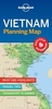

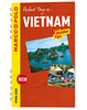

Vietnam ITMB
Vietnam on an indexed, double-sided map at 1:900, 000 from ITMB, a company which, although based in Vancouver, has strong Vietnamese connections and uses local cartographers to produce many of their titles. The map includes several street plans and enlargements.The map divides the country north/south, with an overlap between the sides. Altitude colouring shows the topography, with numerous peaks and spot heights in mountainous areas. Swap areas are also marked. National parks and other protected areas are highlighted. Road network includes selected local roads, tracks and trails, with driving distances on main routes and locations of border crossings. Various routes of the Ho Chi Minh Trail are highlighted. Railway lines and local airports are included. The map indicates numerous
places of interest, both historic sites and natural curiosities, some annotated with brief descriptions. Latitude and longitude lines are drawn at intervals of 1°. Each side of the map is indexed separately.Additional panels, placed on the appropriate side of the map, present:* Street plans of central Hanoi, Ho Chi Minh City (Saigon), Hue, Da Nang, Can Tho and Hoi An, showing selected hotels and guest houses, various sights and facilities.* Enlargements showing the Greater Hanoi area, plus the environs of Hue indicating locations of various temples and tombs.* An enlargement of the Phu Quoc Island at 1:200, 000.* An administrative map of the country showing the division into provinces.
places of interest, both historic sites and natural curiosities, some annotated with brief descriptions. Latitude and longitude lines are drawn at intervals of 1°. Each side of the map is indexed separately.Additional panels, placed on the appropriate side of the map, present:* Street plans of central Hanoi, Ho Chi Minh City (Saigon), Hue, Da Nang, Can Tho and Hoi An, showing selected hotels and guest houses, various sights and facilities.* Enlargements showing the Greater Hanoi area, plus the environs of Hue indicating locations of various temples and tombs.* An enlargement of the Phu Quoc Island at 1:200, 000.* An administrative map of the country showing the division into provinces.

Product Description
Reviews/Comments
Add New
Vouchers
No voucher codes found.
Do you know a voucher code for this product or supplier? Add it to Insights for others to use.
Do you know a voucher code for this product or supplier? Add it to Insights for others to use.
 Denmark