
 United Kingdom
 France
 Germany
 Netherlands
 Sweden
 USA
USA
 Italy
Italy
 Spain
Spain
More From Contributor


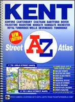
Kent A-Z Street Atlas
Kent Street Atlas from the Geographers` A-Z Map Company covering selected parts of the county, including the whole of its western part, at 1:20, 267 (3” to 1 mile). The whole county with central London is also covered at 1:63.360 (1” to 1 mile). More detailed mapping at 1:10, 135 (6.25” to 1 mile) shows in greater detail town centres of Ashford, Bromley, Canterbury, Chatham, Dover, Folkestone, Gillingham, Maidstone, Margate, Rochester and Tunbridge Wells. Also provided are maps of the Channel Tunnel road approaches and terminals in Folkestone and Calais. Current edition was published in 2013.To see other titles in this series of A-Z county street atlases please click on the series link. A-Z also publish street atlases in a smaller A5 paperback format covering towns and
cities with their surrounding areas - for a list of titles in that series please search for SI00000932.Most A-Z county street atlases are in a spiral-bound format just smaller than A4 size, Most titles offer coverage of only the built-up areas, with selected titles covering the whole county - as indicated in the individual descriptions and our area coverage images. Motorways plus A and B roads are highlighted by colouring and show route numbers. One way or restricted access streets, Park & Ride facilities and selected car parks are marked, as are locations of speed cameras. Also shown are selected cycleway routes. Where appropriate, A and B roads are annotated with selected house numbers for easier identification of addresses. Railway lines are shown with stations and level crossings.
Colouring indicates different types of buildings: educational, hospitals and healthcare, industrial, leisure and recreational, shopping centres and markets, public buildings, and places of interest. Symbols mark locations of facilities usually indicated on street mapping: post offices, emergency services, public toilets, etc. Also marked are postcode and local authority boundaries. Each page has the lines and coordinates of the British National Grid. All the titles have a comprehensive index including, unless specified to the contrary in the description, separate entries for places of interest such as cultural and sport or recreational facilities, historical sites, nature reserves and gardens. Many titles include a separate list of hospitals and hospices in the area covered by
the atlas.

Product Description
Reviews/Comments
Add New
Intelligent Comparison
Archived Product
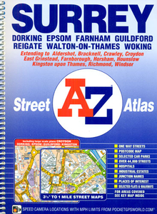
Surrey A-Z Street Atlas Stanfords
£13.95
Archived Product
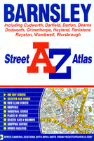
Barnsley A-Z Street Atlas Stanfords
£3.95
Archived Product

Durham A-Z Street Atlas Stanfords
£4.95
Archived Product
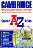
Cambridge A-Z Street Atlas Stanfords
£4.95
Archived Product

Edinburgh A-Z Street Atlas Stanfords
£5.95
Archived Product
Nairobi A-Z Street Atlas Stanfords
£17.50
Archived Product
Vienna Street Atlas Stanfords
£9.95
Archived Product
Isle Of Wight A-Z Street Atlas Stanfords
£4.95
Vouchers
No voucher codes found.
Do you know a voucher code for this product or supplier? Add it to Insights for others to use.
Do you know a voucher code for this product or supplier? Add it to Insights for others to use.
 Denmark