More From Contributor
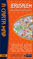
£5.99
From the momentous to the outlandish, this little book brings together past & present to offer a taste of Jersey. Learn about the movers & shakers who shaped this fantastic isl&. The great & the good; the bad & the ugly. Small wonders, tall stories, triumph & tragedy. Best places
- worst places. Origins, evolution, future. Written by a local who knows what makes Jersey tick.
...
Archived Product
£8.99
` He looks like a Brit, this guy. Full of good intentions & bad ideas`. Straddling two continents & two centuries, Patrick Neate`s ” Jerusalem” is a sweeping & hilarious epic of English misadventures abroad & at home. It features a self-serving MP lost & alone in an African dictatorship; a young, ultra-hip entrepreneur looking for something (or someone) new to exploit; &, an English veteran of a colonial war trying to save England from itself. With a host of other brilliant & brilliantly drawn characters, this is the funniest & most moving story of Englishness as it never was, isn`t now &, hopefully, will never be. ...
Archived Product
£7.99
Indexed street map of Jerusalem at 1:13, 000, with an enlargement of the city centre & a smaller map showing the environs of Jerusalem at 1:100, 000. The cartography is clear with bold colouring & places of interest such as places of worship & the numerous holy sites clearly indicated. Districts are also clearly marked. The enlargement of the city centre shows streets in greater detail, with many more street & passageway names; the various steps & entrances to the Temple Mount are shown also. The map showing the environs of Jerusalem shows the major road network & extends to Bethlehem & Atardt airport. The map is comprehensively indexed on the reverse of the map, with museums, sights, places of worship, & other places of interest included with the street names. Map index & legend

Includes::
English.

...
Archived Product
£9.50
Indexed overview map of the city, highlighting access & main routes across it. Coverage extends from Qiryat Hadassa Medical Centre west of Yad Vashem to Mount of Olives. Northern & southern suburbs are shown as insets, as indicated on the area scan. Synagogues, mosques & churches are highlighted & a small enlargement is provided for the Old City, but the map cannot be recommended for tourist visitors. All place names are in Roman alphabet. Map legend is in English. Extensive street index

Includes::
lists of places of interest, places of worship, government buildings & public institutions, hotels, etc.

...
Archived Product
£13.50
Clear street plan, with enlargements for the Old City & the central area, plus notes on main places of interest, accommodation, restaurants, etc. The main map covers the city with its suburbs, extending from Yad Vashem & the surrounding districts to Mount of Olives & the Hebrew University (Mount Scopus). North-south coverage is from Neve Ya'akov (with Atarot Industrial Zone as an inset) to Khomat Shmu ...
Archived Product
£10.39
Jerusalem in the Countries, Regions & Cities series from Rough Guides; comprehensively detailed guidebooks specifically designed for independent travellers & serving a range of worldwide destinations. Widely recognised for their free editorial style, Rough Guide authors are allowed to express their personal opinions on a range of subjects. Although sometimes controversial, this editorial stance allows readers to experience more detailed & personal takes on each destination, a feature often more limited in other guidebooks. Cultural & historical nuances are explored in significant depth throughout the text & descriptions on the ambience of individual settings alongside personal recommendations, particularly in cities, are notably prevalent. Each Rough Guide in the Countries, Regions & Cities series has a similar layout. A ...
Archived Product
£8.99
Jerusalem in the Footprint Focus Guides, which are targeted at cities, regions & countries worldwide that have no, or very limited, coverage from other publishers. Widely recognised for their reliability & independent writing style, Footprint Focus guides all have the same layout. Smaller than their sister Handbooks, the Focus guides are intended to streamline the information contained so that you have more of what you need, without losing Footprint ...
Archived Product
£27.00
Yotam Ottolenghi, well known for his excellent recipes which add a twist of adventure to ordinary ingredients, returns to his native Jerusalem to produce with his friend Sami Tamimi a lovely & interesting cookery book. Given the background of their families, Yotan grew up the Jewish west part of the city while Sami was a child in Muslim east Jerusalem, the books draws on both culinary cultures. As you’d expect chicken soup with knaidlach or latkes are there, but so is baba ghanoush & other Middle Eastern specialities. Like in most Ottolenghi recipes, lists of ingredients are often long but the rewards are well worth the effort. The book is illustrated with nice, not-too-intimidating photos of the dishes & of food-related scenes in the city itself. ...
Archived Product
£7.99
Jerusalem on a street plan from the locally based Carta, prominently highlighting historical locations & important institutions, plus separate enlargements of the central districts & of the Old Town, indexes of streets & suburbs/neighbourhoods, & lists of sights & various institutions. The main plan covers the city with its outer districts, with insets showing the settlements of Homat Shmuel (Har Homa) & East Pisgat Ze’ev. Coverage

Includes::
Mount Herzl & Yad Vashem. Main traffic arteries are highlighted, one way streets or pedestrianized areas are marked, & the plan also shows locations of petrol stations. The route of the light railway line is shown with stops. Various institutions & places of interest are highlighted & named, many shown by small drawings. Next to the main plan is an enlargement showing in greater detail Jerusalem’s central districts between the Old City & the institutions around the Knesset, Israel Museum & the Hebrew University. On the reverse is large, very clear plan of the Old City, a street index, plus a list of various sites & institutions including suburbs & neighbourhoods, synagogues & other places of worship, museums & cultural centres, cemeteries, etc. Also provided is a small map showing the Jerusalem municipal area. All place names are in the Latin alphabet only.

...
Archived Product
£9.99
Waterproof & tear-resistant map from ITMB combining an indexed street plan of Jerusalem with a more detailed enlargement of its Old City, plus on the reverse a road map at 1:225, 000 covering the Holy Land: northern Israel & the Palestinian Territories. On both the plans & the road map all place names are shown only in Latin alphabet. Within Jerusalem’s Old City sites of religious importance are given their alternative names. On one side is coverage of Jerusalem. The city with its outer districts is shown on an indexed plan at 1:10, 000. On the eastern side of the Old City the plan

Includes::
the Mount of Olives & Mount Scopus; in the west it extends beyond the government district & the museum/university quarter but does not include Yad Vashem or Mount Herzl. Main traffic routes are highlighted & locations of petrol stations & car parks are marked. The Jerusalem light rail route is shown with stops. The plan highlights numerous places of interest & facilities, including selected hotels, embassies, museums & other cultural or educational institutions, places of worship, Israeli governmental buildings, etc. Accompanying the main plan are three additional panels: a large, very clear enlargement at 1:4, 000 showing the Old City in much greater detail, including the Stations of the Cross on Via Dolorosa; a road map of the city’s environs including Bethlehem & Jericho, indicating the course of the Separation Barrier at the time of the map’s publication in 2014; plus a diagram of the existing & proposed light rail lines within the whole of Israel. The reverse side is covered by an indexed road map of most of Israel at 1:225, 000, extending south to Rahat & the southern boundary of the West Bank (i.e. along the Dead Sea Masada & Ein Bokek are not included). The map has altitude colouring to show the topography, including the depression along the Jordan & the Dead Sea. National parks & other protected areas are marked. Road network indicates driving distances on main & selected secondary routes. Names of road junctions are not included. Railway lines marked, with a separate diagram of the network, & local airports are also shown. Towns with tourist accommodation are highlighted & symbols mark various other places of interest including campsites & youth hostels, archaeological sites, etc. Latitude & longitude lines are drawn at intervals of 10’. The map gives no indication which areas are now under the direct rule by the Palestinian authorities & the Separation Barrier is not marked.

...
Archived Product

Jerusalem

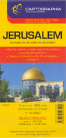
Clear street plan, with enlargements for the Old City and the central area, plus notes on main places of interest, accommodation, restaurants, etc. The main map covers the city with its suburbs, extending from Yad Vashem and the surrounding districts to Mount of Olives and the Hebrew University (Mount Scopus). North-south coverage is from Neve Ya'akov (with Atarot Industrial Zone as an inset) to Khomat Shmu
RIP - This product is no longer available on our network. It was last seen on 25.09.2019

This page now acts as a permanent archive for this product. Add more information using the comments box below to ensure it can still be found by future generations.

Use our search facility to see if it is available from an alternative contributor.
  • Availability: Out Of Stock
  • Supplier: Stanfords
  • SKU: 0039600003555
Availability: In Stock
£13.50

Product Description

Clear street plan, with enlargements for the Old City & the central area, plus notes on main places of interest, accommodation, restaurants, etc. The main map covers the city with its suburbs, extending from Yad Vashem & the surrounding districts to Mount of Olives & the Hebrew University (Mount Scopus). North-south coverage is from Neve Ya'akov (with Atarot Industrial Zone as an inset) to Khomat Shmu

Reviews/Comments

Add New

Price History

Vouchers

No voucher codes found.
Do you know a voucher code for this product or supplier? Add it to Insights for others to use.

Facebook

Jargon Buster

Accommodation - A room in which someone can live in, for example in a hotel

Supplier Information

Stanfords
Stanfords was established in 1853 and opened their iconic Covent Garden flagship store in 1901. They have become the top retailer of maps, travel books and accessories in the UK and arguably offer the largest selection of maps and travel books worldwide. Famous names such as Captain Robert Falcon Scott, Ranulph Fiennes and Michael Palin have purchased from Stanfords. They now have a shop in Bristol and both stores together with other venues operate a calendar of events including talks, book signings and exhibitions. As a specialist map retailer, the map selection is comprehensive and includes road maps, street maps and walking maps from worldwide destinations, as well as a selection of world atlases and wall maps. Books include travel guides and travel literature. Stanfords also stock globes, from miniatures made of blue marble to magnificent floor-standing globes. The website features a selection of interesting articles on travel topics.
Page Updated: 2023-11-12 20:15:36

Community Generated Product Tags

Oh No! The productWIKI community hasn't generated any tags for this product yet!
Menu