More From Contributor

£13.50
Clear street plan, with enlargements for the Old City & the central area, plus notes on main places of interest, accommodation, restaurants, etc. The main map covers the city with its suburbs, extending from Yad Vashem & the surrounding districts to Mount of Olives & the Hebrew University (Mount Scopus). North-south coverage is from Neve Ya'akov (with Atarot Industrial Zone as an inset) to Khomat Shmu ...
Archived Product
£10.39
Jerusalem in the Countries, Regions & Cities series from Rough Guides; comprehensively detailed guidebooks specifically designed for independent travellers & serving a range of worldwide destinations. Widely recognised for their free editorial style, Rough Guide authors are allowed to express their personal opinions on a range of subjects. Although sometimes controversial, this editorial stance allows readers to experience more detailed & personal takes on each destination, a feature often more limited in other guidebooks. Cultural & historical nuances are explored in significant depth throughout the text & descriptions on the ambience of individual settings alongside personal recommendations, particularly in cities, are notably prevalent. Each Rough Guide in the Countries, Regions & Cities series has a similar layout. A ...
Archived Product
£8.99
Jerusalem in the Footprint Focus Guides, which are targeted at cities, regions & countries worldwide that have no, or very limited, coverage from other publishers. Widely recognised for their reliability & independent writing style, Footprint Focus guides all have the same layout. Smaller than their sister Handbooks, the Focus guides are intended to streamline the information contained so that you have more of what you need, without losing Footprint ...
Archived Product
£27.00
Yotam Ottolenghi, well known for his excellent recipes which add a twist of adventure to ordinary ingredients, returns to his native Jerusalem to produce with his friend Sami Tamimi a lovely & interesting cookery book. Given the background of their families, Yotan grew up the Jewish west part of the city while Sami was a child in Muslim east Jerusalem, the books draws on both culinary cultures. As you’d expect chicken soup with knaidlach or latkes are there, but so is baba ghanoush & other Middle Eastern specialities. Like in most Ottolenghi recipes, lists of ingredients are often long but the rewards are well worth the effort. The book is illustrated with nice, not-too-intimidating photos of the dishes & of food-related scenes in the city itself. ...
Archived Product
£7.99
Jerusalem on a street plan from the locally based Carta, prominently highlighting historical locations & important institutions, plus separate enlargements of the central districts & of the Old Town, indexes of streets & suburbs/neighbourhoods, & lists of sights & various institutions. The main plan covers the city with its outer districts, with insets showing the settlements of Homat Shmuel (Har Homa) & East Pisgat Ze’ev. Coverage

Includes::
Mount Herzl & Yad Vashem. Main traffic arteries are highlighted, one way streets or pedestrianized areas are marked, & the plan also shows locations of petrol stations. The route of the light railway line is shown with stops. Various institutions & places of interest are highlighted & named, many shown by small drawings. Next to the main plan is an enlargement showing in greater detail Jerusalem’s central districts between the Old City & the institutions around the Knesset, Israel Museum & the Hebrew University. On the reverse is large, very clear plan of the Old City, a street index, plus a list of various sites & institutions including suburbs & neighbourhoods, synagogues & other places of worship, museums & cultural centres, cemeteries, etc. Also provided is a small map showing the Jerusalem municipal area. All place names are in the Latin alphabet only.

...
Archived Product
£11.99
No place on earth is richer in ancient remains & relics than The Holy City of Jerusalem. Hardly a day goes by without another discovery being made that reveals yet another historical link to Western heritage, culture & religion. This state-of-the-art map, covering the whole of modern Jerusalem with special emphasis on the Old City & adjoining areas, is the first-ever attempt to document, in great detail, the amazing discoveries of sites & remains related to biblical times & themes. Here, for the first time ever, Carta Jerusalem has assembled this fascinating display as a detailed recording & tapestry of Jerusalem`s rich past in today`s setting. An eye-opening presentation, this map of biblical Jerusalem provides a fascinating overview of millennia of biblical & ancient history. As an additional benefit of this unique depiction, finds from later periods are also listed. ...
Archived Product
£8.99
In Jerusalem`s Old City a young priest & a dominatrix converse in the dying light; on Oregon`s windswept coast a fragile woman discovers a body washed up on the beach after a storm; & in Postwar Japan a young protege watches his master`s corpse burn, with bitter thoughts blazing in his mind. Jerusalem Ablaze: Stories of Love & Other Obsessions collects thirteen eclectic works of dark fiction, taking the reader from Los Angeles to the eastern townships of Quebec, & from Tokyo to Jerusalem. Ortega-Medina`s characters are flawed, broken individuals, trying their best to make sense of their lives as they struggle with sexuality, death, obsession, & religion. Sometimes bleak, occasionally violent, & often possessed of a dark humour, this major debut explores the imperfections of life & the unpredictability of death. ...
Archived Product

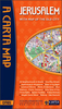
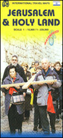
Jerusalem & Holy Land ITMB

Waterproof and tear-resistant map from ITMB combining an indexed street plan of Jerusalem with a more detailed enlargement of its Old City, plus on the reverse a road map at 1:225, 000 covering the Holy Land: northern Israel and the Palestinian Territories. On both the plans and the road map all place names are shown only in Latin alphabet. Within Jerusalem’s Old City sites of religious importance are given their alternative names.On one side is coverage of Jerusalem. The city with its outer districts is shown on an indexed plan at 1:10, 000. On the eastern side of the Old City the plan includes the Mount of Olives and Mount Scopus; in the west it extends beyond the government district and the museum/university quarter but does not include Yad Vashem or Mount Herzl. Main traffic routes
are highlighted and locations of petrol stations and car parks are marked. The Jerusalem light rail route is shown with stops. The plan highlights numerous places of interest and facilities, including selected hotels, embassies, museums and other cultural or educational institutions, places of worship, Israeli governmental buildings, etc. Accompanying the main plan are three additional panels: a large, very clear enlargement at 1:4, 000 showing the Old City in much greater detail, including the Stations of the Cross on Via Dolorosa; a road map of the city’s environs including Bethlehem and Jericho, indicating the course of the Separation Barrier at the time of the map’s publication in 2014; plus a diagram of the existing and proposed light rail lines within the whole of
Israel.The reverse side is covered by an indexed road map of most of Israel at 1:225, 000, extending south to Rahat and the southern boundary of the West Bank (i.e. along the Dead Sea Masada and Ein Bokek are not included). The map has altitude colouring to show the topography, including the depression along the Jordan and the Dead Sea. National parks and other protected areas are marked. Road network indicates driving distances on main and selected secondary routes. Names of road junctions are not included. Railway lines marked, with a separate diagram of the network, and local airports are also shown. Towns with tourist accommodation are highlighted and symbols mark various other places of interest including campsites and youth hostels, archaeological sites, etc. Latitude and
longitude lines are drawn at intervals of 10’. The map gives no indication which areas are now under the direct rule by the Palestinian authorities and the Separation Barrier is not marked.
RIP - This product is no longer available on our network. It was last seen on 25.09.2019

This page now acts as a permanent archive for this product. Add more information using the comments box below to ensure it can still be found by future generations.

Use our search facility to see if it is available from an alternative contributor.
  • Availability: Out Of Stock
  • Supplier: Stanfords
  • SKU: 9781553412687
Availability: In Stock
£9.99

Product Description

Waterproof & tear-resistant map from ITMB combining an indexed street plan of Jerusalem with a more detailed enlargement of its Old City, plus on the reverse a road map at 1:225, 000 covering the Holy Land: northern Israel & the Palestinian Territories. On both the plans & the road map all place names are shown only in Latin alphabet. Within Jerusalem’s Old City sites of religious importance are given their alternative names. On one side is coverage of Jerusalem. The city with its outer districts is shown on an indexed plan at 1:10, 000. On the eastern side of the Old City the plan

Includes::
the Mount of Olives & Mount Scopus; in the west it extends beyond the government district & the museum/university quarter but does not include Yad Vashem or Mount Herzl. Main traffic routes are highlighted & locations of petrol stations & car parks are marked. The Jerusalem light rail route is shown with stops. The plan highlights numerous places of interest & facilities, including selected hotels, embassies, museums & other cultural or educational institutions, places of worship, Israeli governmental buildings, etc. Accompanying the main plan are three additional panels: a large, very clear enlargement at 1:4, 000 showing the Old City in much greater detail, including the Stations of the Cross on Via Dolorosa; a road map of the city’s environs including Bethlehem & Jericho, indicating the course of the Separation Barrier at the time of the map’s publication in 2014; plus a diagram of the existing & proposed light rail lines within the whole of Israel. The reverse side is covered by an indexed road map of most of Israel at 1:225, 000, extending south to Rahat & the southern boundary of the West Bank (i.e. along the Dead Sea Masada & Ein Bokek are not included). The map has altitude colouring to show the topography, including the depression along the Jordan & the Dead Sea. National parks & other protected areas are marked. Road network indicates driving distances on main & selected secondary routes. Names of road junctions are not included. Railway lines marked, with a separate diagram of the network, & local airports are also shown. Towns with tourist accommodation are highlighted & symbols mark various other places of interest including campsites & youth hostels, archaeological sites, etc. Latitude & longitude lines are drawn at intervals of 10’. The map gives no indication which areas are now under the direct rule by the Palestinian authorities & the Separation Barrier is not marked.

Reviews/Comments

Add New

Intelligent Comparison

Oooops!
We couldn't find anything!
Perhaps this product's unique.... Or perhaps we are still looking for comparisons!
Click to bump this page and we'll hurry up.

Price History

Vouchers

No voucher codes found.
Do you know a voucher code for this product or supplier? Add it to Insights for others to use.

Facebook

Jargon Buster

Waterproof - Resistant to water, usualy specified by depth in metres
Car - A machine used for transport which runs on roads
Network - A link and communication between things. Often computers or people.
Large - something that takes up more space than normal.
Road - a manmade lane or a path that is used to speed up travel.
Resistant - Something that can repel against something.
Alternative - Another available choice or possibility
Altitude - Something that can be quite high in relation to sea or ground level.
Accommodation - A room in which someone can live in, for example in a hotel
Museum - A building which exhibits old artefacts for viewing of people who show interest.

Supplier Information

Stanfords
Stanfords was established in 1853 and opened their iconic Covent Garden flagship store in 1901. They have become the top retailer of maps, travel books and accessories in the UK and arguably offer the largest selection of maps and travel books worldwide. Famous names such as Captain Robert Falcon Scott, Ranulph Fiennes and Michael Palin have purchased from Stanfords. They now have a shop in Bristol and both stores together with other venues operate a calendar of events including talks, book signings and exhibitions. As a specialist map retailer, the map selection is comprehensive and includes road maps, street maps and walking maps from worldwide destinations, as well as a selection of world atlases and wall maps. Books include travel guides and travel literature. Stanfords also stock globes, from miniatures made of blue marble to magnificent floor-standing globes. The website features a selection of interesting articles on travel topics.
Page Updated: 2023-11-12 20:15:36

Community Generated Product Tags

Oh No! The productWIKI community hasn't generated any tags for this product yet!
Menu