More From Contributor

£8.99
In Jerusalem`s Old City a young priest & a dominatrix converse in the dying light; on Oregon`s windswept coast a fragile woman discovers a body washed up on the beach after a storm; & in Postwar Japan a young protege watches his master`s corpse burn, with bitter thoughts blazing in his mind. Jerusalem Ablaze: Stories of Love & Other Obsessions collects thirteen eclectic works of dark fiction, taking the reader from Los Angeles to the eastern townships of Quebec, & from Tokyo to Jerusalem. Ortega-Medina`s characters are flawed, broken individuals, trying their best to make sense of their lives as they struggle with sexuality, death, obsession, & religion. Sometimes bleak, occasionally violent, & often possessed of a dark humour, this major debut explores the imperfections of life & the unpredictability of death. ...
Archived Product
£9.95
Jerusalem & North Israel on a light, waterproof & tear-resistant map combining a street plan of Jerusalem with an enlargement of the Old City, plus on the reverse a road map of Israel with the Negev Desert. On one side is coverage of Jerusalem: the city with its outer districts is shown on an indexed plan at 1:10, 000. On the eastern side of the Old City the plan

Includes::
the Mount of Olives & Mount Scopus, but in the west does not cover Yad Vashem or Mount Herzl. Main traffic routes are highlighted & locations of petrol stations & car parks are marked. The Jerusalem light rail route is shown with stops. The plan highlights numerous places of interest & facilities, including selected hotels, embassies, museums & other cultural or educational institutions, places of worship, Israeli governmental buildings, etc. Accompanying the main plan is a large, very clear enlargement at 1:4, 000 showing the Old City in greater detail, including the Stations of the Cross on Via Dolorosa. Also provided is a diagram of the existing & proposed light rail lines, plus a road map of the city

...
Archived Product
£8.99
Excellent plan for visitors to the city: clear, indexed, laminated & waterproof, with a map of greater Jerusalem, plan of Bethlehem, a road map of central Israel & plenty of tourist information. The main street plan extends from the Mount of Olives across the Old City & the central districts to the Israel Museum & the Shrine of the Book, the Knesset, & the Hebrew University at Giv’at Ram. The map highlights numerous places of interest, places of worship of various denominations, selected hotels, one way streets, car parks & petrol stations, etc. The map of Greater Jerusalem at 1:30, 000 extends the coverage to include Yad Vashem, Mount Herzl & the Moskovia district. The map also

Includes::
annotated ground plans of the Holy Sepulchre Church & the Dome of the Rock in the Old City, & a street plan of Bethlehem at 1:11, 000. A road map of central Israel at 1:400, 000, extending to the coast &, north/south, just beyond Hebron & Nablus, shows the road network with numerous places of interest & indicates areas under the Palestinian authority. All place names are in Roman alphabet, with alternative transliterations where appropriate. English names are used for places of interest. All the maps have indexes which include both streets/locations & the main sites, & 30 of the most interesting places worth visiting, both within the city itself & on the other maps, are highlighted & included on a list of Top 30 Sights.

...
Archived Product
£9.99
Large, general street plan of the city with a clear enlargement of the Old City at 1:4, 500. The main plan extends west to beyond the Jerusalem Forest & east to Mount of Olives. Coverage north/south is from Ramat Polin & Beit Khanina to Gilo. Public buildings a highlighted & symbols mark places of worships, monuments, etc. A large inset provides more detailed coverage of the Old City, indicating various places of worship & historical monuments, car parks, etc. All place names are in Roman alphabet only. Multilingual map legend included English & Hebrew. ...
Archived Product
£4.99
Jerusalem in a series of handy pocket street plans from Freytag & Berndt. The map is laminated, so waterproof & tear-resistant, & highlights the publishers’ recommendations of five best choices in five categories: shopping, restaurants & cafes, culture, nightlife & sights. The main plan of Jerusalem extends from the city centre to include the area around the Knesset, Israel Museum, Mount Herzel Cemetery & Yad Vashem. The Old City is presented in greater detail on an enlargement. Both plans are annotated with colour-coded markers highlighting the publishers’ recommendations, all listed on the reverse of the map with brief notes in several languages. Also provided is small road map of the city’s environs including Bethlehem & a Fact Box with phone numbers for tourist offices, car hire & emergency services. Map legend & notes on the recommendations include English. To see other titles in this series please click on the series link. ...
Archived Product
£27.99
Unusual & beautiful wall map showing bird’s-eye view plan of Jerusalem, extending westwards from the Mount of Olives, across the Old City & the central area, to the government districts around the Knesset, Israel Museum & the Shrine of the Book, & the Hebrew University. The buildings are drawn to scale with full architectural detail, viewed at a slightly oblique perspective looking northwards. All the important buildings are identified, using their English names, & the map also provides an excellent picture of the city’s unique topography. The map was drawn in 1969, so any changes since that date will not, of course, be reflected. Coverage of the Old City is also available separately in an enlarged version, both as a wall map & in a folded format. ...
Archived Product
£11.99
Beautiful wall map showing bird’s-eye view plan of Jerusalem’s Old City & its immediate surrounding area, including Mount Zion, the City of David & Gethsemane. The buildings are drawn to scale with full architectural detail, viewed at a slightly oblique perspective looking northwards. All the important buildings are identified, using their English names, & the map provides a particularly good picture of the Western Wall & the Temple Mount with the Dome of the Rock & the El Aqsa Mosque. The map provides an excellent picture of this fascinating area, but it is not recommended as a street plan to be used whilst navigating the narrow lanes & alleyways of the Old City. The map was drawn in 1969, so any changes since that date, particularly in the area west of the Jaffa Gate will not, of course, be reflected. This title is also available as a wall map. ...
Archived Product
£12.99
Jerusalem, Israel, Petra & Sinai Eyewitness travel guide from Dorling Kindersley is a lavishly illustrated book concerned with providing the visitor with detailed background information to sightseeing in the country & a broad cultural introduction. Popular historical buildings & museums are often described with cutaway diagrams allowing you to view ...
Archived Product

Jerusalem Day By Day

Jerusalem in the Frommer`s Day By Day series is a pocket-sized guide ideal for short trips, covering a variety of budgets. The best sights of each destination are listed in convenient full-day tours for one, two or three days such as: thematic tours for interests including art, architecture and history are described, allowing you to get the most out of your time; walking tours take you around each destination’s principal neighbourhoods, detailing selected parks, activities, notable sights, shops and eateries. Categorized listings are given for the best of the area’s hotels and accommodation, shopping, food and drink, nightlife, music, outdoor activities, day-trips, and arts and entertainment, whilst a “Savvy Traveller” section provides practical travel information,
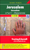
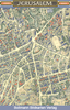
as well as a brief background and history of the destination.The guide is illustrated with colour photography and simple, easy-to-use bulleted maps with locations cross-referenced to the text, as well as having a removable tear-proof folded map in a pouch inside the back cover.
RIP - This product is no longer available on our network. It was last seen on 25.09.2019

This page now acts as a permanent archive for this product. Add more information using the comments box below to ensure it can still be found by future generations.

Use our search facility to see if it is available from an alternative contributor.
  • Availability: Out Of Stock
  • Supplier: Stanfords
  • SKU: 9780470676363
Availability: In Stock
£9.99

Product Description

Jerusalem in the Frommer`s Day By Day series is a pocket-sized guide ideal for short trips, covering a variety of budgets. The best sights of each destination are listed in convenient full-day tours for one, two or three days such as: thematic tours for interests including art, architecture & history are described, allowing you to get the most out of your time; walking tours take you around each destination’s principal neighbourhoods, detailing selected parks, activities, notable sights, shops & eateries. Categorized listings are given for the best of the area’s hotels & accommodation, shopping, food & drink, nightlife, music, outdoor activities, day-trips, & arts & entertainment, whilst a “ Savvy Traveller” section provides practical travel information, as well as a brief background & history of the destination. The guide is illustrated with colour photography & simple, easy-to-use bulleted maps with locations cross-referenced to the text, as well as having a removable tear-proof folded map in a pouch inside the back cover.

Reviews/Comments

Add New

Price History

Vouchers

No voucher codes found.
Do you know a voucher code for this product or supplier? Add it to Insights for others to use.

Facebook

Jargon Buster

History - Anything that happens in the past. An acedemic subject.
Entertainment - Something that provides amusement
Colour - The categorised spectrum of light visable to humans
Day - The time it takes a planet or other space objects to complete one rotation.
Accommodation - A room in which someone can live in, for example in a hotel
Simple - Basic, easy no difficulty in understanding.
Practical - Weather a task is easy to carry out and realistically succeed.
Pocket - A bag shaped insert in clothing used to carry items
Ideal - Something that satisfies a perfect criteria.
Convenient - Something that suits and fits well to other activities.

Supplier Information

Stanfords
Stanfords was established in 1853 and opened their iconic Covent Garden flagship store in 1901. They have become the top retailer of maps, travel books and accessories in the UK and arguably offer the largest selection of maps and travel books worldwide. Famous names such as Captain Robert Falcon Scott, Ranulph Fiennes and Michael Palin have purchased from Stanfords. They now have a shop in Bristol and both stores together with other venues operate a calendar of events including talks, book signings and exhibitions. As a specialist map retailer, the map selection is comprehensive and includes road maps, street maps and walking maps from worldwide destinations, as well as a selection of world atlases and wall maps. Books include travel guides and travel literature. Stanfords also stock globes, from miniatures made of blue marble to magnificent floor-standing globes. The website features a selection of interesting articles on travel topics.
Page Updated: 2023-11-12 20:15:36

Community Generated Product Tags

Oh No! The productWIKI community hasn't generated any tags for this product yet!
Menu