
 United Kingdom
 France
 Germany
 Netherlands
 Sweden
 USA
USA
 Italy
Italy
 Spain
Spain
More From Contributor


Jakarta F&B
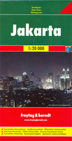
Jakarta on a very large, indexed street plan from Freytag & Berndt. Coverage extends south beyond the inner motorway road to include Mampang and Pancoran districts, westwards beyond the outer ring to Cengkarend and Larangan, and east to Semper and Pd. Kelapa districts. Main through routes are highlighted; the number of smaller streets with names varies from district to district. Public buildings are prominently marked and most are also named, and colouring indicates industrial areas. Symbols highlight locations of selected hotels, museums, shopping centres, car parks, bus terminals, golf courses, hospitals, etc. as well as numerous mosques and other religious buildings.Map legend includes English. Extensive street index is on the reverse of the map.

Product Description
Reviews/Comments
Add New
Intelligent Comparison
Archived Product

Jakarta ITMB Stanfords
£9.99
Archived Product
Jakarta Stanfords
£7.99
Archived Product

Java - Jakarta F&B Stanfords
£10.99
Vouchers
No voucher codes found.
Do you know a voucher code for this product or supplier? Add it to Insights for others to use.
Do you know a voucher code for this product or supplier? Add it to Insights for others to use.
 Denmark