
 United Kingdom
 France
 Germany
 Netherlands
 Sweden
 USA
USA
 Italy
Italy
 Spain
Spain
More From Contributor


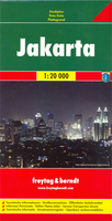
Jakarta
Jakarta with its southern suburbs at 1:30, 000 on a double-sided indexed street plan from Periplus, extensively annotated with numerous places of interest, hotels and other facilities. Trans-Jakarta Busway routes are shown with stops. The map divides the city north/south, covering the city within its outer ring road, and in the south well beyond it. Main traffic arteries are highlighted and, where appropriate, smaller streets are named. Also provided are names of numerous districts and neighbourhoods. The map is extensively annotated with names of various places of interest and facilities and its index includes a list of over 100 hotels.
Product Description
Reviews/Comments
Add New
Intelligent Comparison
Archived Product
Jakarta F&B Stanfords
£9.99
Archived Product

Jakarta ITMB Stanfords
£9.99
Vouchers
No voucher codes found.
Do you know a voucher code for this product or supplier? Add it to Insights for others to use.
Do you know a voucher code for this product or supplier? Add it to Insights for others to use.
 Denmark