
 United Kingdom
 France
 Germany
 Netherlands
 Sweden
 USA
USA
 Italy
Italy
 Spain
Spain
More From Contributor


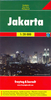


Jakarta ITMB
Jakarta on a double-sided map from ITMB combining a street plan of city’s central district at 1:21, 000 with a more general overview of Greater Jakarta at 1:75.000. Both plans are indexed and highlight places of interest, services and facilities, etc.On one side is a street plan at 1:21, 000 of the city’s central districts with coverage extending south to include the Halim Perdana Kusumah airport. Bus routes are shown with names of stops and railway stations are also clearly marked. Main traffic arteries are highlighted. Districts and neighbourhoods, larger streets and many of the smaller ones are named, and a wide range of symbols highlight various institutions, services and places of interest including temples and other religious buildings, museums, selected hotels (all
named), embassies, shopping centres, petrol stations, etc.On the reverse is a map at 1:75, 000 covering Greater Jakarta, naming main streets and neighbourhoods. Coverage includes the city’s international airport and extends south beyond Kota Bogor. The map is indexed and annotated as the main plan.
named), embassies, shopping centres, petrol stations, etc.On the reverse is a map at 1:75, 000 covering Greater Jakarta, naming main streets and neighbourhoods. Coverage includes the city’s international airport and extends south beyond Kota Bogor. The map is indexed and annotated as the main plan.

Product Description
Reviews/Comments
Add New
Vouchers
No voucher codes found.
Do you know a voucher code for this product or supplier? Add it to Insights for others to use.
Do you know a voucher code for this product or supplier? Add it to Insights for others to use.
 Denmark