
 United Kingdom
 France
 Germany
 Netherlands
 Sweden
 USA
USA
 Italy
Italy
 Spain
Spain
More From Contributor


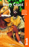
Ivory Coast
The Michelin National road map of Ivory Coast at 1:800, 000 scale is ideal for trip & route planning. The map gives comprehensive coverage of national road networks showing all major motorways and main roads, and good coverage of unsurfaced roads, recognized tracks & shows a good deal of road surface type & quality information. The map is divided by grid showing latitude and longitude. Good coverage of smaller towns and settlements.Distances between major locations are marked along roads, with both total distance and several intermediate distances shown. A quick-reference chart of regional temperature & rainfall data is included, cross referenced to locations on the map. The map also includes a short textual description of the country
Product Description
Reviews/Comments
Add New
Intelligent Comparison
Archived Product
Ivory Coast Stanfords
£10.95
Archived Product
The Ivory Coast Stanfords
£18.99
Archived Product

Flag Of Ivory Coast Stanfords
£8.99
Archived Product
Normandy Coast Stanfords
£4.99
Archived Product

Ivory Coast Michelin Stanfords
£5.99
Vouchers
No voucher codes found.
Do you know a voucher code for this product or supplier? Add it to Insights for others to use.
Do you know a voucher code for this product or supplier? Add it to Insights for others to use.
 Denmark