
 United Kingdom
 France
 Germany
 Netherlands
 Sweden
 USA
USA
 Italy
Italy
 Spain
Spain
More From Contributor


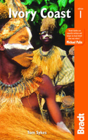
Ivory Coast
General road map of the country with topography indicated by contours at 100m intervals and relief shading. The map shows different types of forestation and the country's national parks. Road network includes seasonal roads and tracks. The map also indicates aerodromes, post offices, medical facilities, places of interest, selected accommodation, etc. Latitude and longitude are shown in the margins at intervals of 1
Product Description
Reviews/Comments
Add New
Intelligent Comparison
Archived Product
Ivory Coast Stanfords
£5.99
Archived Product
The Ivory Coast Stanfords
£18.99
Archived Product

Flag Of Ivory Coast Stanfords
£8.99
Archived Product
Normandy Coast Stanfords
£4.99
Archived Product

Ivory Coast Michelin Stanfords
£5.99
Vouchers
No voucher codes found.
Do you know a voucher code for this product or supplier? Add it to Insights for others to use.
Do you know a voucher code for this product or supplier? Add it to Insights for others to use.
 Denmark