More From Contributor

£16.99
This is real cycling, where the glory is & where dreams come true. So said Bradley Wiggins when, after years of huge success on the track & in time trials, he reached the summit of Mont Ventoux in the 2009 Tour de France alongside the best in the business. Mountains are where professional cycling`s legends are forged & its greatest heroes make their names. Every amateur rider too wishes they could climb better, but what is it about mountains that enthrals them? Are they addicted to the pain? To the achievement? Or to the allure of the peaks? Some spend their weekends ` Everest-ing`, some a summer holiday cycling up mountains from start to finish. But how does a rider push themselves beyond their limits to get up a 10 per cent gradient on pedal power alone? What is happening when they do? Getting High is an exploration of the central place of mountains in the folklore of road cycling, of the mystique that surrounds the grimpeurs, or climbers, & why amateurs feel compelled to follow them. Interweaving adventure & travel writing with the rich narrative of the Grand Tours, Max Leonard speaks to the riders who conquered the summits & encounters stories of courage & sacrifice, war, love, obsession & elephants. ...
Archived Product
£3.50
Higher Disley & Furness Vale in 1907 in a fascinating series of reproductions of old Ordnance Survey plans in the Alan Godfrey Editions, ideal for anyone interested in the history of their neighbourhood or family. The map is double-sided. The main map covers the area around Higher Disley, stretching from Danebank eastward to Broadhey Hill, & from New Mills station southward to Kiln Knoll. Features include Badgersclough, Albert Works, Higher Greenshall, Disley Hall, Pottershey, etc. On the reverse is the adjacent sheet 20.16, extending coverage eastward to the Cheshire boundary (the Derbyshire area is left blank on this sheet). This side covers Furness Vale, including Furness Vale station, Furness Print Works & Furness House. About the Alan Godfrey Editions of the 25” OS Series: Selected towns in Great Britain & Ireland are covered by maps showing the extent of urban development in the last decades of the 19th & early 20th century. The plans have been taken from the Ordnance Survey mapping & reprinted at about 15 inches to one mile (1:4, 340). On the reverse most maps have historical notes & many also include extracts from contemporary directories. Most maps cover about one mile (1.6kms) north/south, one & a half miles (2.4kms) across; adjoining sheets can be combined to provide wider coverage.FOR MORE INFORMATION & A COMPLETE LIST OF ALL AVAILABLE TITLES PLEASE CLICK ON THE SERIES LINK. ...
Archived Product
£8.99
Planning your next beach break or a trip around the world, but worried about the footprint you`ll leave behind? Never fear
- it
...
Archived Product
£14.99
For decades now, Martin Moran has made his living as a mountain guide based in Strathcarron, Wester Ross. The Scottish hills have by no means bound or defined him though. It was after his ascent of the North Face of the Eiger that he made his decision to take the mountain guide qualifications. Martin has climbed & guided in the Alps, Norway, & the Himalayas, experiencing life changing adventures, near death experiences, meeting & guiding many interesting people. Humour has never been far away, but neither has excitement & interest. He has lived life in the mountains to the full & this is his story. ...
Archived Product
£45.00
` Monumental!`
- Bob Ross, Australian Sailing High Performance Sailing is now regarded as the bible of racing sailors & carries
...
Archived Product
£14.99
Stanfords Children`s Book of the Month October 2016 Do you know how tall the tallest mountain on Earth is? Or how deep the deepest ocean goes? Do you know which creature was the largest to ever live? Or how old the oldest tree is? Learn all this & more in this exquisite book of comparisons. Page Tsou`s extraordinarily detailed illustrations have a lithograph aesthetic that is at once vintage & contemporary. ...
Archived Product
£3.50
Highgate in 1869 in a fascinating series of reproductions of old Ordnance Survey plans in the Alan Godfrey Editions, ideal for anyone interested in the history of their neighbourhood or family. Three versions have been published for this area, stretching from Fitzroy Park eastward to Hazellville Road & from Shepherds Hill Road southward to Highgate Cemetery. Features include Park House Penitentiary, Highgate Cemetery, Waterlow Park, Shepherds Hill, a stretch of the GNR High Barnet line including Highgate station & part of Crouch End station, St Pancras Infirmary, Holborn Union Infirmary, a workhouse & Archway. Streets include North Road, North Hill, The Grove, Pond Square, Hampstead Lane, Highgate Hill, Archway Road, St John`s Road. This 1869 map has a description of Highgate Cemetery from Walford`s Old & New London. About the Alan Godfrey Editions of the 25” OS Series: Selected towns in Great Britain & Ireland are covered by maps showing the extent of urban development in the last decades of the 19th & early 20th century. The plans have been taken from the Ordnance Survey mapping & reprinted at about 15 inches to one mile (1:4, 340). On the reverse most maps have historical notes & many also include extracts from contemporary directories. Most maps cover about one mile (1.6kms) north/south, one & a half miles (2.4kms) across; adjoining sheets can be combined to provide wider coverage.FOR MORE INFORMATION & A COMPLETE LIST OF ALL AVAILABLE TITLES PLEASE CLICK ON THE SERIES LINK. ...
Archived Product
£3.50
Highgate in 1894 in a fascinating series of reproductions of old Ordnance Survey plans in the Alan Godfrey Editions, ideal for anyone interested in the history of their neighbourhood or family. Three versions have been published for this area, stretching from Fitzroy Park eastward to Hazellville Road & from Shepherds Hill Road southward to Highgate Cemetery. Features include Park House Penitentiary, Highgate Cemetery, Waterlow Park, Shepherds Hill, a stretch of the GNR High Barnet line including Highgate station & part of Crouch End station, St Pancras Infirmary, Holborn Union Infirmary, a workhouse & Archway. Streets include North Road, North Hill, The Grove, Pond Square, Hampstead Lane, Highgate Hill, Archway Road, St John`s Road. The 1894 map

Includes::
extracts from early directories. About the Alan Godfrey Editions of the 25” OS Series: Selected towns in Great Britain & Ireland are covered by maps showing the extent of urban development in the last decades of the 19th & early 20th century. The plans have been taken from the Ordnance Survey mapping & reprinted at about 15 inches to one mile (1:4, 340). On the reverse most maps have historical notes & many also include extracts from contemporary directories. Most maps cover about one mile (1.6kms) north/south, one & a half miles (2.4kms) across; adjoining sheets can be combined to provide wider coverage.FOR MORE INFORMATION & A COMPLETE LIST OF ALL AVAILABLE TITLES PLEASE CLICK ON THE SERIES LINK.

...
Archived Product
£3.50
Highgate in 1913 in a fascinating series of reproductions of old Ordnance Survey plans in the Alan Godfrey Editions, ideal for anyone interested in the history of their neighbourhood or family. Three versions have been pubslished for this area, stretching from Fitzroy Park eastward to Hazellville Road & from Shepherds Hill Road southward to Highgate Cemetery. Features include Park House Penitentiary, Highgate Cemetery, Waterlow Park, Shepherds Hill, a stretch of the GNR High Barnet line including Highgate station & part of Crouch End station, St Pancras Infirmary, Holborn Union Infirmary, a workhouse & Archway. Streets include North Road, North Hill, The Grove, Pond Square, Hampstead Lane, Highgate Hill, Archway Road, St John`s Road. The 1913 map

Includes::
extracts from early directories. About the Alan Godfrey Editions of the 25” OS Series: Selected towns in Great Britain & Ireland are covered by maps showing the extent of urban development in the last decades of the 19th & early 20th century. The plans have been taken from the Ordnance Survey mapping & reprinted at about 15 inches to one mile (1:4, 340). On the reverse most maps have historical notes & many also include extracts from contemporary directories. Most maps cover about one mile (1.6kms) north/south, one & a half miles (2.4kms) across; adjoining sheets can be combined to provide wider coverage.FOR MORE INFORMATION & A COMPLETE LIST OF ALL AVAILABLE TITLES PLEASE CLICK ON THE SERIES LINK.

...
Archived Product
£15.95
Highgate retains its village atmosphere & magnificent views across London. The author relates its history from wealthy Tudor residents through to the expansive Victorian times when Highgate was fortunate to obtain much public green space, & into modern times. It also acquired a cable tramway up its steep hill, a famous school founded in 1565 & one of the most picturesque cemeteries in the country. It has some notable old pubs & boasts one of the few surviving Literary & Scientific Institutions, Past residents include Baroness Coutts, Steel Gibbons & John Betjeman. ...
Archived Product

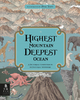
Higher Than The Eagle Soars - A Path To Everest

Stephen Venables is one of the greatest British climbers of his generation and he has now written a full autobiography - Higher than the Eagle Soars - A Path to Everest. He explores how and - more importantly - why he became a mountaineer, and reveals a series of never-recorded adventures on four continents.A highly intimate and epic account, at its climax Venables revisits his dramatic ascent without oxygen on the Kangshung Face of Everest, described by Reinhold Messner as the most adventurous in Everest`s history, and by Lord Hunt as `one of the most remarkable ordeals from which men or women have returned alive`. As Venables writes: `Although we didn`t go seeking deliberately an epic near-death experience, it did turn out that way - the ultimate endurance test for which all the
previous adventures seemed, retrospectively, to be a preparation.`
RIP - This product is no longer available on our network. It was last seen on 25.09.2019

This page now acts as a permanent archive for this product. Add more information using the comments box below to ensure it can still be found by future generations.

Use our search facility to see if it is available from an alternative contributor.
  • External links may include paid for promotion
  • Availability: Out Of Stock
  • Supplier: Stanfords
  • SKU: 9780099505440
Availability: In Stock
£10.99

Product Description

Stephen Venables is one of the greatest British climbers of his generation & he has now written a full autobiography
- Higher than the Eagle Soars
- A Path to Everest. He explores how &
- more importantly
- why he became a mountaineer, & reveals a series of never-recorded adventures on four continents.A highly intimate & epic account, at its climax Venables revisits his dramatic ascent without oxygen on the Kangshung Face of Everest, described by Reinhold Messner as the most adventurous in Everest`s history, & by Lord Hunt as `one of the most remarkable ordeals from which men or women have returned alive`. As Venables writes: ` Although we didn`t go seeking deliberately an epic near-death experience, it did turn out that way
- the ultimate endurance test for which all the previous adventures seemed, retrospectively, to be a preparation.`

Reviews/Comments

Add New

Intelligent Comparison

Oooops!
We couldn't find anything!
Perhaps this product's unique.... Or perhaps we are still looking for comparisons!
Click to bump this page and we'll hurry up.

Price History

Vouchers

No voucher codes found.
Do you know a voucher code for this product or supplier? Add it to Insights for others to use.

Facebook

Jargon Buster

History - Anything that happens in the past. An acedemic subject.
Endurance - A measurement on how long something can last wear and tear.
Experience - To gain further knowledge by practising.

Supplier Information

Stanfords
Stanfords was established in 1853 and opened their iconic Covent Garden flagship store in 1901. They have become the top retailer of maps, travel books and accessories in the UK and arguably offer the largest selection of maps and travel books worldwide. Famous names such as Captain Robert Falcon Scott, Ranulph Fiennes and Michael Palin have purchased from Stanfords. They now have a shop in Bristol and both stores together with other venues operate a calendar of events including talks, book signings and exhibitions. As a specialist map retailer, the map selection is comprehensive and includes road maps, street maps and walking maps from worldwide destinations, as well as a selection of world atlases and wall maps. Books include travel guides and travel literature. Stanfords also stock globes, from miniatures made of blue marble to magnificent floor-standing globes. The website features a selection of interesting articles on travel topics.
Page Updated: 2023-11-12 20:15:36

Community Generated Product Tags

Oh No! The productWIKI community hasn't generated any tags for this product yet!
Menu