More From Contributor
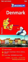
£20.99
We are able to source a wide range of courtesy flags. Flags are available in many sizes & can be sewn or printed on 100% Ministry Of Defence Standard Woven & Knitted Polyester. Flags are supplied with rope & toggle. If you would like more information, have a custom size request or cannot find a desired product, please email us at maritime@stanfords.co.uk. We will be glad to help! ...
Archived Product
£12.99
Detailed touring map of Denmark, also south-western Sweden between Malmo & Gothenburg & extending south to Hamburg & Bremenhaven & covering the whole of the Baltic coast of Germany. The map shows seven different kind of roads, with road names & junction numbers, intermediate driving distances in km, petrol stations, restaurants & motels along main roads. Railways, ferry lines & shipping routes, airports & administrative boundaries are also marked alongside spot elevation in metres, wood, heath & recommended beaches. A number of symbols also indicates places of interests, viewpoints, notable buildings & ruins, monuments & campsites. The map also

Includes::
a special ” Distoguide” incorporated into the map cover, showing at a glance road distances between several Swedish cities. Map index is in a separate booklet attached to the cover. All texts are in six different European languages including English.

...
Archived Product
£12.99
Attractive & colourful map showing roads, railways & ferries. Road detail

Includes::
minor roads, scenic

...
Archived Product
£6.99
Denmark at 1:300, 000 on a road map from Marco Polo Travel Publishing with special features to aid route planning, a street plan of central Copenhagen, plus an inset showing access to the adjoining areas of Sweden: the bridge to Malmö & the ferry connections to Helsingborg & Landskrona.A fold-out extension of the map cover gives at-a-glance overview of the whole area covered by the map with the adjoining regions, highlighting main places of interest & making it much easier to find various localities on the main map and/or plan a route. A set of seven peel-on/peel-off stickers, removable without damaging the map, is provided to make routes or locations more prominent when navigating. Cartography is from the renowned German publishers Mairs Dumont. Road network

Includes::
minor local roads & selected unsurfaced tracks, indicates motorway services, truck shops, toll stations, traffic or seasonal restrictions, etc, & gives driving distances on main & most secondary routes. Scenic roads, special tourist routes & viewpoints are highlighted. Railway lines, ferry routes & local airports are included. Locations of interest are prominently highlighted, with separate colouring for towns or villages & for natural sites. National parks & other protected areas are marked. Symbols highlight locations of campsites, youth hostels & other tourist accommodation. Topography is shown by relief shading with spot heights, plus graphics for bogs, marshland & tidal flats. The map has no geographical coordinates. Multilingual map legend

Includes::
English.A booklet attached to the map cover has an extensive index of place names, including geographical features & places of interest, with post codes given for towns & villages, plus distance/driving times table & basic driving regulations.


...
Archived Product
£14.99
Fully updated for 2017...and now with ZOOM system for even better orientation! Unique spiral binding with wrap-around spine. High quality cartography with distance indicators & scale converters to aid route planning. Comprehensive index & inset street plans of major cities. ...
Archived Product
£11.50
Denmark at 1:300, 000 on an indexed, waterproof & tear-resistant road map with topographic & tourist information, published by Reise Know-How as part of their highly acclaimed World Mapping Project. The map is double-sided, with a good overlap between the sides, to provide the best balance between a good scale & a convenient size sheet. The country’s road & rail networks are easy to see on a clear base with light altitude colouring. Ferry connections between the islands are also indicated. Protected nature reserves are marked & symbols highlight various places of interest including viewpoints, campsites, beaches & marinas, golf courses, historical & cultural sites, etc. The map has both a UTM grid & a latitude/longitude grid at intervals of 20’, plus an extensive index of localities. Map legend

Includes::
English.

...
Archived Product
£22.95
Road Atlas of Denmark at 1:200, 000, 2013/2014 edition, published by Legind with indexed, full-page street plans of 16 cities. Spiral-bound & with pages 31 x 29cm, the atlas folds in half for storage into a 16 x 30cm slipcase. The atlas presents the road network with clear numbering of routes & junctions; motorway services indicate fuel supplies, rest areas with toilets, & cafes. The course of the Marguerite Route, over 3, 000-km long country-wide scenic route that takes you past more than 200 of Denmark's top attractions & through some of the country's most picturesque scenery, is highlighted. Railway lines are shown with stations; car ferry routes are marked & a separate section provides more information about the services. Topography is indicated by spot heights, with colouring for national parks / protected areas & woodlands. Campsites & youth hostels are marked & other symbols indicate tourist information offices, viewpoints, golf courses, amusement parks & other places of interest. No geographical coordinates are indicated. Also provided are maps at 1:250, 000 of the border area of Germany &, for travellers wishing to explore the lands beyond the ...
Archived Product
£11.99
The southern part of Jutland with Funen & the smaller adjoining islands including Als, Ærø, Langeland & Samsø presented on a large, waterproof & tear-resistant, double-sided, indexed road map at 1:175, 000 from Hallwag Kümmerly + Frey. Coverage, with an overlap between the sides, extends on Jutland northwards to Århus, & south of the border within Germany

Includes::
the Friesian islands of Sylt, Föhr & Amrum with the mainl&. Road network, graded into six types, shows motorway junctions with their numbers & names, indicates motorway services & gives driving distances on main, secondary & selected local routes. Also marked are roads closed to motorized traffic and/or not recommended for caravans. Scenic routes are highlighted. Railway lines are shown with stations & ferry connections are marked. Symbols mark various places of interest including campsites & youth hostels. The map has latitude & longitude lines at 10’ intervals & is indexed. Map legend

Includes::
English.


...
Archived Product
£9.99
Southern Jutland & the islands in Mair Dumont`s Marco Polo regional series of Denmark at 1:200, 000, now on only two double-sided sheets, with special new features to aid route planning whilst retaining the publisher’s excellent cartography. The index is now in a separate booklet, which also

Includes::
street plans of main cities. The new presentation of this series, introduced in March 2009,

Includes::
a fold-out extension of the jacket so that the whole area covered by the map, plus the surrounding regions, can be shown with the map’s coordinate system, making it much easier to find various localities on the main map and/or plan a route. Also new is a set of seven peel-on/peel-off stickers, removable without damaging the map, for making routes or locations more prominent when navigating. The maps retain the publisher’s traditional cartography of this series, boldly stressing main roads & motorways in strong colours & selected towns in large letters, but also showing minor roads & villages in considerable detail. Road information

Includes::
toll roads, traffic restrictions, gradient marking for steep roads, routes not recommended for caravans, scenic roads & special tourist routes, etc. Motorway services clearly indicate types of facilities available there. Railway network

Includes::
narrow gauge & tourist lines, cable car lines, & chair lifts. Ferry routes are marked. Picturesque towns & places of interest are given star rating, & other tourist information

Includes::
campsites & youth hostels, landmarks, recreational facilities etc. Latitude & longitude grid is drawn at intervals of 10`. Map legend

Includes::
English. Each title comes with a booklet which contains street plans of main cities, plus an extensive index of place names showing full postal code for each locality. Also included is a table with distances & traveling times.* In this title:* street plans of central Copenhagen, Esbjerg, Helsingør, Kolding & Odense.


...
Archived Product
£8.99
Cycling Map of Denmark at 1:500, 000 from Nordisk Korthandel showing the network of numbered national & regional cycle routes, other roads with cycle tracks, campsites & youth hostels, ferry connections with journey times, etc, plus on the reverse additional tourist information. Plain unobtrusive base has colouring only for woodlands, sand dunes & tidal flats. Cycle routes clearly show their national or regional route numbers. The map also indicates other roads with cycle tracks as well as roads where cycling is prohibited. Symbols mark locations of camping places which accept only cyclists & hikers, general campsites & youth hostels. Ferry routes between Jutland & the islands indicate approximate journey times. The map has no geographical coordinates. An enlargement shows the Copenhagen area in greater detail. The index of place names is on the reverse, together with general information on cycling in Denmark including notes on taking bicycles on trains. Map legend & all the text include English. ...
Archived Product

Denmark Michelin

Updated regularly, Michelin National Maps will give you an overall picture of your journey thanks to their clear and accurate imagery and mapping scales. This map will help you easily plan your safe and enjoyable journey thanks to comprehensive keys, complete name indexes as well clever time & distance charts. Michelin`s driving information will help you navigate safely in all circumstances. With Michelin National Maps, find more than just your way.
RIP - This product is no longer available on our network. It was last seen on 25.09.2019

This page now acts as a permanent archive for this product. Add more information using the comments box below to ensure it can still be found by future generations.

Use our search facility to see if it is available from an alternative contributor.
  • External links may include paid for promotion
  • Availability: Out Of Stock
  • Supplier: Stanfords
  • SKU: 9782067216396
Availability: In Stock
£5.99

Product Description

Updated regularly, Michelin National Maps will give you an overall picture of your journey thanks to their clear & accurate imagery & mapping scales. This map will help you easily plan your safe & enjoyable journey thanks to comprehensive keys, complete name indexes as well clever time & distance charts. Michelin`s driving information will help you navigate safely in all circumstances. With Michelin National Maps, find more than just your way.

Reviews/Comments

Add New

Intelligent Comparison

Oooops!
We couldn't find anything!
Perhaps this product's unique.... Or perhaps we are still looking for comparisons!
Click to bump this page and we'll hurry up.

Price History

Vouchers

No voucher codes found.
Do you know a voucher code for this product or supplier? Add it to Insights for others to use.

Facebook

Jargon Buster

Denmark - A country in Scandinavia, Northern Europe.
Accurate - A measurement of precision when all elements are correct.

Supplier Information

Stanfords
Stanfords was established in 1853 and opened their iconic Covent Garden flagship store in 1901. They have become the top retailer of maps, travel books and accessories in the UK and arguably offer the largest selection of maps and travel books worldwide. Famous names such as Captain Robert Falcon Scott, Ranulph Fiennes and Michael Palin have purchased from Stanfords. They now have a shop in Bristol and both stores together with other venues operate a calendar of events including talks, book signings and exhibitions. As a specialist map retailer, the map selection is comprehensive and includes road maps, street maps and walking maps from worldwide destinations, as well as a selection of world atlases and wall maps. Books include travel guides and travel literature. Stanfords also stock globes, from miniatures made of blue marble to magnificent floor-standing globes. The website features a selection of interesting articles on travel topics.
Page Updated: 2023-11-12 20:15:36

Community Generated Product Tags

Oh No! The productWIKI community hasn't generated any tags for this product yet!
Menu