
 United Kingdom
 France
 Germany
 Netherlands
 Sweden
 USA
USA
 Italy
Italy
 Spain
Spain
More From Contributor


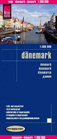
Denmark Reise Know-How
Denmark at 1:300, 000 on an indexed, waterproof and tear-resistant road map with topographic and tourist information, published by Reise Know-How as part of their highly acclaimed World Mapping Project. The map is double-sided, with a good overlap between the sides, to provide the best balance between a good scale and a convenient size sheet.The country’s road and rail networks are easy to see on a clear base with light altitude colouring. Ferry connections between the islands are also indicated. Protected nature reserves are marked and symbols highlight various places of interest including viewpoints, campsites, beaches and marinas, golf courses, historical and cultural sites, etc. The map has both a UTM grid and a latitude/longitude grid at intervals of 20’, plus an
extensive index of localities. Map legend includes English.
extensive index of localities. Map legend includes English.

Product Description
Reviews/Comments
Add New
Vouchers
No voucher codes found.
Do you know a voucher code for this product or supplier? Add it to Insights for others to use.
Do you know a voucher code for this product or supplier? Add it to Insights for others to use.
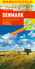
 Denmark