
 United Kingdom
 France
 Germany
 Netherlands
 Sweden
 USA
USA
 Italy
Italy
 Spain
Spain
More From Contributor


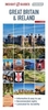


Great Britain & Ireland Flexi Map
Great Britain and Ireland on an Insight Flexi Pocket Map in their new format introduced to provide more convenient access to the special features of this series: various additional maps and/or street plans plus tourist information including a list of must-see sights. The map is tear-resistant, waterproof, and can be written on with non-permanent marker pens. On one side is a road map showing the network of main road and railway connections on a base indicating physical geography by colouring with names of mountain ranges and highlighting selected places of interest. PLEASE NOTE: the map scale is incorrectly given at 1:500, 000. The map is indexed for places and points of interest.On the reverse are this title’s additional features:- A road map at 1:330, 000 of the Greater London area
within the M25 motorway but including Windsor, St. Albans and the Royal Horticultural Society garden at Wisley. The map is indexed for places and point of interest.- A diagram of the Transport for London Underground and Overground network.- 33 main sights, neatly grouped into sections covering Top Museums & Galleries, Top Royal Homes, Best Gardens, plus Important Ancient Sites, are given brief descriptions and are prominently highlighted on the relevant maps.- Information about Getting Around and Facts for Visitors, including tourist information, money, opening times, telecommunications, plus monthly climate charts.
within the M25 motorway but including Windsor, St. Albans and the Royal Horticultural Society garden at Wisley. The map is indexed for places and point of interest.- A diagram of the Transport for London Underground and Overground network.- 33 main sights, neatly grouped into sections covering Top Museums & Galleries, Top Royal Homes, Best Gardens, plus Important Ancient Sites, are given brief descriptions and are prominently highlighted on the relevant maps.- Information about Getting Around and Facts for Visitors, including tourist information, money, opening times, telecommunications, plus monthly climate charts.
Product Description
Reviews/Comments
Add New
Vouchers
No voucher codes found.
Do you know a voucher code for this product or supplier? Add it to Insights for others to use.
Do you know a voucher code for this product or supplier? Add it to Insights for others to use.
 Denmark