
 United Kingdom
 France
 Germany
 Netherlands
 Sweden
 USA
USA
 Italy
Italy
 Spain
Spain
More From Contributor


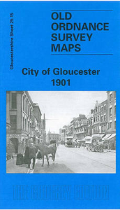
Gloucester Central 1901
Gloucester Central in 1901 in a fascinating series of reproductions of old Ordnance Survey plans in the Alan Godfrey Editions, ideal for anyone interested in the history of their neighbourhood or family. Gloucester is covered by four maps. In this title coverage extends north-east towardss Oxstalls and Cole Bridge. Features include the Cathedral, Westgate Street, Eastgate Street, Soutgate Street, Northgate Street, tramways, Shire Hall, St Catharine`s church, Infirmary, Market, GWR and MR stations, locomotive sheds, Wotton Vill, First County Lunatic Asylum, Hillfield House, Barnwood Bridge, Wotton Farm, cattle market, Kingsholm, football ground, vinegar works, Workhouse, and much more. On the reverse are contemporary street directory entries for Eastgate Street,
Northgate Street, Southgate Street and Westgate Street.About the Alan Godfrey Editions of the 25” OS SeriesSelected towns in Great Britain and Ireland are covered by maps showing the extent of urban development in the last decades of the 19th and early 20th century. The plans have been taken from the Ordnance Survey mapping and reprinted at about 15 inches to one mile (1:4, 340). On the reverse most maps have historical notes and many also include extracts from contemporary directories. Most maps cover about one mile (1.6kms) north/south, one and a half miles (2.4kms) across; adjoining sheets can be combined to provide wider coverage.FOR MORE INFORMATION AND A COMPLETE LIST OF ALL AVAILABLE TITLES PLEASE CLICK ON THE SERIES LINK.
Northgate Street, Southgate Street and Westgate Street.About the Alan Godfrey Editions of the 25” OS SeriesSelected towns in Great Britain and Ireland are covered by maps showing the extent of urban development in the last decades of the 19th and early 20th century. The plans have been taken from the Ordnance Survey mapping and reprinted at about 15 inches to one mile (1:4, 340). On the reverse most maps have historical notes and many also include extracts from contemporary directories. Most maps cover about one mile (1.6kms) north/south, one and a half miles (2.4kms) across; adjoining sheets can be combined to provide wider coverage.FOR MORE INFORMATION AND A COMPLETE LIST OF ALL AVAILABLE TITLES PLEASE CLICK ON THE SERIES LINK.

Product Description
Reviews/Comments
Add New
Intelligent Comparison
Archived Product
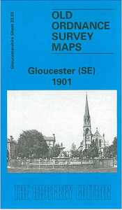
Gloucester South East 1901 Stanfords
£3.50
Archived Product

Gloucester North West 1901 Stanfords
£3.50
Archived Product
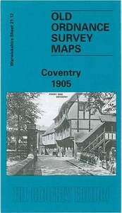
Coventry Central 1905 Stanfords
£3.50
Archived Product

Southport Central 1909 Stanfords
£3.50
Archived Product

Newcastle Central 1914 Stanfords
£3.50
Archived Product

Peterborough Central 1901 Stanfords
£3.50
Vouchers
No voucher codes found.
Do you know a voucher code for this product or supplier? Add it to Insights for others to use.
Do you know a voucher code for this product or supplier? Add it to Insights for others to use.
 Denmark