
 United Kingdom
 France
 Germany
 Netherlands
 Sweden
 USA
USA
 Italy
Italy
 Spain
Spain
More From Contributor


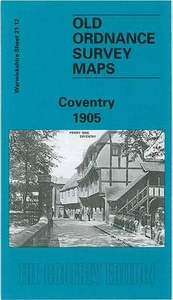
Coventry Central 1905
Central Coventry in 1905 in a fascinating series of reproductions of old Ordnance Survey plans in the Alan Godfrey Editions, ideal for anyone interested in the history of their neighbourhood or family. Coventry in covered on four maps:This title, COVENTRY CENTRAL 1905 map, covers the city centre, extending from Queen Victoria Road eastward to Gosford Green and Stoke Knob, and from the station (bottom left corner) northward to Drapers Field and Sackville Street. Features include St Michael`s church, Cattle Market, Maudslay Motor Works, Velox Motor Works, Kitson Works, Cheylesmore Works, Meteor motor cycle works, Triumph cycle works, Challenge Cycle Works, Singer cycle works, Premier cycle works, Coronet motor works, Sparkbrook cycle works, Dunlop works and many more
factories for cycles, motors or related trades. Street directory entries for Broadgate, Butcher Row, Cross Cheaping, Greyfriars Lane and High Street are also provided. COVENTRY NORTH 1912 map, covers an area around Foleshill Road and Stoney Stanton Road, stretching from Harnall Lane East northward to Great Heath, Paradise and Highfield Street, and from Sandy Lane eastward to Stoke Heath and Barras Heath. Features include the Coventry Canal, tramways and tram depot, mineral railway leading to an ordnance factory, Bishopsgate Green, King Field ribbon works, Swanswell Ward, Harnall Ward, Courtauld`s Artificial Silk factory, Daimler`s Motor Mill, etc. On the reverse is a section of the 1921 Directory, A to G. COVENTRY WEST 1094-1911 map is taken from the unusual Inland
Revenue; these were maps partially revised to 1911 to chart the progress of the area between 1904 and 1911. Spon End is in the centre, with coverage stretching from Spon Street and St Osburg`s Priory westward to Chapel Fields, Hearsall Common and, at the western edge of the map, Whoberley Hall. Features include Coundon Road station, Rudge Motor & Cycle Works, St Thomas`s church. The directory continues on this map with entries H to P, plus a timetable for the Coventry-Nuneaton railway in 1897. COVENTRY SOUTH 1912 map continues coverage south and is far less built up. The railways include the Leamington branch. Features include Whitley Common, Whitley Coal Wharf, engine shed (at Leamington Jct), St James church Stivichall. Directory entries P to Z are also included, plus a
directory for the tiny village (population 81) of Stivichall. About the Alan Godfrey Editions of the 25” OS Series:Selected towns in Great Britain and Ireland are covered by maps showing the extent of urban development in the last decades of the 19th and early 20th century. The plans have been taken from the Ordnance Survey mapping and reprinted at about 15 inches to one mile (1:4, 340). On the reverse most maps have historical notes and many also include extracts from contemporary directories. Most maps cover about one mile (1.6kms) north/south, one and a half miles (2.4kms) across; adjoining sheets can be combined to provide wider coverage.FOR MORE INFORMATION AND A COMPLETE LIST OF ALL AVAILABLE TITLES PLEASE CLICK ON THE SERIES LINK.

Product Description
Reviews/Comments
Add New
Intelligent Comparison
Archived Product
Ossett Central 1905 Stanfords
£3.50
Archived Product
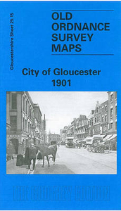
Gloucester Central 1901 Stanfords
£3.50
Vouchers
No voucher codes found.
Do you know a voucher code for this product or supplier? Add it to Insights for others to use.
Do you know a voucher code for this product or supplier? Add it to Insights for others to use.
 Denmark