
 United Kingdom
 France
 Germany
 Netherlands
 Sweden
 USA
USA
 Italy
Italy
 Spain
Spain
More From Contributor


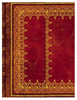


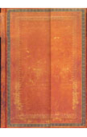
Foiled Leather Journal - Blank
This journal features striking gold embellishment combined with the look of an old leather journal that has been lovingly used for at least a century.It is made of paper and thick cardboard and the back cover comes up to wrap itself on the front cover with the help of an invisible magnet, thus protecting the pages inside.It has 144 blank pages, a memento pouch, and a grey ribbon marker. 13x18cm.

Product Description
Reviews/Comments
Add New
Intelligent Comparison
Archived Product
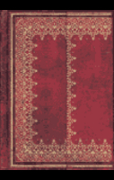
Foiled Leather Journal - Ruled Stanfords
£11.99
Archived Product
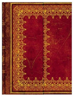
Saddleworn Leather Journal - Blank Stanfords
£11.99
Archived Product
Foiled Leather Journal (Large) - Ruled Stanfords
£16.99
Vouchers
No voucher codes found.
Do you know a voucher code for this product or supplier? Add it to Insights for others to use.
Do you know a voucher code for this product or supplier? Add it to Insights for others to use.
 Denmark