
 United Kingdom
 France
 Germany
 Netherlands
 Sweden
 USA
USA
 Italy
Italy
 Spain
Spain
More From Contributor


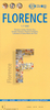


Florence City Flash
Waterproof, durable, indexed street plan of Florence at 1:15, 000, presented in a handy concertina fold, with an enlargement of the city centre at 1:9, 000, a map of the environs of Florence, and a diagram of the metro network. The main street plan is spread over both sides of the map, with one way streets indicated clearly, as are metro stations. Similar cartography is present in the city centre enlargement, whilst the map showing the environs of Florence shows only the major road network for the area from Modena in the north down to Siena. The map index only includes a selection of streets, and places of interest.A small inset box provides a selection of dialing codes for Florence, currency conversion information, and also emergency phone numbers.
Product Description
Reviews/Comments
Add New
Intelligent Comparison
Archived Product
Venice City Flash Stanfords
£6.95
Archived Product
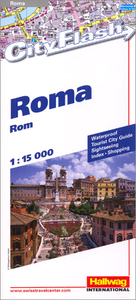
Rome City Flash Stanfords
£5.99
Archived Product
Milan City Flash Stanfords
£6.95
Archived Product

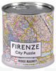
Florence City Puzzle Magnets Stanfords
£11.99
Archived Product

Berlin City Flash Stanfords
£6.95
Archived Product
Lisbon City Flash Stanfords
£6.95
Archived Product
Prague City Flash Stanfords
£6.95
Archived Product
Vienna City Flash Stanfords
£6.95
Vouchers
No voucher codes found.
Do you know a voucher code for this product or supplier? Add it to Insights for others to use.
Do you know a voucher code for this product or supplier? Add it to Insights for others to use.
 Denmark