
 United Kingdom
 France
 Germany
 Netherlands
 Sweden
 USA
USA
 Italy
Italy
 Spain
Spain
More From Contributor


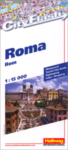
Rome City Flash
Street plan of Rome from Hallwag, laminated so waterproof and tear-resistant, and presented in a handy concertina format with an enlargement for the city centre, plans of the Vatican, Via Condotti, and the Leonardo da Vinci airport, plus a road map of the environs including access to the city’s two airports, Castel Gandolfo and Lido di Ostia.The main plan is divided between the two sides of the map and covers the city’s central districts, extending west to include the Vatican and most of the Villa Doria Pamphilj Park, south beyond the Terme di Caracalla, east beyond the Roma Termini central railway station, and north to include the Villa Borghese Park. Metro stations are clearly marked and the plan also shows one way streets, car parks and the central traffic zone. The city
centre from the Castel San Angelo to Trevi Fountain and the Foro Romano is shown in greater detail on an enlargement at 1:11, 000. The up-market shopping area of Via Condotti is presented with colour-coded markers highlighting its famous fashion boutiques and other shops. The index has only a selection of main streets but provides a separate list of places of interest. Map legend includes English.Also included is a detailed plan of the Vatican City with a list of 18 of its most famous museums, chapels and buildings. A road map of the environs extends well beyond the GRA outer motorway ring and includes access to the Leonardo da Vinci and Ciampino airports, Castel Gandolfo and Lido di Ostia, with a separate map showing the layout of the Leonardo da Vinci airport.* Please note: the same
cartography but with a wider coverage of the city and of its centre is provided by Hallwag’s other street plan of the city.

Product Description
Reviews/Comments
Add New
Intelligent Comparison
Archived Product
Florence City Flash Stanfords
£6.95
Archived Product

Berlin City Flash Stanfords
£6.95
Archived Product
Lisbon City Flash Stanfords
£6.95
Archived Product
Prague City Flash Stanfords
£6.95
Archived Product
Venice City Flash Stanfords
£6.95
Archived Product
Vienna City Flash Stanfords
£6.95
Archived Product
Paris City Flash Stanfords
£6.95
Archived Product
Milan City Flash Stanfords
£6.95
Vouchers
No voucher codes found.
Do you know a voucher code for this product or supplier? Add it to Insights for others to use.
Do you know a voucher code for this product or supplier? Add it to Insights for others to use.
 Denmark