
 United Kingdom
 France
 Germany
 Netherlands
 Sweden
 USA
USA
 Italy
Italy
 Spain
Spain
More From Contributor


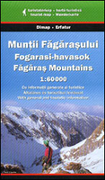
Fagaras Mountains
Fagaras Mountains at 1:60, 000 in a series of detailed contoured maps covering popular hiking areas of Transylvania published by Dimap, one of Hungary’s leading publishers specializing in mapping of that region. The maps show local hiking routes and provide tourist information such as campsites, places of interest, etc. Many titles include street plans and/or English language descriptions of recommended hiking trails.*In this title:* hiking map with contours at 100m intervals, highlighting several local footpaths and trails and indicating their waymarking signs. Symbols show local caves, waterfalls, and springs; hotels and campsites; places of interest, etc. Latitude and longitude lines are drawn at 2` intervals. On the reverse notes describe the region and the tourist routes
numbered on the map, plus provide details of local hotels and campsites.*Map legend and all the notes include English.*
numbered on the map, plus provide details of local hotels and campsites.*Map legend and all the notes include English.*

Product Description
Reviews/Comments
Add New
Vouchers
No voucher codes found.
Do you know a voucher code for this product or supplier? Add it to Insights for others to use.
Do you know a voucher code for this product or supplier? Add it to Insights for others to use.
 Denmark