More From Contributor
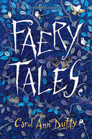
£12.99
Explore a world of topics, from hilarious animals, to unbelievable-but-true science facts, mind-blowing space stats, to incredible human achievements. Discover a fact for everyone, everyday, in this book. Did you know that Ancient Romans used wee to whiten their teeth, & to do their laundry? Or have you heard of the parrotfish, which covers itself in a cosy, thick layer of its own slime before it goes to sleep? Why not celebrate New Year`s Eve like the Estonians: tuck into seven meals to give you strength for the year ahead. Delicious! It`s most important to know that you should never shake hands with a bushbaby: the animals pee on their paws so that they leave a smelly trail wherever they go. Find out all this & much, much more, with enough facts for even the most curious reader. Also

Includes::
seasonal & `on this day` facts for added curiosity & fun, plus a completely random mix of everything else you can imagine. These facts are brought to life with stylish, full colour illustrations from Fatti Burke. Her charmingly beautiful artwork makes this a book to keep coming back to.

...
Archived Product
£8.99
” Original & witty & goes like stink.”
- Greg Loftin, director, Saxon. The mysterious return of a deceased film icon forces media
...
Archived Product
£14.99
One boy`s journey from a life on the streets to the glory of the boxing ring. Albert Kemp is a lonely widower, whose only son was killed in the war. Now, in 1953, he is working in a pub by the railway arches. Downstairs is a traditional bar, upstairs is a famous boxing gym. It is here that Albert brings Danny, a fatherless boy who he rescues from gang life on the streets. But as Danny begins to grow into a champion, the predators start to circle, luring him with glittering promises back into a life of crime in the corrupt world of match fixing. Will Danny listen to his wise old mentor? Or will the prospect of fame & money be too tempting. ...
Archived Product
£12.99
Take a photographic journey into London`s often overlooked advertising history & see how the capital`s businesses of old made use of h&-painted signs to inform, advertise & appeal to consumers. This intriguing book profiles h&-painted advertising from across the city & investigates the companies that commissioned the signs that now appear faded
- like ghosts
- on the brickwork of buildings. It is a snapshot of a time that is almost forgotten but which lives on through the sometimes haunting presence of ghost signs on the city`s streets. Richly illustrated with 150 full-colour signs, this collection reveals the many varied industries & businesses of London`s past. Fading Ads of London is a must for all true local historians.

...
Archived Product
£14.99
Faeries, elves, goblins, leprechauns, brownies, spriggans & many other supernatural beings leap vividly off the page in this collection of 25 haunting stories & folklore from the rich narrative heritage of Britain & Irel&, including authentic historical material dating from Anglo-Saxon times, the early Middle Ages & the 17th Century. Marvel over ancient spells to summon faeries to your house, tremble at the shapeshifting powers of dangerous faery queens, lose yourself amongst the illusions of Faeryland & learn how to protect family members from the terrors of faery abduction. Interspersed with facts on faery folklore, these tales cover faery morals, elvish misdemeanours, the spells cast by goblins & the sightings of the creatures, as well as their dealings with mortals. With charming illustrations from favourite illustrators throughout, including Arthur Rackham, this book reminds us of the enduring appeal of folklore & mystery for all generations. ...
Archived Product
£14.99
The Fagaras & Bucegi Mountains in the Transylvania, including the Piatra Craiului National Park & Brasov, on a waterproof & tear-resistant, double-sided, contoured & GPS compatible map at 1:80, 000 from terra Quest, highlighting hiking trails, campsites & refuges, etc. The map

Includes::
a street plan of central Bra?ov & is presented in a special format handy for conveniently viewing just small sections of it at one time. Topography is shown by contours at 10m intervals enhanced by relief shading & spot heights for local peaks, plus colouring for woodlands. Numerous hiking trails are prominently highlighted, indicating their waymarking colours & signage. Symbols mark various facilities & places of interest including hotels, campsites, mountain refuges & shelters, historical sites, etc. Local roads show locations of car parks & petrol stations. The map has latitude & longitude grid at intervals of 1’. Map legend

Includes::
English. Also provided is a street plan at 1:15, 000 of central Bra?ov, plus a road map at 1:850, 000 showing central Romania between Targu Mures, Alba Iulia, Brasov & Pitesti. The map is laminated in a format similar to the old cloth-dissected maps so that sections of it can be easily folded back without damage, & can be annotated with write-on/wipe-off marker pens.


...
Archived Product
£9.99
Fagaras Mountains at 1:60, 000 in a series of detailed contoured maps covering popular hiking areas of Transylvania published by Dimap, one of Hungary’s leading publishers specializing in mapping of that region. The maps show local hiking routes & provide tourist information such as campsites, places of interest, etc. Many titles include street plans and/or English language descriptions of recommended hiking trails.* In this title:* hiking map with contours at 100m intervals, highlighting several local footpaths & trails & indicating their waymarking signs. Symbols show local caves, waterfalls, & springs; hotels & campsites; places of interest, etc. Latitude & longitude lines are drawn at 2` intervals. On the reverse notes describe the region & the tourist routes numbered on the map, plus provide details of local hotels & campsites.* Map legend & all the notes include English.* ...
Archived Product
£12.99
Fagaras Mountains at 1:75, 000 from Bel Alpin on a contoured walking map with a 64-page guide providing descriptions of 56 hiking routes & 90km traverse along the ridge route across the whole lengths of the chain. The map has contours at 100m intervals with additional shading & graphic relief for rocky ridges & outcrops, plus colouring for woodlands. An overprint highlight hiking routes, indicating waymarking & shows chalets, refuges, campsites, hunting lodges, mountain rescue posts, etc. The map has no geographical coordinates for GPS. The 64-page guide attached to the map cover provides detailed descriptions of 56 hiking trails & of the 90km-long main ridge route, with separate descriptions for the traverse in the westerly & the easterly directions. The guide also provides information on the cabanas (mountain huts & chalets), alpine refuges & other types of shelters in the mountains, as well as notes on the region’s fauna, flora & local villages. All the text is in English. ...
Archived Product
£23.99
Map No. 10049, Fagernes, in the new topographic survey of Norway at 1:50, 000 covering the country on 195 double-sided sheets & first published by Nordeca in 2011
- 2012; fully GPS compatible, indicating waymarked footpaths, campsites, tourist huts, illuminated ski runs, etc. The maps, now published by Nordeca, the successors to Statens Kartverk & its subsequent owners the Ugland Group, are printed on light, waterproof & tear-resistant synthetic paper. Each map covers an area of 62x 45 kilometres (39 x 28 miles approx.), with a 2-km overlap between the sheets. The maps have contours at 20m intervals (10m glacier contours), plus colouring & graphics to show cultivated areas, bogs, forests, etc. In addition to all the information expected of topographic mapping at this scale the maps distinguish between waymarked & unmarked footpaths & show campsites, tourist huts (serviced/self service/no supplies), country hotels & restaurants, & illuminated ski trails. The series uses EUREF89 (WGS84) datum & the maps have a 1-km UTM grid. Map legend is in Norwegian & English. Each title comes in a sturdy protective card envelope.
...
Archived Product
£16.99
Sverigeserien is an outdoor map series consisting of 116 sheets with coverage of southern & central Sweden & the northern coastline. The map is suitable for outdoor activities such as hiking, excursions, trail running, hunting, fishing, riding, cycling, mountain biking, paddling, skating & much more. Every sheet covers an area of 45x 68km. These topographical maps in scale 1:50 000 contain all the information needed for outdoor activities: Terrain information, hiking trails, illuminated tracks, camping, shelters, golf courses, leisure baths, historical remains, roads in different categories, railway lines & much more. Easy to read topography with contour lines, vertical interval 5 m. Sverigeserien is a high-quality map series & is durable for frequent use! Updated content with map data from Lantmäteriet (National Land Survey of Sweden) & printed on Polyart which is water & tear resistant. This means that the map can be folded repeatedly without breaking & can withstand the challenging weather in Sweden during both winter & summer. Legend is in Swedish, English & German. ...
Archived Product

Faery Tales

Once upon a time, there was a rich merchant who had three daughters. The girls were just as clever as they were bella and none more so than the youngest, whose name was Beauty. Disappear to faraway lands of wicked witches, evil monsters and brave heroines in Poet Laureate Carol Ann Duffy`s stunning collection of fairy tales. Including her beautiful and haunting retellings of the Grimm classics Hansel and Gretel, Snow White and the Pied Piper, as well as other tales from around the world, and new stories of her own, this book will make you think again about once upon a time...
RIP - This product is no longer available on our network. It was last seen on 25.09.2019

This page now acts as a permanent archive for this product. Add more information using the comments box below to ensure it can still be found by future generations.

Use our search facility to see if it is available from an alternative contributor.
  • External links may include paid for promotion
  • Availability: Out Of Stock
  • Supplier: Stanfords
  • SKU: 9780571314270
Availability: In Stock
£20.00

Product Description

Once upon a time, there was a rich merchant who had three daughters. The girls were just as clever as they were bella & none more so than the youngest, whose name was Beauty. Disappear to faraway lands of wicked witches, evil monsters & brave heroines in Poet Laureate Carol Ann Duffy`s stunning collection of fairy tales. Including her beautiful & haunting retellings of the Grimm classics Hansel & Gretel, Snow White & the Pied Piper, as well as other tales from around the world, & new stories of her own, this book will make you think again about once upon a time...

Reviews/Comments

Add New

Intelligent Comparison

Oooops!
We couldn't find anything!
Perhaps this product's unique.... Or perhaps we are still looking for comparisons!
Click to bump this page and we'll hurry up.

Price History

Vouchers

No voucher codes found.
Do you know a voucher code for this product or supplier? Add it to Insights for others to use.

Facebook

Jargon Buster

White - A colour combining all colours
World - A physical grouping, commonly used to describe earth and everything associated with ti
Snow - Water and vapour in clouds that falls in a white crystal form leaving a white layer.

Supplier Information

Stanfords
Stanfords was established in 1853 and opened their iconic Covent Garden flagship store in 1901. They have become the top retailer of maps, travel books and accessories in the UK and arguably offer the largest selection of maps and travel books worldwide. Famous names such as Captain Robert Falcon Scott, Ranulph Fiennes and Michael Palin have purchased from Stanfords. They now have a shop in Bristol and both stores together with other venues operate a calendar of events including talks, book signings and exhibitions. As a specialist map retailer, the map selection is comprehensive and includes road maps, street maps and walking maps from worldwide destinations, as well as a selection of world atlases and wall maps. Books include travel guides and travel literature. Stanfords also stock globes, from miniatures made of blue marble to magnificent floor-standing globes. The website features a selection of interesting articles on travel topics.
Page Updated: 2023-11-12 20:15:36

Community Generated Product Tags

Oh No! The productWIKI community hasn't generated any tags for this product yet!
Menu