More From Contributor
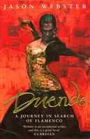
£3.50
Dudley Castle in 1901 in a fascinating series of reproductions of old Ordnance Survey plans in the Alan Godfrey Editions, ideal for anyone interested in the history of their neighbourhood or family. The map covers the northern part of Dudley, Tipton Green, Burnt Tree & much of Dudley Port. Features include Dudley Castle, GWR railway with Dudley station, LNWR South Staffordshire Line with Sedgley Junction, The Priory, Dudley Canal with tunnel, Birmingham Canal (Wolverhampton Level), tramways & depot, Guest Hospital, Victoria Park, Todd`s End, Lime Works, Coneygree Colliery, old coal shafts, Burnt Tree area, St Michael`s church, Model Sausage Factory, Park Hotel, industrial tramways, etc. The map doubles as Worcestershire sheet 1.12 & highlights the complicated county structure in this area, with two detached portions of Worcestershire. About the Alan Godfrey Editions of the 25” OS Series: Selected towns in Great Britain & Ireland are covered by maps showing the extent of urban development in the last decades of the 19th & early 20th century. The plans have been taken from the Ordnance Survey mapping & reprinted at about 15 inches to one mile (1:4, 340). On the reverse most maps have historical notes & many also include extracts from contemporary directories. Most maps cover about one mile (1.6kms) north/south, one & a half miles (2.4kms) across; adjoining sheets can be combined to provide wider coverage.FOR MORE INFORMATION & A COMPLETE LIST OF ALL AVAILABLE TITLES PLEASE CLICK ON THE SERIES LINK. ...
Archived Product
£4.50
Dudley West in 1881 in a fascinating series of reproductions of old Ordnance Survey plans in the Alan Godfrey Editions, ideal for anyone interested in the history of their neighbourhood or family. Two versions have been published for this area. The maps cover the western part of Dudley town, including the Old Dock area, & extend westward to the Old Park area, & southward to Scotts Green & Blowers Green. Other districts mentioned include Thornleigh Collieries, Springs Mire, New Dock, Sunnyside. The area is split between Staffordshire & Worcestershire, & doubles as Worcestershire sheet 1.15. Features include tramways, short stretch of GWR OWW line, several mineral railways, Yorkspark Colliery (disused), Thornleigh Works, old mine shafts, public baths, St Luke`s church, schools, Russell`s Hall, Himley Colliery, Graveyard Farm, Parkhead Colliery (disused), St Augustine`s church, expanses of old industrial sites & coalfield, etc. The 1881 version is in colour, taken from the beautiful h&-coloured OS 1st Edition map. About the Alan Godfrey Editions of the 25” OS Series Selected towns in Great Britain & Ireland are covered by maps showing the extent of urban development in the last decades of the 19th & early 20th century. The plans have been taken from the Ordnance Survey mapping & reprinted at about 15 inches to one mile (1:4, 340). On the reverse most maps have historical notes & many also include extracts from contemporary directories. Most maps cover about one mile (1.6kms) north/south, one & a half miles (2.4kms) across; adjoining sheets can be combined to provide wider coverage.FOR MORE INFORMATION & A COMPLETE LIST OF ALL AVAILABLE TITLES PLEASE CLICK ON THE SERIES LINK. ...
Archived Product
£3.50
Dudley West in 1901 in a fascinating series of reproductions of old Ordnance Survey plans in the Alan Godfrey Editions, ideal for anyone interested in the history of their neighbourhood or family. Two versions have been published for this area. The maps cover the western part of Dudley town, including the Old Dock area, & extend westward to the Old Park area, & southward to Scotts Green & Blowers Green. Other districts mentioned include Thornleigh Collieries, Springs Mire, New Dock, Sunnyside. The area is split between Staffordshire & Worcestershire, & doubles as Worcestershire sheet 1.15. Features include tramways, short stretch of GWR OWW line, several mineral railways, Yorkspark Colliery (disused), Thornleigh Works, old mine shafts, public baths, St Luke`s church, schools, Russell`s Hall, Himley Colliery, Graveyard Farm, Parkhead Colliery (disused), St Augustine`s church, expanses of old industrial sites & coalfield, etc. The 1881 version is in colour, taken from the beautiful h&-coloured OS 1st Edition map. About the Alan Godfrey Editions of the 25” OS Series Selected towns in Great Britain & Ireland are covered by maps showing the extent of urban development in the last decades of the 19th & early 20th century. The plans have been taken from the Ordnance Survey mapping & reprinted at about 15 inches to one mile (1:4, 340). On the reverse most maps have historical notes & many also include extracts from contemporary directories. Most maps cover about one mile (1.6kms) north/south, one & a half miles (2.4kms) across; adjoining sheets can be combined to provide wider coverage.FOR MORE INFORMATION & A COMPLETE LIST OF ALL AVAILABLE TITLES PLEASE CLICK ON THE SERIES LINK. ...
Archived Product
£3.50
Dudley, Bridgnorth & District in 1898 in a series of reproductions of Ordnance Survey’s famous ” Inch to the Mile” maps published in the Alan Godfrey Editions to provide a historical record of England & Wales in the second half of 19th & early 20th century. The map covers the western part of the Black Country, plus a good section of east Shropshire. Coverage stretches from Dudley & Tipton westward to Morville, & from Bilston southward to Wolverley. Features include much of the Severn Valley Railway, Kinlet Park, the industrial area around Sedgley, the Staffordshire & Worcestershire Canal, etc. Other locations on the map include: in SHROPSHIRE Alveley, Billingsley, Chelmarsh, Claverley, Eardington, Glazeley, Highley, Middleton Scriven, Oldbury, Quatford, Quatt, Rudge, Sidbury, Stottesden & Worfield; in STAFFORDSHIRE Bobbington, Bradley, Brettell Lane, Brierley Hill, Cradley Heath, Enville, Gornalwood, Kingswinford, Kinver, Netherton, Pensnett, Quarry Bank, Seisdon, Upper Arley, Upper Gornal, Upper Penn & Wombourne; plus in WORCESTERSHIRE Blakedown, Broom, Churchill, Clent, Cradley, Hagley, Hasbury, Lutley, Lye, Pedmore, Stourbridge & Wollaston. On the reverse is a map of the village of Trysull. About the Alan Godfrey Editions of the OS Inch to the Mile Maps: the maps provide an invaluable overview of a wider area, typically 18 x 12 miles (29 x 19 kms approx.), & offer historical mapping for small towns & villages not covered by the more detailed series for which the Godfrey Editions are better known. On the reverse all the maps have historical notes & most titles also include a more detailed, large scale map of a small town or a village in the area. To see other titles in this series please click on the series link. ...
Archived Product
£9.99
Dudley, West Bromwich, Halesowen & Stourbridge in the Cassini Past & Present map series which covers town & cities of England & Wales & offers a unique way of tracing their history & expansion by showing four different periods of their development using Ordnance Survey mapping from the mid-19th century, the late 19th century, the 1920s & the present day. Coverage

Includes::
Blackheath, Brierley Hill, Clent, Kingswinford, Oldbury, Sedgley, Tipton & Wombourne. Each Past & Present map consists of four panels, all centred on a city or a town & covering exactly the same 15km x 15km area. Three of the panels reproduce Ordnance Survey’s historical editions: the Old Series, the Revised New Series & the Popular Edition, enlarged from their original inch-to-the-mile to match the 1:50, 000 scale of the present-day Landranger extract shown in the fourth panel.* Old Series: the first detailed survey mapping dating from the first half of the 19th century, in black & white & with relief shown by hachuring.* Revised New Series from 1880s/1900s, with some colouring & a mixture of hachuring & contour lines.* Popular Edition from the inter-war years, with contour lines & colouring to indicate woodlands, parks, etc. National Grid lines are shown on all four panels for easy comparison across the four time periods. Historical notes, details of the original maps used & web-links for local history societies & other sources of information are also provided. *PLEASE NOTE:** Reproductions from the Ordnance Survey’s historical series are also available as maps of a wider area, with each title corresponding in its coverage to a present day Landranger map. Please see Great Britain: Cassini Historical Reproductions of Ordnance Survey One-Inch Maps series.* Stanfords can also print on request mapping from all the series *centring the map on a location of your choice.* For more information please click on the link below.

...
Archived Product
£9.99
Dugi Otok
- the “ Long Island”, with the nearby Iž, Sestrunj, Rava, Zverinac & the surrounding smaller islands on a contoured
...
Archived Product
£8.99
Falk, one of Germany`s leading publishers of street plans, produce their town plans in two different formats. Falk Extra plans are folded in a standard way, where the whole map can be opened to view the entire area it covers. For larger cities, the same mapping is also published with a special folding system designed to show only a small section of the map at one time. The whole map can be opened but it will be cut in several places. Many find these street plans very user-friendly & easier to handle than conventional maps. The plans, which cover towns with their outer suburbs, indicate main landmarks & public buildings & show all the public transport facilities, one way streets & car parks. Plans of lager cities include a separate map of the town centre at a more detailed scale & a diagram of the underground & the suburban rail network. The plans also show the postal divisions & have an extensive street index which, where appropriate, shows individual postal codes for each street. Map legend

Includes::
English. Falk Extra plans also include on the reverse a road map of the surrounding area.

...
Archived Product
£3.95
Duisburg & Ruhrort in 1944 in the Alan Godfrey series of reproductions of British War Office survey first published in 1945 prior to the Allied occupation of the area. The map covers the centre of Duisburg, Ruhrort, Laar & parts of Meiderich, Homberg & Beeck. Coverage stretches from Duisburg Hauptbanhof northward to Beeck & westward to Hochheide. Features include the various docks at Ruhrort, the largest inland port in Europe; the harbours at Duisburg; several collieries, the major steelworks at Laar, other industries on the west side of Duisburg, railways, Duissern, Papandell, Meiderich, Laar, Kaddlerfeld, Neuenkamp, Ruhrort, Beeck, Homberg, Essenberg, Asterlagen, Hochheide, Hochhalen, River Rhein. An index names many of the factories & other large buildings. To see other titles in this series please click on the series link. This series of reproductions from Alan Godfrey covers the major industrial area east of the Rhine that

Includes::
Bochum, Cologne, Dortmund, Duisburg, Düsseldorf, Essen, Gelsenkirchen, Oberhausen & other towns, with their great network of railways & industries. The maps are taken from the British War Office 1:12, 500 plans & reduced at Approx. 1:19, 000. Published in 1945, prior to the Allied occupation of the area, the maps are especially good at showing industry, collieries & transport. They are not bombing maps
- indeed, they make clear that allowance is not made for bomb damage
- but show the areas with all their industrial sites & railways largely as they were before the bombing raids of 1943-44. The maps have additional information added by British intelligence. This is normally accurate but allowance must be made for the `fog of war` & occasional spelling mistakes, etc. Each title has on the reverse a specially written introduction to the area in English, with a shorter text in German. Map legend is in English only.


...
Archived Product
£3.95
Duisburg North: Hamborn & Bruckhausen in 1944 in the Alan Godfrey series of reproductions of British War Office survey first published in 1945 prior to the Allied occupation of the area. The map covers the northern part of Duisburg, including Hamborn, once a major city in its own right. Features include Bruckhausen, Marxloh, Schwelgern, part of Beeck, Fahrn, Alsum, Walsum, Binsheim, Neumühl, Obermarxloh, many steelworks, collieries, railways & docks in this major industrial area. To see other titles in this series please click on the series link. This series of reproductions from Alan Godfrey covers the major industrial area east of the Rhine that

Includes::
Bochum, Cologne, Dortmund, Duisburg, Düsseldorf, Essen, Gelsenkirchen, Oberhausen & other towns, with their great network of railways & industries. The maps are taken from the British War Office 1:12, 500 plans & reduced at Approx. 1:19, 000. Published in 1945, prior to the Allied occupation of the area, the maps are especially good at showing industry, collieries & transport. They are not bombing maps
- indeed, they make clear that allowance is not made for bomb damage
- but show the areas with all their industrial sites & railways largely as they were before the bombing raids of 1943-44. The maps have additional information added by British intelligence. This is normally accurate but allowance must be made for the `fog of war` & occasional spelling mistakes, etc. Each title has on the reverse a specially written introduction to the area in English, with a shorter text in German. Map legend is in English only.


...
Archived Product
£3.95
Duisburg South: Rheinhausen & Wedau in 1944 in the Alan Godfrey series of reproductions of British War Office survey first published in 1945 prior to the Allied occupation of the area. The map is in colour & covers the southern part of Duisburg, including Wanheim, Angerhausen, Buxchholz, Hochfeld, Wanheimerort, Wedau. On the left bank of the Rhine is Rheinhausen with the vast Krupp steelworks; also Friemersheim, Bergheim, Atrop, Schwarzenberg, Hochemmerich. The area is fascinating for its various industries & railways on the edge of the Wedau woods. Of especial interest to many British readers are the barracks at Buchholz, built as anti-aircraft barracks but later taken over as Glamorgan Barracks. Also included is an index naming many of the factories & other large buildings. To see other titles in this series please click on the series link. This series of reproductions from Alan Godfrey covers the major industrial area east of the Rhine that

Includes::
Bochum, Cologne, Dortmund, Duisburg, Düsseldorf, Essen, Gelsenkirchen, Oberhausen & other towns, with their great network of railways & industries. The maps are taken from the British War Office 1:12, 500 plans & reduced at Approx. 1:19, 000. Published in 1945, prior to the Allied occupation of the area, the maps are especially good at showing industry, collieries & transport. They are not bombing maps
- indeed, they make clear that allowance is not made for bomb damage
- but show the areas with all their industrial sites & railways largely as they were before the bombing raids of 1943-44. The maps have additional information added by British intelligence. This is normally accurate but allowance must be made for the `fog of war` & occasional spelling mistakes, etc. Each title has on the reverse a specially written introduction to the area in English, with a shorter text in German. Map legend is in English only.


...
Archived Product

Duende

When Jason Webster heads off for Spain in search of “duende”, the intense emotional state - part ecstasy, part desperation - so intrinsic to flamenco, he has no idea what to expect.What he finds is a kaleidoscope of experience and excitement: From the tyranny of his guitar teacher, practising for hours on end until his fingers bleed, to his passionate affair with Lola, a flamenco dancer (and older woman) married to the gun-toting Vicente, which causes him to flee Alicante in fear of his life. In Madrid, he falls in with gypsies and meets the imperious Jesus. Joining their dislocated, cocaine-fuelled world, stealing cars by night and sleeping away the days in tawdry rooms, he finds himself spiralling self-destructively downwards.It is only when he arrives in Granada bruised
and battered, after two years total immersion in the flamenco lifestyle, that he is able to put his obsession into context.
RIP - This product is no longer available on our network. It was last seen on 25.09.2019

This page now acts as a permanent archive for this product. Add more information using the comments box below to ensure it can still be found by future generations.

Use our search facility to see if it is available from an alternative contributor.
  • External links may include paid for promotion
  • Availability: Out Of Stock
  • Supplier: Stanfords
  • SKU: 9780552999977
Availability: In Stock
£8.99

Product Description

When Jason Webster heads off for Spain in search of “duende”, the intense emotional state
- part ecstasy, part desperation
- so intrinsic to flamenco, he has no idea what to expect. What he finds is a kaleidoscope of experience & excitement: From the tyranny of his guitar teacher, practising for hours on end until his fingers bleed, to his passionate affair with Lola, a flamenco dancer (and older woman) married to the gun-toting Vicente, which causes him to flee Alicante in fear of his life. In Madrid, he falls in with gypsies & meets the imperious Jesus. Joining their dislocated, cocaine-fuelled world, stealing cars by night & sleeping away the days in tawdry rooms, he finds himself spiralling self-destructively downwards. It is only when he arrives in Granada bruised & battered, after two years total immersion in the flamenco lifestyle, that he is able to put his obsession into context.

Reviews/Comments

Add New

Intelligent Comparison

Oooops!
We couldn't find anything!
Perhaps this product's unique.... Or perhaps we are still looking for comparisons!
Click to bump this page and we'll hurry up.

Price History

Vouchers

No voucher codes found.
Do you know a voucher code for this product or supplier? Add it to Insights for others to use.

Facebook

Jargon Buster

Spain - A country within the EU.
World - A physical grouping, commonly used to describe earth and everything associated with ti
Experience - To gain further knowledge by practising.

Supplier Information

Stanfords
Stanfords was established in 1853 and opened their iconic Covent Garden flagship store in 1901. They have become the top retailer of maps, travel books and accessories in the UK and arguably offer the largest selection of maps and travel books worldwide. Famous names such as Captain Robert Falcon Scott, Ranulph Fiennes and Michael Palin have purchased from Stanfords. They now have a shop in Bristol and both stores together with other venues operate a calendar of events including talks, book signings and exhibitions. As a specialist map retailer, the map selection is comprehensive and includes road maps, street maps and walking maps from worldwide destinations, as well as a selection of world atlases and wall maps. Books include travel guides and travel literature. Stanfords also stock globes, from miniatures made of blue marble to magnificent floor-standing globes. The website features a selection of interesting articles on travel topics.
Page Updated: 2023-11-12 20:15:36

Community Generated Product Tags

Oh No! The productWIKI community hasn't generated any tags for this product yet!
Menu