-
Home
-
Contributors
-
International
-
Account
-
Information
More From Contributor
Includes:: expert advice, tracking down the best sights & experiences; suggested itineraries & highlights ...
Includes:: lists of selected places of interest, market days & farmers markets, plus brief notes on the Jurassic Coast World Heritage site. Current edition of this title was published in February 2016. To see the list of titles in this series please click on the series list – Ordnance Survey’s Tour maps have extra clear, uncluttered cartography. Topography is shown by altitude colouring & relief shading, plus names of local hill or mountain ranges & heights of important peaks. Additional colouring indicates woodlands; boundaries of National Parks or designated Areas of Outstanding Natural Beauty are also marked. Road information very clearly distinguishes between different types of roads, from motorways to small local roads, with distances on main routes. Scenic routes are highlighted; motorway services, tolls, gradients on steep roads & level crossings are marked & towns used in motorway signs as Primary Route Destinations are indicated. Railway lines are shown with stations &, where appropriate, ferry routes are marked. Roads which are part of the national or regional cycle network are highlighted & shown with route numbers; the maps also show the National Trail long-distance hiking paths. An extensive range of symbols indicate various places of interest, including campsites/caravan parks & youth hostels/bunkhouses, historic buildings, sport & recreational facilities, country pubs, etc. The maps have lines of the British National Grid. The place names index is supplemented by a list of selected places of interest plus, in most titles, of market days and/or farmers markets. The maps also include city navigation maps, highlighting main traffic arteries, car parks, principal sights & facilities, etc. For more information please see descriptions & coverage images of individual maps. ...
Includes:: rides near Tavistock, Bideford, Okehampton, Tiverton, Totnes & Sidmouth. ...
Includes:: distance from London of main towns, market days, post towns, coast guard & life boat stations, etc. Each title also gives county statistics: population, area in acres, gross rental, inhabited houses, poor rate, & the number of paupers (!). Where appropriate, hachures are used to show the topography. The area outside the county boundary is not coloured but main towns plus road & rail connections are marked. Each map is backed onto cloth & presented folded in a colourful case covered with a unique design marbled paper. To see the list of all the titles in this series please click on the series link. ...
Includes:: distance from London of main towns, market days, post towns, coast guard & life boat stations, etc. Each title also gives county statistics: population, area in acres, gross rental, inhabited houses, poor rate, & the number of paupers (!). Where appropriate, hachures are used to show the topography. The area outside the county boundary is not coloured but main towns plus road & rail connections are marked. Each map is backed onto cloth & presented folded in a colourful case covered with a unique design marbled paper. To see the list of all the titles in this series please click on the series link. ...

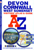
Devon - Cornwall - West Somerset A-Z Visitors` Atlas & Guide
interest and facilities, which are also listed in the index of towns and villages. 25 street plans, each accompanied by a brief description and a list of attractions, cover Barnstaple, Bodmin, Brixham, Bude, Dartmouth, Exeter, Falmouth, Fowey, Ilfracombe, Lauceston, Liskeard, Lynton – Lynmouth, Minehead, Newquay, Newton Abbot, Padstow, Paignton, Penzance, Plymouth, St. Ives, Taunton, Torquay and Truro. Current 8th edition of this title was published in 2014. To see the list of titles on A-Z’s Visitor’ series please click on the series link.
This page now acts as a permanent archive for this product. Add more information using the comments box below to ensure it can still be found by future generations.
Use our search facility to see if it is available from an alternative contributor.
- External links may include paid for promotion
- Availability: Out Of Stock
- Supplier: Stanfords
- SKU: 9781843486459
Product Description
Devon, Cornwall & West Somerset road atlas from Geographers’ A-Z Map Company covering the region at 1:158, 400 (1” to 2.5 miles), plus street plans & tourist information for 25 local towns. Numerous places of interest are prominently highlighted on the map & the plans, plus listed in an extensive index. Coverage along the northern coast extends to Weston-super-Mare, & on the southern coast to Lyme Regis & Bridport. Road network is shown with Primary Route Destinations prominently marked, services on motorways & major roads, locations of safety cameras with speed limits, tolls, steep gradients, etc. Topography is indicated by colouring for national parks, areas of natural beauty & woodlands. A very wide range of symbols indicates various attractions, places of interest & facilities, which are also listed in the index of towns & villages. 25 street plans, each accompanied by a brief description & a list of attractions, cover Barnstaple, Bodmin, Brixham, Bude, Dartmouth, Exeter, Falmouth, Fowey, Ilfracombe, Lauceston, Liskeard, Lynton – Lynmouth, Minehead, Newquay, Newton Abbot, Padstow, Paignton, Penzance, Plymouth, St. Ives, Taunton, Torquay & Truro. Current 8th edition of this title was published in 2014. To see the list of titles on A-Z’s Visitor’ series please click on the series link.
Reviews/Comments
Add New
Intelligent Comparison
We couldn't find anything!
Perhaps this product's unique.... Or perhaps we are still looking for comparisons!
Click to bump this page and we'll hurry up.
Price History
Vouchers
Do you know a voucher code for this product or supplier? Add it to Insights for others to use.


 United Kingdom
 France
 Germany
 Netherlands
 Sweden
 USA
USA
 Italy
Italy
 Spain
Spain


 Denmark