
 United Kingdom
 France
 Germany
 Netherlands
 Sweden
 USA
USA
 Italy
Italy
 Spain
Spain
More From Contributor


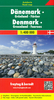


Denmark F&B Top 10 Tips 2-Map Set
Denmark at 1:150, 000 in a set of two large, double-sided, GPS compatible maps from Freytag & Berndt highlighting National Cycle Routes and selected other cycle trails, officially designated tourist routes, and best sights, with descriptions in the accompanying booklet; plus street plans of central Copenhagen, Aalborg, Aarhus and Odense. Southern Jutland and the islands are on one map (coverage includes the adjoining coast of Sweden between Malmö and Helsingborg with the Øresund Bridge and ferry connections), with central and northern Jutland on the other sheet.Topography is shown by spot heights, with colouring for woodlands and protected areas. Road network indicates distances on most small local routes. Denmark’s National Cycle Routes and PR panoramic trails are marked and
annotated with their official numbers. The map also highlights special tourist routes and scenic roads. Railway lines are shown with stations and ferry routes are marked. Symbols show various places of interest and the map indicates locations worth visiting, with 10 top sights cross-referenced to their descriptions in the accompanying booklet. Latitude and longitude lines are drawn at 10’ intervals. The index is in the booklet and lists locations with their postcodes.The booklet also includes street plans of central Copenhagen, Aalborg, Aarhus and Odense, plus brief descriptions of Denmark’s 12 National Cycle Routes and eight panoramic cycle trails. Map legend and all the text include English.
annotated with their official numbers. The map also highlights special tourist routes and scenic roads. Railway lines are shown with stations and ferry routes are marked. Symbols show various places of interest and the map indicates locations worth visiting, with 10 top sights cross-referenced to their descriptions in the accompanying booklet. Latitude and longitude lines are drawn at 10’ intervals. The index is in the booklet and lists locations with their postcodes.The booklet also includes street plans of central Copenhagen, Aalborg, Aarhus and Odense, plus brief descriptions of Denmark’s 12 National Cycle Routes and eight panoramic cycle trails. Map legend and all the text include English.
Product Description
Reviews/Comments
Add New
Vouchers
No voucher codes found.
Do you know a voucher code for this product or supplier? Add it to Insights for others to use.
Do you know a voucher code for this product or supplier? Add it to Insights for others to use.
 Denmark