More From Contributor

£8.99
Dartmoor National Park on a detailed topographic & GPS compatible map OL28, paper version, from the Ordnance Survey’s 1:25, 000 Explorer series. Coverage

Includes::
Ivybridge, Tavistock, Buckfastleigh, Ashburton, Peter Tavy, Okehampton, Moretonhampstead, Widecombe in the Moor, a section of the Two Moors Way, the West Devon Way, the Tarka Trail, etc.MOBILE DOWNLOADS: this title & all the other OS Explorer maps include a code for downloading after purchase the digital version onto your smartphone or tablet for viewing on the OS smartphone app.OS EXPLORER SERIES: to see the list of all the titles in the OS Explorer series, both paper & waterproof versions, please click on the series link. The Explorer series, Ordnance Survey’s most detailed maps recommended for anyone enjoying outdoor activities, provides topographic coverage of Great Britain at 1:25, 000 on GPS compatible maps with hiking trails, cycling routes & extensive tourist information. Each printed map is available either on paper or as a waterproof & tear-resistant OS Active Map, as indicated in its title. Britain’s National Parks & other areas of particular tourist interest are presented on often double-sided OL (Outdoor Leisure) maps, whilst most standard format Explorers cover an area of 30 x 20km (approx. 19 x 12 miles). All three versions (paper, waterproof & digital) are the same & provide plenty of recreational & tourist information, indicating the traditional public right of way paths (except in Scotland where different laws apply), including bridleways & byways. National Trails & other long-distance paths are marked, as well as permissive footpaths or bridleways & on-road or traffic-free cycle routes with, where appropriate, their National/ Regional Cycle Network numbers. Boundaries of access land are clearly marked. A wide range of symbols provides additional tourist information, highlighting camping & caravanning sites, information offices & visitors’ centres, parking & picnicking places, country pubs, sport & recreational facilities including cycle hire locations & mountain biking trails, historic buildings & museums, etc. Exceptionally clear presentation of the landscape is provided by contours at 5m or in the uplands at 10m intervals, with additional spot heights plus colouring and/or graphics for different types of woodlands, orchards, heath, marshl&, scree or boulders, & other topographic features. For GPS users the maps have British National Grid lines at 1km intervals, with latitude & longitude given by margin ticks at 1`. Clearly laid out map legend

Includes::
French & German translations for the tourist information symbols.


...
Archived Product
£7.99
These are circular routes & family traffic-free cycling trails with clear, easy to follow maps. National Cycle Network Routes are shown as are well researched local routes to make the most of the beautiful scenery in the area. Cycle hire centres are highlighted as well as places to eat or grab a coffee. The maps are laminated for protection. ...
Archived Product
£12.95
John Earle’s Cicerone guide to Walking on Dartmoor explores one of England’s favourite National Park walking destinations as well as its surrounding areas. Dartmoor has been referred to as one of the last great wildernesses in the country, where it is possible to get further away from civilisation than anywhere else. Its wild, lonely & remote areas of uplands & mountains, even in holiday periods, make it ideal walking country. The guide is organized into five sections
- the South Moor, Widecombe walks, the North-East Moor, the North-West Moor & other Long walks taking in a total of 43 walking experiences. Each walk has a distance & difficulty rating at the start to help walkers plan their routes & the guide also allows for those of different abilities. An extensive introduction

Includes::
essential information for any visitor- details on the geology & formation of Dartmoor, its legends & history as well as practical information on maps & compasses, equipment, clothing, tips on walking & climbing & the unique curiosity of the Dartmoor letterbox. Detailed route descriptions are accompanied by Ordnance Survey extracts mapping the route as well as colour photographs illustrating some of the highlights of the region.


...
Archived Product
£11.99
Dartmoor in the Pathfinder Guides series, produced in association with Ordnance Survey & published by Crimson; comprising a range of walking guides to popular British destinations. Each Pathfinder guide

Includes::
28 varied walks ranging from easy strolls to exhilarating hikes & is accompanied by 1:25, 000 Ordnance Survey mapping with marked, colour-coded routes. Introductory sections profile the county or region covered, with recommendations on the best time to visit & a brief explanation of GPS. An

...
Archived Product
£2.99
Dartmouth & Slapton area on a very detailed, GPS compatible hiking, cycling & horse riding map from Croydecycle at 1:12, 500, printed on light, waterproof & tear-resistant synthetic paper. The map is part of publishers’ series covering the western coast of Somerset, both coastlines of Devon, & the adjoining areas of Dorset. Each handy size, 50 x 35cm, map is double-sided to cover a wider area. Topography is indicated by contours at 10m intervals with graphics and/or colouring for different type of terrain (s&, shingle, mud, high or low cliffs, etc) & vegetation (woodlands, gorse, scrub, etc). An overprint highlights footpaths, permissive paths & small permissive paths, Bridleways, cycle tracks & country roads which are byways for all traffic. On other roads markings indicate routes which are part of the National Cycle Network. Symbols show locations of campsites & caravan sites, riding stables, pubs/cafes/restaurants, shops & other local facilities, etc. For GPS users each map has in the margins National Grid coordinates. Most 1:12, 500 maps include enlargements of main town (s), an inset providing geological information, & details of transport options. ...
Archived Product
£2.95
Darwen in 1909 in a fascinating series of reproductions of old Ordnance Survey plans in the Alan Godfrey Editions, ideal for anyone interested in the history of their neighbourhood or family. Selected towns in Great Britain & Ireland are covered by maps showing the extent of urban development in the last decades of the 19th & early 20th century. In this title: the map covers the Lancashire mill town of Darwen & the area south towards Spring Vale station. Much of the town is covered, with coverage extending from Vale Street & Robert Street southward to Melbourne Street, & from Sunnyhurst eastward to Turncroft. Features include Darwen station (at top of map), Spring Vale station, tramways, Market Square & town centre, Trinity church, Bold Venture Park, Thorny Height Quarry, Knowl Heights Plantation, Darwen Hill with Jubilee Tower, paper mills, Higher Sunnyhurst, Sniddle Hill, Radfield Head, Sough (bottom right corner), Pickup Fold, St John's church, Farther Flag Quarry, The Green. The many mills include Bowling Green, Hope, Britannia, Albert, Hampden, Darwen, Carr's, Holme, India, Bank Top, Belgrave, Woodside, New, Primrose, Progress & Starkie Mills. Extracts from a trade directory are on the reverse. About the Alan Godfrey Editions of the 25 ...
Archived Product
£9.99
Darwin & Region in a series of maps from Hema presenting Australia’s main cities with three maps: a detailed street plan of the central area, a road map of the city with its outer suburbs, plus a map of the wider surrounding region for out-of-town excursions. The Darwin map has on one side a street plan of city centre highlighting locations of 17 places of interest & 28 hotels, plus an indexed map of the city & its suburbs at 1:25, 000, extending south to include the Charles Darwin National Park. On the reverse is a road map of the Darwin Region (not indexed) at approx. 1:1, 500, 000 including the whole of the Kakadu National Park & extending south along the Stuart Highway to Mataranka. This title in addition provides indexed maps of Palmerston (1:25, 000) & Howard Springs – Humpty Doo (1:75, 000). Both the suburban & the regional maps show the road network indicating unsurfaced roads & tracks. Symbols mark roadside rest areas, campsites, accredited information centres, places of interest, etc. Topography is indicated by names of mountain ranges & selected peaks, plus rivers & lakes; national & state parks, conservation areas & reserves are all highlighted. The suburban map also shows suburb names with their postal codes. To see other titles in this series please click on the series link. ...
Archived Product
£14.99
One snowy day in Ushuaia, Argentina, the self-proclaimed 'southernmost city in the world, ' at the end of a long trip designed to put as much distance between himself & a frustrating post-college job as possible, writer Eric Simons picked up a copy of Charles Darwin's Voyage of the Beagle. Simons & two friends had just hiked the mountains overlooking Beagle Channel, & Simons found himself engrossed in Darwin's account. Like Simons, Darwin was in his mid-twenties when he travelled to the continent, having joined a five-year expedition designed to survey & map the coastline of South America, to serve as the expedition's naturalist. Simons found himself compelled to return to follow Darwin further into South America
- to stand where Darwin had, & to explore the histories, legends & people that had fascinated him two centuries before. Simons trekked to as many of the locations Darwin wrote about as he could find, to see if he could see these places through Darwin's eyes, & to see what South Americans know about Darwin.2009 is a double anniversary year for Darwin: The 200th anniversary of his birth in February, & the 150th anniversary of the publication of On the Origin of Species in November. Part travelogue, part insight into one of the greatest scientific minds in history, Darwin Slept Here will fascinate & enthral.
...
Archived Product
£8.99
One snowy day in Ushuaia, Argentina, the self-proclaimed `southernmost city in the world, ` at the end of a long trip designed to put as much distance between himself & a frustrating job as possible, writer Eric Simons picked up a copy of Charles Darwin`s Voyage of the Beagle. Simons had just hiked the mountains overlooking Beagle Channel, & found himself engrossed in Darwin`s account. Like Simons, Darwin was in his mid-twenties when he travelled to the continent, having joined a five-year expedition to survey & map the coastline of South America, as the expedition`s naturalist. Simons found himself compelled to follow Darwin further into South America
- to stand where Darwin had, & to explore the landscapes, legends & people that had fascinated Darwin two centuries before. Simons trekked to as many of the locations Darwin wrote about as he could find, to see if he could see these places through Darwin`s eyes, & to see what South Americans know about Darwin. Part travelogue, part insight into one of the greatest scientific minds in history, Darwin Slept Here will fascinate & enthral.
...
Archived Product
£8.99
In these extraordinary poems, using multiple viewpoints
- from Darwin himself, to his beloved wife Emma, & even, at one point,
...
Archived Product

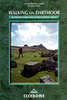
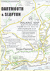
Dartmouth - Dittisham & Coast To Brixham Walking Map

Dartmouth - Dittisham & Coast to Brixham Walking Map at 1:12, 500 from Croydecycle covering River Dart’s estuary; handy size, double-sided, contoured, printed on light waterproof and tear-resistant synthetic paper and showing National Cycle routes and numerous local facilities, including campsites, pubs, etc.Topography is indicated by contours at 10m intervals, with colouring for different types of vegetation including woodlands with public access. The map also shows the high tide level and classifies beaches as sand, shingle, boulders or rock. Where appropriate, the paths or the terrain are annotated with comments providing useful advice for bikers and hikers. Roads are presented according to the density of traffic and have gradient markings. An overprint indicates cycle paths
and private roads with access on bike or foot, as well as bridleways, footpaths and permissive paths. On roads which are part of the National Cycle Network route numbers are marked. Symbols indicate numerous facilities: campsites and caravan sites, pubs and cafes, car parks and picnic sites, local shops, cycle hire, tourist information, etc. National Grid coordinates are marked in the margins.To see other titles in this series please click on the series link.
RIP - This product is no longer available on our network. It was last seen on 25.09.2019

This page now acts as a permanent archive for this product. Add more information using the comments box below to ensure it can still be found by future generations.

Use our search facility to see if it is available from an alternative contributor.
  • Availability: Out Of Stock
  • Supplier: Stanfords
  • SKU: 9781909117150
Availability: In Stock
£2.99

Product Description

Dartmouth
- Dittisham & Coast to Brixham Walking Map at 1:12, 500 from Croydecycle covering River Dart’s estuary; handy size, double-sided, contoured, printed on light waterproof & tear-resistant synthetic paper & showing National Cycle routes & numerous local facilities, including campsites, pubs, etc. Topography is indicated by contours at 10m intervals, with colouring for different types of vegetation including woodlands with public access. The map also shows the high tide level & classifies beaches as s&, shingle, boulders or rock. Where appropriate, the paths or the terrain are annotated with comments providing useful advice for bikers & hikers. Roads are presented according to the density of traffic & have gradient markings. An overprint indicates cycle paths & private roads with access on bike or foot, as well as bridleways, footpaths & permissive paths. On roads which are part of the National Cycle Network route numbers are marked. Symbols indicate numerous facilities: campsites & caravan sites, pubs & cafes, car parks & picnic sites, local shops, cycle hire, tourist information, etc. National Grid coordinates are marked in the margins. To see other titles in this series please click on the series link.

Reviews/Comments

Add New

Intelligent Comparison

Oooops!
We couldn't find anything!
Perhaps this product's unique.... Or perhaps we are still looking for comparisons!
Click to bump this page and we'll hurry up.

Price History

Vouchers

No voucher codes found.
Do you know a voucher code for this product or supplier? Add it to Insights for others to use.

Facebook

Jargon Buster

Paper - A thin sheet mainly used for writing. Available in a variety of colours. Made mainly from wood pulp.
Foot - A part of the body at the bottom end of the leg
Foot - or Feet - a measurement equivilent to 30cm
Waterproof - Resistant to water, usualy specified by depth in metres
Car - A machine used for transport which runs on roads
Size - is the measurement of how big an object is in space.
Network - A link and communication between things. Often computers or people.
Resistant - Something that can repel against something.

Supplier Information

Stanfords
Stanfords was established in 1853 and opened their iconic Covent Garden flagship store in 1901. They have become the top retailer of maps, travel books and accessories in the UK and arguably offer the largest selection of maps and travel books worldwide. Famous names such as Captain Robert Falcon Scott, Ranulph Fiennes and Michael Palin have purchased from Stanfords. They now have a shop in Bristol and both stores together with other venues operate a calendar of events including talks, book signings and exhibitions. As a specialist map retailer, the map selection is comprehensive and includes road maps, street maps and walking maps from worldwide destinations, as well as a selection of world atlases and wall maps. Books include travel guides and travel literature. Stanfords also stock globes, from miniatures made of blue marble to magnificent floor-standing globes. The website features a selection of interesting articles on travel topics.
Page Updated: 2023-11-12 20:15:36

Community Generated Product Tags

Oh No! The productWIKI community hasn't generated any tags for this product yet!
Menu