
 United Kingdom
 France
 Germany
 Netherlands
 Sweden
 USA
USA
 Italy
Italy
 Spain
Spain
More From Contributor

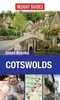
Cotswolds Flexi Map
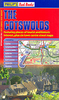
The Cotswolds on a laminated, tear-resistant Insight Flexi Map, with a road map of the region and street plans of central Cheltenham and Cirencester, all indexed, plus brief descriptions of 20 main sights and other tourist information.On one side is a road map of the region at 1:141, 000 with colouring providing some indication of its topography. Road network emphasizes motorways and main routes, with driving distance shown on A and B roads. Various places of interest are highlighted, with 20 main sights prominently marked and each provided with a description. The map is indexed and has no geographical coordinates. Clear, indexed street plans annotated with places of interest, public buildings and selected hotels cover central Cheltenham and Cirencester. Also provided is a general
description of the region, information on getting there by car or public transport, various contact addresses for tourist information and local tours, and notes on Cotswolds for children.Please note: current edition of this map was published in 2000.
description of the region, information on getting there by car or public transport, various contact addresses for tourist information and local tours, and notes on Cotswolds for children.Please note: current edition of this map was published in 2000.
Product Description
Reviews/Comments
Add New
Intelligent Comparison
Archived Product
Cotswolds Cycling Map Stanfords
£6.99
Archived Product
Boston Flexi Map Stanfords
£5.99
Archived Product
Cologne Flexi Map Stanfords
£4.99
Archived Product
Croatia Flexi Map Stanfords
£6.99
Archived Product
Croatia Flexi Map Stanfords
£5.99
Archived Product
Seoul Flexi Map Stanfords
£4.99
Archived Product
Italy Flexi Map Stanfords
£6.99
Archived Product
Tokyo Flexi Map Stanfords
£4.99
Vouchers
No voucher codes found.
Do you know a voucher code for this product or supplier? Add it to Insights for others to use.
Do you know a voucher code for this product or supplier? Add it to Insights for others to use.
 Denmark