More From Contributor

£5.99
A brand new range of practical little walk guides endorsed by the Ramblers. All the walks are 5 miles or under in length & can easily be completed in less that 3 hours. 20 walks are included & use clear maps to show the route plus easy to follow walk descriptions. The beautiful Cotswolds, with its rolling hills & pretty little villages, is perfect walking country. The distinctive local limestone, varying in hue from yellow to cream to gold, inspired J B Priestley to say that the stone from which the characteristic dry stone walls & pretty little houses are built have 'the trick of keeping the lost sunlight of centuries glimmering upon them'. This guide, produced in co-operation with the Ramblers & featuring Ordnance Survey mapping, is the perfect way to really appreciate the gentle beauty of this area. This compact little guide contains walks, all of which are 5 miles or under, which are ideal for an afternoon stroll.
Includes:: 20 easy to follow walks which can be completed in 3 hours & under. Each walk has a detailed Ordnance Survey map with the route clearly marked plus a detailed description of the route. The walks have been chosen with issues like parking & refreshments in mind to make life easy for families. There are interesting facts about the things you'll see along the route. All the books include general information on walking & also the general area covered by the guide. Packed with colour photographs of scenes you will see along the walk.
...
Archived Product
£6.99
A brand new range of practical little walk guides endorsed by the Ramblers. All the walks are 5 miles or under in length & can easily be completed in less that 3 hours. 20 walks are included & use clear maps to show the route plus easy to follow walk descriptions. The beautiful Cotswolds, with its rolling hills & pretty little villages, is perfect walking country. The distinctive local limestone, varying in hue from yellow to cream to gold, inspired J B Priestley to say that the stone from which the characteristic dry stone walls & pretty little houses are built have `the trick of keeping the lost sunlight of centuries glimmering upon them`. This guide, produced in co-operation with the Ramblers & featuring Ordnance Survey mapping, is the perfect way to really appreciate the gentle beauty of this area. This compact little guide contains walks, all of which are 5 miles or under, which are ideal for an afternoon stroll.
Includes:: * 20 easy to follow walks which can be completed in 3 hours & under. * Each walk has a detailed Ordnance Survey map with the route clearly marked plus a detailed description of the route.* The walks have been chosen with issues like parking & refreshments in mind to make life easy for families. * There are interesting facts about the things you`ll see along the route. * All the books include general information on walking & also the general area covered by the guide. * Packed with colour photographs of scenes you will see along the walk.
...
Archived Product
£3.99
The Cotswolds & Gloucestershire at 1:100, 000 on the Ordnance Survey Tour Map No. 8, extending in the north-west to Great Malvern, west to Monmouth & Chepstow, south-west to Bristol & east to Banbury, Witney & Swindon. Insets show town navigation maps of Bath, Cirencester, Gloucester, Cheltenham, Stroud, Tewkesbury, Bourton-on-the-Water, Stow-on-the-Wold, & Cinderford, plus an overview of the whole area with cycle routes & national hiking trails. Additional topographic information along the Severn Estuary shows s&, dunes, foreshore & high water mark. Also included are lists of selected places of interest, market days & farmer markets. Edition E; Publication Date: May 2011 About this series: Ordnance Survey ...
Archived Product
£4.99
The Cotswolds & Gloucestershire at 1:100, 000 on the Ordnance Survey Tour Map No. 8, extending in the north-west to Great Malvern, west to Monmouth & Chepstow, south-west to Bristol & east to Banbury, Witney & Swindon. Insets show town navigation maps of Bath, Cirencester, Gloucester, Cheltenham, Stroud, Tewkesbury, Bourton-on-the-Water, Stow-on-the-Wold, & Cinderford, plus an overview of the whole area with cycle routes & national hiking trails. Additional topographic information along the Severn Estuary shows s&, dunes, foreshore & high water mark. Also included are lists of selected places of interest, market days & farmer markets. Edition F; Publication date January 2014 About this series: Ordnance Survey ...
Archived Product
£6.99
Cotswold Cycling Country Lanes Map at 1:100, 000 from Goldeneye in their series covering popular regions of England & Wales on waterproof & tear-resistant, double-sided cycling maps designed to highlight a selection of recommended cycle routes on country lanes & off-road. An overprint highlights the Sustrans National Cycle Network & regional routes, 24 cycling circuits recommended by the publishers, & 3 traffic-free family routes. The routes are listed in an information panel with distances & brief descriptions. Also listed are 8 local cycle hire facilities. The map shows camping & caravan sites, youth hostels, & numerous other places of interest. Unlike most other titles in this series, this map has no index. Current edition of this title was published in 2012. Maps in the Goldeneye Cycling Country Lanes series use altitude colouring to show the topography, with spot heights & plenty of names of geographical features such as moors, hills, etc. Road network

Includes::
local country tracks & railway lines are shown with stations. All the maps highlight recommended cycle routes but, as series is currently being revised, presentation and/or classification of the routes varies
- please refer to the individual descriptions. Symbols highlight locations of various facilities, such as campsites or caravan parks, & a wide selection of places of interest. Unless indicated to the contrary in the individual description, the maps are indexed & have no GPS coordinates.


...
Archived Product
£4.99
The Cotswolds on a laminated, tear-resistant Insight Flexi Map, with a road map of the region & street plans of central Cheltenham & Cirencester, all indexed, plus brief descriptions of 20 main sights & other tourist information. On one side is a road map of the region at 1:141, 000 with colouring providing some indication of its topography. Road network emphasizes motorways & main routes, with driving distance shown on A & B roads. Various places of interest are highlighted, with 20 main sights prominently marked & each provided with a description. The map is indexed & has no geographical coordinates. Clear, indexed street plans annotated with places of interest, public buildings & selected hotels cover central Cheltenham & Cirencester. Also provided is a general description of the region, information on getting there by car or public transport, various contact addresses for tourist information & local tours, & notes on Cotswolds for children. Please note: current edition of this map was published in 2000. ...
Archived Product
£5.99
The Cotswolds is the top spot for those seeking the quintessential English countryside. From the engaging university city of Oxford to the elegant spa towns of Cheltenham & Bath, there are valleys dotted with stone cottages & slow rivers to take your breath away in between. Footprint Focus provides invaluable information on transport, accommodation, eating & entertainment to ensure that your trip

Includes::
the best of this delightful region of the UK. Essentials section with useful advice on getting to & around The Cotswolds, Oxford, Bath, Cheltenham, Gloucester. Comprehensive, up-to-date listings of where to eat, sleep & play.

Includes::
information on tour operators & activities, from boating down the river to cider-tasting. Detailed maps for the Cotswolds & other key destinations. Slim enough to fit in your pocket. With detailed information on all the main sights, plus many lesser-known attractions, Footprint Focus Cotswolds (
Includes: Oxford, Bath, Cheltenham & Gloucester) provides concise & comprehensive coverage of one of England's most quintessential regions.


...
Archived Product
£6.99
Cotswolds in the Great Breaks mini series from Insight Guides is a slim, focussed short break guide to the city, whether you are aiming for a relaxing or active break, illustrated with vivid colour photographs & containing easy to navigate information. A top 10 sites for the destination & its surrounding area are given, with a selection of detailed & mapped tour/walk ideas, special features on the uniqueness of the place e.g. its heritage, festivals & wildlife, as well as practical information on active pursuits, themed holidays, & selected places to stay to suit a cross section of budgets & tastes. An overview map showing selected tour routes & a selection of five summary boxes of top five great things to do or places to do adorn the inside jackets. ...
Archived Product
£7.99
Cotswolds in the Great Breaks mini series from Insight Guides is a slim, focussed short break guide to the city, whether you are aiming for a relaxing or active break, illustrated with vivid colour photographs & containing easy to navigate information. A top 10 sites for the destination & its surrounding area are given, with a selection of detailed & mapped tour/walk ideas, special features on the uniqueness of the place e.g. its heritage, festivals & wildlife, as well as practical information on active pursuits, themed holidays, & selected places to stay to suit a cross section of budgets & tastes. An overview map showing selected tour routes & a selection of five summary boxes of top five great things to do or places to do adorn the inside jackets. ...
Archived Product
£4.99
The Cotswolds at 1:125, 000 in a series of maps at varying scales from Philip’s, all designed to highlight very clearly each area’s diverse cultural & industrial heritage, natural attractions, sport & recreational sites, & tourist facilities. Different types of small icons or signs prominently indicate a wide range of places of interest from aerial activity, ancient forts or animal attractions to windmills, working farms & zoos. Most titles include campsites, caravan sites, youth hostels & holiday centres & several maps also show National Long-distance Trails and/or recommended cycle routes. Road information is clearly laid out, with minor country roads easy to see. Driving distances are given on main routes & in some titles recommended country tours are highlighted. Railway lines are shown with stations &, where appropriate, ferry routes are marked. Presentation of the topography varies, with some altitude tinting provided on the more detailed maps. Unless specified in their descriptions, the maps have no geographical coordinates for GPS users. Many titles also include additional street plans of each area’s main towns.*IN THIS TITLE: plain white background with colouring for national parks, woods & forests. The map has an index of selected places of interest, but not a more general index of towns & villages. Current edition was published in 2012. ...
Archived Product

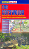
Cotswolds Cycling Map

The Cotswolds at 1:100, 000 from Goldeneye in a series of double-sided, waterproof and tear-resistant cycling maps of popular regions of England and Wales designed to highlight a selection of recommended cycle routes and other tourist information.The maps use altitude colouring to show the topography, with spot heights and plenty of names of geographical features such as moors, hills, etc. Road network includes local country tracks and railway lines are shown with stations. All the maps highlight recommended cycle routes but, as series is currently being revised, presentation and/or classification of routes varies - please refer to the individual descriptions. Symbols highlight locations of various facilities, such as campsites or caravan parks, and places of interest. The maps
have no GPS coordinates.In this title: the map, printed on light waterproof and tear-resistant plastic paper, lists and highlights 28 recommended cycle routes with alternative variants and link routes. Also indicated are local sections of the Sustrans National Cycle Network, other regional cycle routes, traffic-free family routes and off-road routes. Symbols also indicate locations with youth hostels. The map is not indexed. Also included is a list of cycle hire points.
RIP - This product is no longer available on our network. It was last seen on 25.09.2019

This page now acts as a permanent archive for this product. Add more information using the comments box below to ensure it can still be found by future generations.

Use our search facility to see if it is available from an alternative contributor.
  • Availability: Out Of Stock
  • Supplier: Stanfords
  • SKU: 9781859651544
Availability: In Stock
£6.99

Product Description

The Cotswolds at 1:100, 000 from Goldeneye in a series of double-sided, waterproof & tear-resistant cycling maps of popular regions of England & Wales designed to highlight a selection of recommended cycle routes & other tourist information. The maps use altitude colouring to show the topography, with spot heights & plenty of names of geographical features such as moors, hills, etc. Road network

Includes::
local country tracks & railway lines are shown with stations. All the maps highlight recommended cycle routes but, as series is currently being revised, presentation and/or classification of routes varies
- please refer to the individual descriptions. Symbols highlight locations of various facilities, such as campsites or caravan parks, & places of interest. The maps have no GPS coordinates. In this title: the map, printed on light waterproof & tear-resistant plastic paper, lists & highlights 28 recommended cycle routes with alternative variants & link routes. Also indicated are local sections of the Sustrans National Cycle Network, other regional cycle routes, traffic-free family routes & off-road routes. Symbols also indicate locations with youth hostels. The map is not indexed. Also included is a list of cycle hire points.

Reviews/Comments

Add New

Price History

Vouchers

No voucher codes found.
Do you know a voucher code for this product or supplier? Add it to Insights for others to use.

Facebook

Jargon Buster

GPS - Global Positioning System - Global position using satellites
Paper - A thin sheet mainly used for writing. Available in a variety of colours. Made mainly from wood pulp.
Plastic - A generic term for a synthetic product used in the manufacture of products
England - A country within the United Kingdom.
Waterproof - Resistant to water, usualy specified by depth in metres
Network - A link and communication between things. Often computers or people.
Road - a manmade lane or a path that is used to speed up travel.
Resistant - Something that can repel against something.
Alternative - Another available choice or possibility
Altitude - Something that can be quite high in relation to sea or ground level.
Popular - Something that is admired and liked by many people.
Regional - An adjective to describe a set geographic area.
Individual - A single separate item or person.
Family - A group of people that live together made up from parents and children.

Supplier Information

Stanfords
Stanfords was established in 1853 and opened their iconic Covent Garden flagship store in 1901. They have become the top retailer of maps, travel books and accessories in the UK and arguably offer the largest selection of maps and travel books worldwide. Famous names such as Captain Robert Falcon Scott, Ranulph Fiennes and Michael Palin have purchased from Stanfords. They now have a shop in Bristol and both stores together with other venues operate a calendar of events including talks, book signings and exhibitions. As a specialist map retailer, the map selection is comprehensive and includes road maps, street maps and walking maps from worldwide destinations, as well as a selection of world atlases and wall maps. Books include travel guides and travel literature. Stanfords also stock globes, from miniatures made of blue marble to magnificent floor-standing globes. The website features a selection of interesting articles on travel topics.
Page Updated: 2023-11-12 20:15:36

Community Generated Product Tags

Oh No! The productWIKI community hasn't generated any tags for this product yet!
Menu