
 United Kingdom
 France
 Germany
 Netherlands
 Sweden
 USA
USA
 Italy
Italy
 Spain
Spain
More From Contributor


Coatbridge 1910
Coatbridge in 1910 in a fascinating series of reproductions of old Ordnance Survey plans in the Alan Godfrey Editions, ideal for anyone interested in the history of their neighbourhood or family.Two versions have been published for this area. The maps cover the town centre and western portion of Coatbridge. Coverage stretches from Sunnyside Road and Colt Terrace southward to Dundyvan, and from Weir Street westward to Ryefield Park. Features include Main Street, Bank Street, Summerlee Iron Works, Summerlee, Merryston Square, Gartsherrie Hornock & Summerlee Branch Canal, Sunnyside station, Drumpelier & Gartsherrie station, Blairhill Plantation, Langloan Plantation, West End Public Park, Drumpelier Colliery, Llangloan Iron & Chemical Works, Langloan Railway, North British Iron
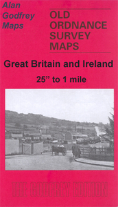
Works, Dundyvan, British Tube Works, Stobcross Rivet Bolt & Nut Works, Coatbridge Iron Works, Whifflet Farm, Dundyvan Iron & Steel Works, Langloan station, Victoria Tube Works, Gartsherrie church, Coatbridge CR station, Woodside Steel & Iron Works, Summerlee Kirkwood Colliery, Green Park, Drumpelier House, Monkland Canal, etc. The 1910 map has extracts from an early trade directory.About the Alan Godfrey Editions of the 25” OS Series:Selected towns in Great Britain and Ireland are covered by maps showing the extent of urban development in the last decades of the 19th and early 20th century. The plans have been taken from the Ordnance Survey mapping and reprinted at about 15 inches to one mile (1:4, 340). On the reverse most maps have historical notes and many also include
extracts from contemporary directories. Most maps cover about one mile (1.6kms) north/south, one and a half miles (2.4kms) across; adjoining sheets can be combined to provide wider coverage.FOR MORE INFORMATION AND A COMPLETE LIST OF ALL AVAILABLE TITLES PLEASE CLICK ON THE SERIES LINK.

Product Description
Reviews/Comments
Add New
Intelligent Comparison
Archived Product

Coatbridge 1897 Stanfords
£3.50
Archived Product

Cowbridge 1914 Stanfords
£3.50
Archived Product

Cambridge 1925 Stanfords
£3.50
Archived Product
Banbridge 1903 Stanfords
£3.50
Archived Product

Ironbridge 1901 Stanfords
£3.50
Archived Product
Wadebridge 1906 Stanfords
£2.95
Archived Product
Wadebridge 1906 Stanfords
£3.50
Vouchers
No voucher codes found.
Do you know a voucher code for this product or supplier? Add it to Insights for others to use.
Do you know a voucher code for this product or supplier? Add it to Insights for others to use.
 Denmark