More From Contributor

£6.99
Forth & Clyde Cycle Routes at 1:100, 000 in a series of cycling maps from Sustrans, the charity behind developing UK’s National Cycle Network. The map is printed on light waterproof synthetic paper & presents the route on three panels linking Edinburgh, Glasgow & the Cowal Peninsula along the Union Canal & the Forth & Clyde Canal, with variants & day ride suggestions. Each title in the Sustrans series of cycling maps covers either a single route, presented in sections on separate strip maps, or a wider area with the main cycling route (s) prominently highlighted but other recommendations for cyclists also marked. The area covered each map is shown on our website on its individual “coverage” image. The route has markers indicating steep gradients, controlled access, distances & possible danger points. Route profiles indicate riding surface & the density of traffic (main road, minor road & traffic-free) &, where appropriate, street plans show the course of the route across towns & cities. On maps covering a wider area around the main National Cycle Route suggestions of possible day ride excursions are also marked. A range of symbols highlight various facilities & places of interest, including tourist information centres, youth hostels, cafes & pubs, grocery shops, cycle shops & hire, historical & natural sites, etc. For access by rail, the rail network is shown with stations &, where appropriate, metro stations are also marked. Topography is shows by altitude colouring. Unless specifically indicated in the individual description, the maps do not show British National Grid lines for GPS. Each title also contains contact addresses for various useful organizations, etc. Many titles are printed on light, waterproof & tear-resistant synthetic paper. ...
Archived Product
£2.50
Clydebank street map from Nicolson Maps; coverage

Includes::
Drumchapel & Old Kilpatrick. Nicolson Maps, Scotland’s

...
Archived Product
£3.50
Clydebank in 1896 in a fascinating series of reproductions of old Ordnance Survey plans in the Alan Godfrey Editions, ideal for anyone interested in the history of their neighbourhood or family. Coverage stretches from the Kilbowie Factory southward to the Old Canal & Hamilton Free Church. Features include Kilbowie Sewing Machine Factory, Clydebank Engineering & Shipbuilding Works, dock, Kilbowie Iron Works, Forth & Clyde Canal, NBR railway with Kilbowie station, Lanarkshire & Dumbartonshire Railway with station, Glasgow Yoker & Clydebank Railway with terminus, railways into dock, chemical works, etc. On the reverse are extracts from a trade directory. About the Alan Godfrey Editions of the 25” OS Series: Selected towns in Great Britain & Ireland are covered by maps showing the extent of urban development in the last decades of the 19th & early 20th century. The plans have been taken from the Ordnance Survey mapping & reprinted at about 15 inches to one mile (1:4, 340). On the reverse most maps have historical notes & many also include extracts from contemporary directories. Most maps cover about one mile (1.6kms) north/south, one & a half miles (2.4kms) across; adjoining sheets can be combined to provide wider coverage.FOR MORE INFORMATION & A COMPLETE LIST OF ALL AVAILABLE TITLES PLEASE CLICK ON THE SERIES LINK. ...
Archived Product
£6.99
Street atlas of County Antrim & County Londonderry at 1:15, 800 from Collins, with enlarged city centre mapping of Belfast. The street mapping has been sourced from Ordnance Survey data with bold road classification colouring on a plain white base; main mapping is at 1:50, 000 & 1:20, 000 for the Greater Belfast areas & for the towns of Antrim, Ballyclare, Ballymena, Ballymoney, Carrickfergus, Coleraine, Cookstown, Larne, Limavady, Londonderry, Magherafelt, Newtownabbey, Portrush & Portstewart. These scales show motorways, A & B roads, & minor roads, with names clearly displayed; railways lines & stops, bus stops, & tramway lines & stops are marked. Local facilities such as post offices, police & fire stations, schools, car parks & mare are displayed. The enlarged city centre map of Belfast shows streets in greater detail at Approx. 1:8, 000, with one ways streets prominently highlighted. All mapping is indexed by street name, with highlighted schools, industrial estates, hospitals, & sports centres
- towns & villages included.
...
Archived Product
£5.50
Photoluminescent Vinyl
- 150mm x 150mm. Stanfords is an official distributor of Maritime Progress safety signs. We are able to
...
Archived Product
£10.50
One of the titles in a series of road maps of the administrative states of Mexico, highlighting places of interest. The maps show four different grades of roads, with intermediate driving distances on main routes, railways, local airports, ferry connections & administrative boundaries. Topographic information is limited to names of main mountain ranges, spot heights for main peaks, rivers & lakes. The maps have no geographical coordinates. Map legend is in Spanish only. On the reverse each title has a black & white version of the same map, highlighting places of interest with brief notes in Spanish only. ...
Archived Product
£12.99
One of the titles in a series of road maps of the administrative states of Mexico, highlighting places of interest. The maps show four different grades of roads, with intermediate driving distances on main routes, railways, local airports, ferry connections & administrative boundaries. Topographic information is limited to names of main mountain ranges, spot heights for main peaks, rivers & lakes. The maps have no geographical coordinates. Map legend is in Spanish only. On the reverse each title has a black & white version of the same map, highlighting places of interest with brief notes in Spanish only. ...
Archived Product
£13.99
Road maps of Mexico’s states from Ediciones Independencia highlighting numerous places of interest & tourist facilities, with each title also providing a large street plan of the provincial capital plus maps of other local towns, popular tourist resorts and/or archaeological sites. The state maps show the road & rail networks on a clear base, with topography indicated by rivers & areas liable to inundation, plus names of main mountain ranges & peaks (no heights). National parks & other protected areas are brightly highlighted. A range of symbols provides information for tourists: accommodation including campsites & trailer parks, historical & archaeological sites, beaches & spas, sport & leisure centres, natural curiosities, etc. The maps show latitude & longitude as margin ticks & crosshairs, mostly at 30’ or 1° intervals. Map legend

Includes::
English. Most maps have no index. Each title

Includes::
a large street plan of the provincial capital, plus plans of selected other towns. In addition to street names, the plans also show names of local districts. Plans of the state capital usually have a list of various locations, facilities and/or places on interest highlighted on it, & some include an enlargement showing the town centre in greater detail. Each title also has a table of distances, plus a table showing various facilities & places of interest in the main towns of the state.


...
Archived Product
£4.99
This book tells how mines evolved from simple bell pits into extensive networks of shafts & tunnels & extending deep underground. It describes the methods used to drive tunnels through the rock & the machines that were developed to cut the coal. It explains how the coal was transported from the coalface to the shaft, a task performed variously by women or children with sleds of baskets, pit ponies, rope haulage systems, conveyors & locomotives, & it describes the winding engines used to lower men & equipment into the mine & to bring them & the coal back to the surface. ...
Archived Product
£16.99
The reputed home of the Queen of Sheba, Yemen has been at the crossroads of Africa, the Middle East & Asia for thousands of years thanks to its position on the ancient spice routes. Ten thousand years of trade along Yemen`s Red Sea & Indian Ocean coasts, over its mountains & across its deserts made it a meeting point of people, ideas, money & goods & the centuries of trading generated much wealth. There has been a British presence in Yemen ever since the early 1600s when the East India Company set up trading posts in Mukha (Mocha in the west), a port then famous as the world centre for trade in coffee. In 1839 the port city of Aden was captured to provide a base to protect British trade routes. This began an even stronger relationship which would last some 130 years until 1967 when the Britain finally pulled out, having granted independence after several years of insurgency against British rule including riots & attacks on its troops. But Britain`s links do not end there. Yemen is the mother country of the longest-established of Britain`s Muslim communities. Yemenis came to Britain from the 1890s onwards, many as an indirect result of having joined the British Merchant Navy, & after World War Two there was further emigration. By the mid-1970s there were some 15, 000 Yemenis in Britain, though today this figure has shrunk back considerably. One of the poorest countries in the region, Yemen still maintains much of its tribal character & old ways. People wear traditional dress & the custom of chewing the narcotic plant khat in the afternoons is still widely observed. Yemen remains a country of great mystery & in recent years it has attracted the curiosity of a growing number of the more adventurous tourists. ...
Archived Product

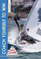
Coach Yourself To Win

This book covers the twelve fundamental aspects of successful sailing, and will help you to succeed on the water whether your aim is club, national, international (or even Olympic) level. With detailed analysis, challenging exercises and useful top tips throughout, everything is covered: from targets, goal setting and a winning mental attitude to boat handling, strategy and tactics (plus lots more). Handy diagrams on almost every page help to clarify complex concepts and scenarios, and brilliant action photographs bring the text to life. Each chapter is closed with not-to-be missed advice from Olympic medallists - making this a must-have book for all sailors who aspire to great success. Written by a gold medal winning coach and sailor, this book will have you climbing the
leaderboard in no time. It is a re-written and more focused version of the author`s popular title Be Your Own Sailing Coach, and its publication marks the re-launch of the iconic Sail to Win series, loved by sailors for over 30 years.
RIP - This product is no longer available on our network. It was last seen on 25.09.2019

This page now acts as a permanent archive for this product. Add more information using the comments box below to ensure it can still be found by future generations.

Use our search facility to see if it is available from an alternative contributor.
  • Availability: Out Of Stock
  • Supplier: Stanfords
  • SKU: 9781909911215
Availability: In Stock
£12.99

Product Description

This book covers the twelve fundamental aspects of successful sailing, & will help you to succeed on the water whether your aim is club, national, international (or even Olympic) level. With detailed analysis, challenging exercises & useful top tips throughout, everything is covered: from targets, goal setting & a winning mental attitude to boat handling, strategy & tactics (plus lots more). Handy diagrams on almost every page help to clarify complex concepts & scenarios, & brilliant action photographs bring the text to life. Each chapter is closed with not-to-be missed advice from Olympic medallists
- making this a must-have book for all sailors who aspire to great success. Written by a gold medal winning coach & sailor, this book will have you climbing the leaderboard in no time. It is a re-written & more focused version of the author`s popular title Be Your Own Sailing Coach, & its publication marks the re-launch of the iconic Sail to Win series, loved by sailors for over 30 years.

Reviews/Comments

Add New

Intelligent Comparison

Oooops!
We couldn't find anything!
Perhaps this product's unique.... Or perhaps we are still looking for comparisons!
Click to bump this page and we'll hurry up.

Price History

Vouchers

No voucher codes found.
Do you know a voucher code for this product or supplier? Add it to Insights for others to use.

Facebook

Jargon Buster

Gold - A precious highly conductive metal
water - A chemical substance. Chemical formula H2O.
Attitude - a humans feelings towards a specific person, animal or object.
Gold - A colour, a type of rich metal. Chemical symbol AU.
Popular - Something that is admired and liked by many people.

Supplier Information

Stanfords
Stanfords was established in 1853 and opened their iconic Covent Garden flagship store in 1901. They have become the top retailer of maps, travel books and accessories in the UK and arguably offer the largest selection of maps and travel books worldwide. Famous names such as Captain Robert Falcon Scott, Ranulph Fiennes and Michael Palin have purchased from Stanfords. They now have a shop in Bristol and both stores together with other venues operate a calendar of events including talks, book signings and exhibitions. As a specialist map retailer, the map selection is comprehensive and includes road maps, street maps and walking maps from worldwide destinations, as well as a selection of world atlases and wall maps. Books include travel guides and travel literature. Stanfords also stock globes, from miniatures made of blue marble to magnificent floor-standing globes. The website features a selection of interesting articles on travel topics.
Page Updated: 2023-11-12 20:15:36

Community Generated Product Tags

Oh No! The productWIKI community hasn't generated any tags for this product yet!
Menu