More From Contributor
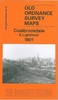
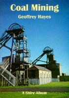
£5.50
Photoluminescent Vinyl
- 150mm x 150mm. Stanfords is an official distributor of Maritime Progress safety signs. We are able to
...
Archived Product
£12.99
This book covers the twelve fundamental aspects of successful sailing, & will help you to succeed on the water whether your aim is club, national, international (or even Olympic) level. With detailed analysis, challenging exercises & useful top tips throughout, everything is covered: from targets, goal setting & a winning mental attitude to boat handling, strategy & tactics (plus lots more). Handy diagrams on almost every page help to clarify complex concepts & scenarios, & brilliant action photographs bring the text to life. Each chapter is closed with not-to-be missed advice from Olympic medallists
- making this a must-have book for all sailors who aspire to great success. Written by a gold medal winning coach & sailor, this book will have you climbing the leaderboard in no time. It is a re-written & more focused version of the author`s popular title Be Your Own Sailing Coach, & its publication marks the re-launch of the iconic Sail to Win series, loved by sailors for over 30 years.
...
Archived Product
£10.50
One of the titles in a series of road maps of the administrative states of Mexico, highlighting places of interest. The maps show four different grades of roads, with intermediate driving distances on main routes, railways, local airports, ferry connections & administrative boundaries. Topographic information is limited to names of main mountain ranges, spot heights for main peaks, rivers & lakes. The maps have no geographical coordinates. Map legend is in Spanish only. On the reverse each title has a black & white version of the same map, highlighting places of interest with brief notes in Spanish only. ...
Archived Product
£12.99
One of the titles in a series of road maps of the administrative states of Mexico, highlighting places of interest. The maps show four different grades of roads, with intermediate driving distances on main routes, railways, local airports, ferry connections & administrative boundaries. Topographic information is limited to names of main mountain ranges, spot heights for main peaks, rivers & lakes. The maps have no geographical coordinates. Map legend is in Spanish only. On the reverse each title has a black & white version of the same map, highlighting places of interest with brief notes in Spanish only. ...
Archived Product
£13.99
Road maps of Mexico’s states from Ediciones Independencia highlighting numerous places of interest & tourist facilities, with each title also providing a large street plan of the provincial capital plus maps of other local towns, popular tourist resorts and/or archaeological sites. The state maps show the road & rail networks on a clear base, with topography indicated by rivers & areas liable to inundation, plus names of main mountain ranges & peaks (no heights). National parks & other protected areas are brightly highlighted. A range of symbols provides information for tourists: accommodation including campsites & trailer parks, historical & archaeological sites, beaches & spas, sport & leisure centres, natural curiosities, etc. The maps show latitude & longitude as margin ticks & crosshairs, mostly at 30’ or 1° intervals. Map legend

Includes::
English. Most maps have no index. Each title

Includes::
a large street plan of the provincial capital, plus plans of selected other towns. In addition to street names, the plans also show names of local districts. Plans of the state capital usually have a list of various locations, facilities and/or places on interest highlighted on it, & some include an enlargement showing the town centre in greater detail. Each title also has a table of distances, plus a table showing various facilities & places of interest in the main towns of the state.


...
Archived Product
£16.99
The reputed home of the Queen of Sheba, Yemen has been at the crossroads of Africa, the Middle East & Asia for thousands of years thanks to its position on the ancient spice routes. Ten thousand years of trade along Yemen`s Red Sea & Indian Ocean coasts, over its mountains & across its deserts made it a meeting point of people, ideas, money & goods & the centuries of trading generated much wealth. There has been a British presence in Yemen ever since the early 1600s when the East India Company set up trading posts in Mukha (Mocha in the west), a port then famous as the world centre for trade in coffee. In 1839 the port city of Aden was captured to provide a base to protect British trade routes. This began an even stronger relationship which would last some 130 years until 1967 when the Britain finally pulled out, having granted independence after several years of insurgency against British rule including riots & attacks on its troops. But Britain`s links do not end there. Yemen is the mother country of the longest-established of Britain`s Muslim communities. Yemenis came to Britain from the 1890s onwards, many as an indirect result of having joined the British Merchant Navy, & after World War Two there was further emigration. By the mid-1970s there were some 15, 000 Yemenis in Britain, though today this figure has shrunk back considerably. One of the poorest countries in the region, Yemen still maintains much of its tribal character & old ways. People wear traditional dress & the custom of chewing the narcotic plant khat in the afternoons is still widely observed. Yemen remains a country of great mystery & in recent years it has attracted the curiosity of a growing number of the more adventurous tourists. ...
Archived Product
£2.95
Coalbrookdale & Lightmoor in 1901 in a fascinating series of reproductions of old Ordnance Survey plans in the Alan Godfrey Editions, ideal for anyone interested in the history of their neighbourhood or family. Selected towns in Great Britain & Ireland are covered by maps showing the extent of urban development in the last decades of the 19th & early 20th century. In this title: the map covers the area from the Iron Works eastward to Lightmoor & Roughpark, & northward to Dawley Parva & Stoneyhill. The map will be essential for all interested in industrial archaeology &

Includes::
Cherrytree Hill Brick Works, Shutfield Brick Works & Lightmoor Brick Works, with the tramway between them, also the GWR Wellington & Severn Jct railway, Lightmoor Junction, the disused Lightmoor & Dawley Parva collieries. On the reverse are contemporary directories for Dawley Parva & Coalbrookdale. About the Alan Godfrey Editions of the 25

...
Archived Product
£3.50
Coalbrookdale & Lightmoor in 1901 in a fascinating series of reproductions of old Ordnance Survey plans in the Alan Godfrey Editions, ideal for anyone interested in the history of their neighbourhood or family. Tthe map covers the area from the Iron Works eastward to Lightmoor & Roughpark, & northward to Dawley Parva & Stoneyhill. The map will be essential for all interested in industrial archaeology &

Includes::
Cherrytree Hill Brick Works, Shutfield Brick Works & Lightmoor Brick Works, with the tramway between them, also the GWR Wellington & Severn Jct railway, Lightmoor Junction, the disused Lightmoor & Dawley Parva collieries. On the reverse are contemporary directories for Dawley Parva & Coalbrookdale. About the Alan Godfrey Editions of the 25” OS Series: Selected towns in Great Britain & Ireland are covered by maps showing the extent of urban development in the last decades of the 19th & early 20th century. The plans have been taken from the Ordnance Survey mapping & reprinted at about 15 inches to one mile (1:4, 340). On the reverse most maps have historical notes & many also include extracts from contemporary directories. Most maps cover about one mile (1.6kms) north/south, one & a half miles (2.4kms) across; adjoining sheets can be combined to provide wider coverage.FOR MORE INFORMATION & A COMPLETE LIST OF ALL AVAILABLE TITLES PLEASE CLICK ON THE SERIES LINK.

...
Archived Product
£3.50
Coalville in 1901 in a fascinating series of reproductions of old Ordnance Survey plans in the Alan Godfrey Editions, ideal for anyone interested in the history of their neighbourhood or family. The map covers much of the small industrial town of Coalville, stretching from Gutteridge Street eastward to Broom Leys & Constable Lane. Features include Midland Railway with Coalville station, LNWR Charnwood Forest Branch with station, Whitwick Colliery & Whitwick Colliery Railway, Railway Wagon Works, Elastic Web Factory, iron works, cattle market, The Park, Christ Church, part of Snibston Colliery Railway, Colliery Farm, brick & terra cotta works, Glebe Farm, Broom Leys, Whitwickwaste Farm, etc. On the reverse is an 1891 directory of Coalville, plus an extract from a 1916 timetable for the Leicester-Burton line. About the Alan Godfrey Editions of the 25” OS Series: Selected towns in Great Britain & Ireland are covered by maps showing the extent of urban development in the last decades of the 19th & early 20th century. The plans have been taken from the Ordnance Survey mapping & reprinted at about 15 inches to one mile (1:4, 340). On the reverse most maps have historical notes & many also include extracts from contemporary directories. Most maps cover about one mile (1.6kms) north/south, one & a half miles (2.4kms) across; adjoining sheets can be combined to provide wider coverage.FOR MORE INFORMATION & A COMPLETE LIST OF ALL AVAILABLE TITLES PLEASE CLICK ON THE SERIES LINK. ...
Archived Product
£12.99
This first volume of Coarse Angling in Northern France with Phil Pembroke covers 176 excellent angling locations including Paris. Vendee, Aube. Yonne, Marne, Somme, Loire, Cher & Indre. If angling is your thing, then the numerous possibilities listed here will have you spoilt for choice when you’re planning your weekend break across the Channel. With a French angling licence being all that’s needed to fish in public rivers & lakes, Phil Pembroke takes you through all your initial bases. From the River Somme, to the beautiful Loire Valley, to the historic chateaux a mere hours drive south west of Paris…this volume is aimed at visitors from the UK who will appreciate the list of smaller scale, privately-managed carp fisheries providing all-inclusive angling holiday packages. Containing numerous black-&-white sketched maps, this volume has a particular focus on the area to the south & east of Paris, thought to contain some of the best carp fishing sites in France – notably the large reservoirs of the River Seine basin, less than four hours drive from Calais. For those with restricted mobility, the book directs users towards appropriate facilities that include pontoon-fishing platforms with easy car access, highlighting their location in each chapter. Fishing schools are also listed in detail for most areas, as well as night fishing zones for the increasing numbers of visitors who wish to avail themselves of angling opportunities outside of traditional hours. Finally, this book might save your life: given the increased dangers of electrocution resulting from longer & lighter fishing poles, this guide highlights the importance of caution whenever visitors see the EDF danger signs warning of the proximity of overhead power lines. ...
Archived Product

Coal Mining

This book tells how mines evolved from simple bell pits into extensive networks of shafts and tunnels and extending deep underground. It describes the methods used to drive tunnels through the rock and the machines that were developed to cut the coal. It explains how the coal was transported from the coalface to the shaft, a task performed variously by women or children with sleds of baskets, pit ponies, rope haulage systems, conveyors and locomotives, and it describes the winding engines used to lower men and equipment into the mine and to bring them and the coal back to the surface.
RIP - This product is no longer available on our network. It was last seen on 25.09.2019

This page now acts as a permanent archive for this product. Add more information using the comments box below to ensure it can still be found by future generations.

Use our search facility to see if it is available from an alternative contributor.
  • Availability: Out Of Stock
  • Supplier: Stanfords
  • SKU: 9780747804345
Availability: In Stock
£4.99

Product Description

This book tells how mines evolved from simple bell pits into extensive networks of shafts & tunnels & extending deep underground. It describes the methods used to drive tunnels through the rock & the machines that were developed to cut the coal. It explains how the coal was transported from the coalface to the shaft, a task performed variously by women or children with sleds of baskets, pit ponies, rope haulage systems, conveyors & locomotives, & it describes the winding engines used to lower men & equipment into the mine & to bring them & the coal back to the surface.

Reviews/Comments

Add New

Intelligent Comparison

Oooops!
We couldn't find anything!
Perhaps this product's unique.... Or perhaps we are still looking for comparisons!
Click to bump this page and we'll hurry up.

Price History

Vouchers

No voucher codes found.
Do you know a voucher code for this product or supplier? Add it to Insights for others to use.

Facebook

Jargon Buster

Equipment - A product or good that is tactile.
Simple - Basic, easy no difficulty in understanding.
Children - A young life form within the early stages of physical development,

Supplier Information

Stanfords
Stanfords was established in 1853 and opened their iconic Covent Garden flagship store in 1901. They have become the top retailer of maps, travel books and accessories in the UK and arguably offer the largest selection of maps and travel books worldwide. Famous names such as Captain Robert Falcon Scott, Ranulph Fiennes and Michael Palin have purchased from Stanfords. They now have a shop in Bristol and both stores together with other venues operate a calendar of events including talks, book signings and exhibitions. As a specialist map retailer, the map selection is comprehensive and includes road maps, street maps and walking maps from worldwide destinations, as well as a selection of world atlases and wall maps. Books include travel guides and travel literature. Stanfords also stock globes, from miniatures made of blue marble to magnificent floor-standing globes. The website features a selection of interesting articles on travel topics.
Page Updated: 2023-11-12 20:15:36

Community Generated Product Tags

Oh No! The productWIKI community hasn't generated any tags for this product yet!
Menu