More From Contributor
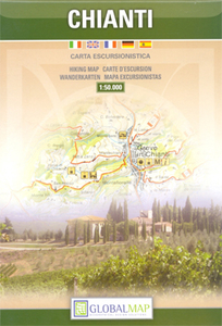
£8.99
Chiang Mai & Nearby Provinces at 1:550, 000 in a series of regional road maps of Thailand from the Bangkok based Think Net, with street plans of Chiang Mai, Chiang Rai, Lampang, Mae Hong Son & Lamphun, each with a list of main tourist attractions, temples, & various facilities. All information is bilingual, shown in Thai & English. Road & rail networks are shown on a base with colouring indicating the country’s administrative provinces. The map offers no topographic information beyond rivers & lakes. Road network does not give driving distances but does indicate locations of petrol stations. The map is indexed & has latitude & longitude lines are drawn at intervals of 30’. Map legends are in English. No information is provided outside Thailand’s borders. On the reverse side is an indexed street plan of Chiang Mai, extending beyond its airport to the west & beyond the motorway ring to the north & east. Both the main map & the city plans have very extensive bilingual overprint highlighting not only various places of interest but also public buildings and/or facilities such as schools, medical centres, etc. PLEASE NOTE: place names on maps in this series, apart from names of administrative units, are in print size significantly smaller than usually found on most road maps. All the information is clearly legible, but it’s not always easy to locate main towns. To see the list of titles in this series please click on the series link. ...
Archived Product
£6.99
Chiang Mai in the Luxe city guides series, which are slim & small enough to fit easily in a pocket or handbag. Information is distilled from elite suggestions by city residents, specially selected for their style, knowledge & expertise. Luxe guides aim at the upper end of the market & subjectively edit to choose the very best recommendations for shopping, restaurants, leisure options & nightlife. Half day shopping & activity itineraries are suggested for you to mix & match your visit to suit your timetable. When folded close the cardboard guide slots into its own protective plastic frame. Vanity Fair magazine calls them “delightful, de-lovely, & deluxe”, & that’s just what they are. ...
Archived Product
£13.99
Bangkok on Nancy Chandler`s colourful, h&-drawn map with an 96-page booklet, described by top guidebooks & travel writers as ”the best tourist map of Bangkok”, ”an indispensable guide” & ”the very best resource”. Double-sided, the map is presented as a series of panels covering:- Central Bangkok- Greater Bangkok- Chatuchak Weekend Market Area- Central Shopping Area- Banglampoo: Khao San / Phra Athit- Sukhumvit Road- Chinatown- Suvarnabhumi International Airport The map, now in it`s 26th edition, is accompanied by a 96-page pocket book index including secrets rarely shared with visitors (for example, shops & sales supporting good causes, & dining tips ” For the Sweet Tooth”). Bars are categorized by their crowds for those who want to befriend fun Thais, hang out with other travellers, meet ex-pats, listen to live music, test the local brews, support their rugby team at a sports bar, go pub crawling, or just enjoy a sunset drink atop a quiet riverside guesthouse. Restaurant listings include Nancy`s favourites & contact details; other listings include cooking classes, cinemas, hobbies, spas, sports, supermarkets, etc. ...
Archived Product
£11.50
Chiang Mai on Nancy Chandler's colourful, h&-drawn map with a 76 page booklet, described by top guidebooks & travel writers as the best tourist map of Chiang Mai, an indispensable guide & the very best resource. Double-sided, the map is presented as a series of panels covering:- Chiang Mai city map- Old Town & Central Chiang Mai- Night Bazaar area- Warorot Day Market- Out of town trips The map is accompanied by a 76 page pocket book index, including accommodation listings, very extensive shopping section, advice on entertainment, sport facilities, etc. The lists & advice provided here are far more comprehensive & informative than what is offered in travel guides. ...
Archived Product
£11.99
Chiang Mai on Nancy Chandler's colourful, h&-drawn map with a 76 page booklet, described by top guidebooks & travel writers as the best tourist map of Chiang Mai, an indispensable guide & the very best resource. Double-sided, the map is presented as a series of panels covering:- Chiang Mai city map- Old Town & Central Chiang Mai- Night Bazaar area- Warorot Day Market- Out of town trips The map is accompanied by an 84-page pocket book index, including accommodation listings, very extensive shopping section, advice on entertainment, sport facilities, etc. The lists & advice provided here are far more comprehensive & informative than what is offered in travel guides. ...
Archived Product
£14.99
Chianti from Florence to Siena at 1:50, 000 in a series of hiking maps from Edizioni Multigraphic covering Tuscany, parts of Umbria, & the adjoining areas. The cartography is rather old fashioned & sometimes not as clear as in the other map series but for many areas, especially for parts of Tuscany, these are the only hiking maps available. Most maps have contours at 25-metre intervals, with some relief shading & colouring for forests. An overprint highlights hiking paths, including all the popular hiking routes such as the Grandi Sentieri della Provincia di Siena, etc. The overprint also shows campsites &, where appropriate, mountain refuges & other types of alpine accommodation. Some of the maps indicate latitude & longitude at the map corners, but with longitude sometimes based on Rome rather than Greenwich. Map legends vary, most maps include English. Some maps include street plans & additional notes on the region. For more details see individual descriptions.* In this title:* double-sided map covering a large area of Approx. 60 x 84km /37 x 52 miles. The map has contours, although no interval is given, & spot heights. Towns & villages of particular interest are highlighted. The map also shows mountain bike routes, although it is difficult to tell at times which roads & tracks the bike icons refer to. No geographical coordinates are shown. Map legend

Includes::
English.

...
Archived Product
£14.99
Chianti Classico: Val di Pesa
- Val d` Elsa at 1:25, 000 in a series of hiking maps from Edizioni Multigraphic covering Tuscany,
...
Archived Product
£8.99
The Chianti region of Tuscany on a light, waterproof & tear resistant map at 1:175, 000 from the Touring Club Italiano with publishers’ recommendations for best sights along the route linking Florence & Siena, plus extensive text, all in Italian only, with more suggestions on how to get the best of the region. Coverage extends from north of Pistoia to Siena & from Sam Miniato in the west to Arezzo. Cartography is from TCI’s excellent regional series at 1:200, 000, enlarged here to 1:175, 000 & with an additional overprint to highlight the 11 recommended sights. The reverse side provides extensive notes about the region, its cultural & historical heritage, gastronomy, landscape, leisure activities, etc. Map legend & all the text are in ITALIAN only. To see the list of titles in this series please click on the series link. ...
Archived Product
£12.99
One of the titles in a series of road maps of the administrative states of Mexico, highlighting places of interest. The maps show four different grades of roads, with intermediate driving distances on main routes, railways, local airports, ferry connections & administrative boundaries. Topographic information is limited to names of main mountain ranges, spot heights for main peaks, rivers & lakes. The maps have no geographical coordinates. Map legend is in Spanish only. On the reverse each title has a black & white version of the same map, highlighting places of interest with brief notes in Spanish only. ...
Archived Product
£13.99
Road maps of Mexico’s states from Ediciones Independencia highlighting numerous places of interest & tourist facilities, with each title also providing a large street plan of the provincial capital plus maps of other local towns, popular tourist resorts and/or archaeological sites. The state maps show the road & rail networks on a clear base, with topography indicated by rivers & areas liable to inundation, plus names of main mountain ranges & peaks (no heights). National parks & other protected areas are brightly highlighted. A range of symbols provides information for tourists: accommodation including campsites & trailer parks, historical & archaeological sites, beaches & spas, sport & leisure centres, natural curiosities, etc. The maps show latitude & longitude as margin ticks & crosshairs, mostly at 30’ or 1° intervals. Map legend

Includes::
English. Most maps have no index. Each title

Includes::
a large street plan of the provincial capital, plus plans of selected other towns. In addition to street names, the plans also show names of local districts. Plans of the state capital usually have a list of various locations, facilities and/or places on interest highlighted on it, & some include an enlargement showing the town centre in greater detail. Each title also has a table of distances, plus a table showing various facilities & places of interest in the main towns of the state.


...
Archived Product

Chianti

Chianti, the region between Florence and Siena, on a detailed contoured map at 1:50, 000 from Litografia Artistica Cartografica, overprinted with numerous hiking routes and highlighting various places of interest. Coverage extends from Tavarnelle Val di Pesa and Poggibonsi in the east to San Giovanni Valdarno and Castelnuovo Berardegna in the west.Topography is shown by contours at 25m intervals enhanced by subtle relief shading and colouring for woodlands. Nature reserves and other protected areas are highlighted. Road network includes local cart tracks and paths, and railway lines are shown with stations. In rural areas isolated individual buildings are marked.An overprint highlights numerous hiking routes indicating, where appropriate, their official waymarking numbers. Icons show
various places of interest, including campsites and caravan parks, tourist information offices, archaeological sites, castles, churches and monasteries, museums, historic gardens, etc. The map has no geographical coordinates. Map legend includes English.
RIP - This product is no longer available on our network. It was last seen on 25.09.2019

This page now acts as a permanent archive for this product. Add more information using the comments box below to ensure it can still be found by future generations.

Use our search facility to see if it is available from an alternative contributor.
  • External links may include paid for promotion
  • Availability: Out Of Stock
  • Supplier: Stanfords
  • SKU: 9788879149211
Availability: In Stock
£10.99

Product Description

Chianti, the region between Florence & Siena, on a detailed contoured map at 1:50, 000 from Litografia Artistica Cartografica, overprinted with numerous hiking routes & highlighting various places of interest. Coverage extends from Tavarnelle Val di Pesa & Poggibonsi in the east to San Giovanni Valdarno & Castelnuovo Berardegna in the west. Topography is shown by contours at 25m intervals enhanced by subtle relief shading & colouring for woodlands. Nature reserves & other protected areas are highlighted. Road network

Includes::
local cart tracks & paths, & railway lines are shown with stations. In rural areas isolated individual buildings are marked. An overprint highlights numerous hiking routes indicating, where appropriate, their official waymarking numbers. Icons show various places of interest, including campsites & caravan parks, tourist information offices, archaeological sites, castles, churches & monasteries, museums, historic gardens, etc. The map has no geographical coordinates. Map legend

Includes::
English.

Reviews/Comments

Add New

Price History

Vouchers

No voucher codes found.
Do you know a voucher code for this product or supplier? Add it to Insights for others to use.

Facebook

Jargon Buster

Hiking - An outdoor activity envolving walking in nature
Network - A link and communication between things. Often computers or people.
Road - a manmade lane or a path that is used to speed up travel.
Subtle - Something that is delicate and not to harsh, can be difficult to describe.
Individual - A single separate item or person.

Supplier Information

Stanfords
Stanfords was established in 1853 and opened their iconic Covent Garden flagship store in 1901. They have become the top retailer of maps, travel books and accessories in the UK and arguably offer the largest selection of maps and travel books worldwide. Famous names such as Captain Robert Falcon Scott, Ranulph Fiennes and Michael Palin have purchased from Stanfords. They now have a shop in Bristol and both stores together with other venues operate a calendar of events including talks, book signings and exhibitions. As a specialist map retailer, the map selection is comprehensive and includes road maps, street maps and walking maps from worldwide destinations, as well as a selection of world atlases and wall maps. Books include travel guides and travel literature. Stanfords also stock globes, from miniatures made of blue marble to magnificent floor-standing globes. The website features a selection of interesting articles on travel topics.
Page Updated: 2023-11-12 20:15:36

Community Generated Product Tags

Oh No! The productWIKI community hasn't generated any tags for this product yet!
Menu