
 United Kingdom
 France
 Germany
 Netherlands
 Sweden
 USA
USA
 Italy
Italy
 Spain
Spain
More From Contributor


Chiang Mai
Chiang Mai on an indexed street plan from Periplus, plus a series other plans and maps covering popular tourist destinations from the city: Chiang Rai, Mae Hong Son, the environs of the city, the Golden Triangle, and the whole of northern Thailand, all accompanied by notes on main sights, etc.On one side are maps of northern Thailand at 1:1, 000, 000 with an enlargement of the Chiang Mai area at 1:150, 000, both showing road and rail networks and highlighting numerous places of interest, with 15 main sights prominently marked and cross-referenced to a panel of descriptions. On the reverse, a similar map at 1:500, 000 covers the Golden Triangle. The maps have relief shading to show the topography; no geographical coordinates are marked.Street plans cover Chiang Mai and Chiang Rai,
showing main streets and access roads to their airports, highlighting numerous hotels, restaurants and places of interest, with main sights also cross-referenced to panels of descriptions. Both plans are indexed for streets, hotels, restaurants, places of interest, etc. Also included is a street plan of central Mae Hong Son and practical information on getting to and around Chiang Mai.
showing main streets and access roads to their airports, highlighting numerous hotels, restaurants and places of interest, with main sights also cross-referenced to panels of descriptions. Both plans are indexed for streets, hotels, restaurants, places of interest, etc. Also included is a street plan of central Mae Hong Son and practical information on getting to and around Chiang Mai.
Product Description
Reviews/Comments
Add New
Intelligent Comparison
Archived Product
Chiang Mai Stanfords
£4.99
Archived Product
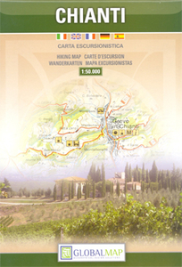
Chianti Stanfords
£10.99
Vouchers
No voucher codes found.
Do you know a voucher code for this product or supplier? Add it to Insights for others to use.
Do you know a voucher code for this product or supplier? Add it to Insights for others to use.
 Denmark