
 United Kingdom
 France
 Germany
 Netherlands
 Sweden
 USA
USA
 Italy
Italy
 Spain
Spain
More From Contributor


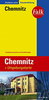
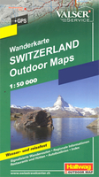
Chemnitz And Environs
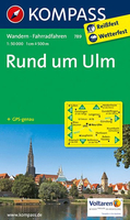
Chemnitz and Environs (No. 817), a detailed, GPS compatible map at 1:50, 000 from Kompass with local and long-distance footpaths, cycling routes, accommodation, etc, printed on durable, waterproof and tear-resistant synthetic paper.KOMPASS HIKING & RECREATIONAL MAPS:This title is part of an extensive series covering Austria, much of Germany and the Slovenian Alps. Kompass are Europe’s largest publishers of hiking maps; their mapping of other countries, including expanding coverage of Italy, is listed on our website separately.CARTOGRAPHY:The maps are contoured with additional shading, graphic relief and colouring to provide a more detailed picture of the terrain, vegetation and/or land use. Contour interval varies from 10m in the coastal areas of Northern Germany to 40 or 50
metres in the mountainous regions. All the maps highlight local and long-distance waymarked footpaths, including climbing trails. Most titles also show cycling routes, mountain bike trails, and, the in mountainous areas, ski routes. The maps indicate various types of accommodation (selected inns and hotels, youth hostels, campsites, mountain refuges), as well as recreational facilities, places of interest, etc. Latest editions also show access by public transport with bus stops and/or Park+Ride facilities.GEOGRAPHICAL COORDINATES:Unless indicated to the contrary in the individual description, the maps have a UTM grid for GPS users. MAP LEGEND:Most maps now include full English legend, particularly titles covering the Alpine areas. Some maps covering mainly eastern Austria or
the less popular parts of Germany may still have a legend in German only.OTHER FEATURES:Selected titles include on the reverse panorama drawings of their area with names of villages, peaks, valleys, etc. and/or have a booklet with pictures of local wild flowers with their Latin names. Many titles are now published as competitively priced sets of two or more maps, offering a wider coverage.BOOKLETS: PLEASE NOTE BEFORE ORDERING! Many titles come with a booklet describing the area and/or various hiking routes. Unless indicated in the individual description that the booklet includes English, these booklets are IN GERMAN only. The booklets are not necessary to use the maps since, as stated above, full English language map legend is provided.
Product Description
Reviews/Comments
Add New
Intelligent Comparison
Archived Product
Ulm And Environs Stanfords
£10.95
Archived Product

Munich And Environs Stanfords
£9.99
Archived Product
Berlin And Environs Stanfords
£10.99
Archived Product
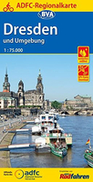
Dresden And Environs Stanfords
£10.99
Archived Product
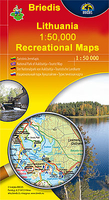
Vilnius And Environs Stanfords
£9.95
Archived Product
Vilnius And Environs Stanfords
£9.95
Archived Product
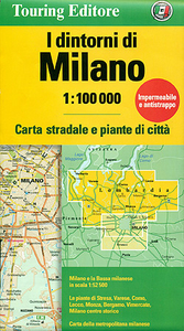
Milan And Environs Stanfords
£8.99
Archived Product
Basel And Environs Stanfords
£19.99
Vouchers
No voucher codes found.
Do you know a voucher code for this product or supplier? Add it to Insights for others to use.
Do you know a voucher code for this product or supplier? Add it to Insights for others to use.
 Denmark