More From Contributor
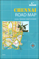
£19.95
One of the titles in a series of regional street atlases providing detailed mapping of the main urban conurbations in Germany. The plans name all the individual streets & indicate all the main landmarks & public buildings. All public transport facilities are shown: buses, trams, underground & overland rail lines. One way streets & car parks are indicated. Each atlas also

Includes::
enlargements showing town centres at a more detailed scale, a general road map of the area, & diagrams of motorways with exits & service areas. The plans also show the postal divisions & have an extensive street index which, where appropriate, shows individual postal codes for each street. Map legend

Includes::
English. In this atlas: the area around Chemnitz & Zwickau, including Altenburg, Gera, Glauchau, Freiberg, Greiz, Plauen, Bautzen, & Annaberg-Bucholz.


...
Archived Product
£11.50
Chemnitz & Environs (No. 817), a detailed, GPS compatible map at 1:50, 000 from Kompass with local & long-distance footpaths, cycling routes, accommodation, etc, printed on durable, waterproof & tear-resistant synthetic paper.KOMPASS HIKING & RECREATIONAL MAPS: This title is part of an extensive series covering Austria, much of Germany & the Slovenian Alps. Kompass are Europe’s largest publishers of hiking maps; their mapping of other countries, including expanding coverage of Italy, is listed on our website separately.CARTOGRAPHY: The maps are contoured with additional shading, graphic relief & colouring to provide a more detailed picture of the terrain, vegetation and/or land use. Contour interval varies from 10m in the coastal areas of Northern Germany to 40 or 50 metres in the mountainous regions. All the maps highlight local & long-distance waymarked footpaths, including climbing trails. Most titles also show cycling routes, mountain bike trails, &, the in mountainous areas, ski routes. The maps indicate various types of accommodation (selected inns & hotels, youth hostels, campsites, mountain refuges), as well as recreational facilities, places of interest, etc. Latest editions also show access by public transport with bus stops and/or Park+ Ride facilities.GEOGRAPHICAL COORDINATES: Unless indicated to the contrary in the individual description, the maps have a UTM grid for GPS users. MAP LEGEND: Most maps now include full English legend, particularly titles covering the Alpine areas. Some maps covering mainly eastern Austria or the less popular parts of Germany may still have a legend in German only.OTHER
Features: Selected titles include on the reverse panorama drawings of their area with names of villages, peaks, valleys, etc. and/or have a booklet with pictures of local wild flowers with their Latin names. Many titles are now published as competitively priced sets of two or more maps, offering a wider coverage.BOOKLETS: PLEASE NOTE BEFORE ORDERING! Many titles come with a booklet describing the area and/or various hiking routes. Unless indicated in the individual description that the booklet

Includes::
English, these booklets are IN GERMAN only. The booklets are not necessary to use the maps since, as stated above, full English language map legend is provided.


...
Archived Product
£7.99
Falk, one of Germany`s leading publishers of street plans, produce their town plans in two different formats. Falk Extra plans are folded in a standard way, where the whole map can be opened to view the entire area it covers. For larger cities, the same mapping is also published with a special folding system designed to show only a small section of the map at one time. The whole map can be opened but it will be cut in several places. Many find these street plans very user-friendly & easier to handle than conventional maps. The plans, which cover towns with their outer suburbs, indicate main landmarks & public buildings & show all the public transport facilities, one way streets & car parks. Plans of lager cities include a separate map of the town centre at a more detailed scale & a diagram of the underground & the suburban rail network. The plans also show the postal divisions & have an extensive street index which, where appropriate, shows individual postal codes for each street. Map legend

Includes::
English. Falk Extra plans also include on the reverse a road map of the surrounding area.

...
Archived Product
£8.99
Chennai & Tamil Nadu in the Footprint Focus Guides, which are targeted at cities, regions & countries worldwide that have no, or very limited, coverage from other publishers. Widely recognised for their reliability & independent writing style, Footprint Focus guides all have the same layout. Smaller than their sister Handbooks, the Focus guides are intended to streamline the information contained so that you have more of what you need, without losing Footprint ...
Archived Product
£4.95
Map of the city & suburbs from Ennore in the north-east to Tambaram in the south-west, (an area measuring approx 42x 30km). Road detail does not include minor roads. Detail

Includes::
one-way streets, railways, locality names, parks, wooded areas. Symbols denote places of worship & a range of essential services & locations of interest eg. police, hospitals, post offices, museums, cinemas, monuments, etc. Indexed on reverse, which also has useful information for visitors.

...
Archived Product
£10.95
Paperback, 17x 24cm, 187-page atlas of Chennai, including Tambaram, Ambattur, Ennore & Omr, showing names of local neighbourhoods & streets with house numbers. The whole area is covered at 1:12, 500, with the city centre at 1:6, 250. The atlas has very well designed, clear cartography, with colours indicating residential & industrial areas, slums, shopping streets & centres, parks & gardens, & wooded areas. Street information

Includes::
dual carriageways, flyovers, one way streets, traffic lights & pedestrian subways. Railways are shown with stations. A very vide range of symbols indicate various facilities & places of interest, including banks, taxi stands, fuel supplies, monuments & museums, restaurants & hotels, places of worship, police stations, post offices, electricity/water/sewer complaint offices, etc. Extensive index

Includes::
separate lists of various institutions & facilities, from airlines & travel agencies, apartments & art & cultural institutions to sport complexes, tourist information centres & water features.


...
Archived Product
£9.99
Explore one of Tamil Nadu`s many grand Hindu temples, stopping to savour the smell of jasmine garlands piled up before carved granite gods. Crane your neck to see the top of these towering pyramid-like temples adorned with the statues of deities, warriors & dancers. Escape the heat by following the footsteps of the British colonialists into the charming hill stations, or go surround yourself by nature in the blue Nilgiri mountains. Featuring detailed coverage of this wonderfully diverse region, Footprint Focus Chennai & Tamil Nadu will prove an invaluable companion. Essentials section with practical tips on getting there & around. Background section with fascinating information on the region`s unique history, culture & cuisine. Comprehensive listings of where to eat, sleep & play including festivals & horse riding. Detailed street maps for important cities & towns. Slim enough to fit in your pocket. Loaded with advice & information, this concise Footprint Focus guide will help you get the most out of Tamil Nadu without weighing you down. The content of the Footprint Focus Chennai & Tamil Nadu guide has been extracted from Footprint`s India Handbook. ...
Archived Product
£14.99
Chennai & Tamil Nadu in the Green Guide series from Michelin; detailed guides exploring the major sights & attractions of a range of cities, regions & countries. Drawing on a long publishing history, Michelin guides are renowned for their individual ‘star rating’, ranking restaurants, sights & attractions. Listings in each guide are organised alphabetically, allowing readers to access information quickly as well as being designed for practical use on the road. With an emphasis on cultural activities & history, each sight is graded & has extensive background information. Practical visitor information is clearly highlighted with symbols. Predominantly recognised for their extensive coverage of French regions (shown on our website in a separate series), the Green Guides also cover international destinations. An extensive introductory section on planning your trip provides information on when & where to go, useful pre-trip information, getting there, where to stay & eat & what to do & see. There are also individual sections on Nature, History & Art ad Culture & a selection of driving tours of the area. Fold-out maps at the front & back of the book give an overview of the area covered by the guide. The structure of each guide varies depending on the type of destination. National & regional guides cover regions alphabetically, each with their own accommodation, sights & food & drink listings, while City guides cover sights alphabetically with one city-wide section for listings. Accommodation & food & drink listings are both concise & comprehensive, aiming to cater for all budgets & tastes. Both sights & listings often include information specific to travelling with kids. Each of the places covered in the guide is listed alphabetically & three Michelin star ratings
- highly recommended, recommended & interesting, which have been used for more than 100 years
- help readers identify places of interest, restaurants & notable local attractions. Individual listings include principal sights for each city or town, local walking & driving tours in addition to tips on local excursions. There is also an ‘address book’ information box in each section including recommendations for the best restaurants & accommodation in the area, as well as any relevant leisure activities. A series of overview regional & city plans also helps navigation & orientation for each region.

...
Archived Product
£29.95
One of the maps in the topographic survey of Peru from the country’s national survey organization, Instituto Geográfico Nacional. Contours are at 25m intervals & colouring/symbols indicate different types of terrain & vegetation. Some of the maps may contain small blank spaces representing as yet unmapped areas. Each sheet covers 30’ latitude by 30’ longitude. The maps have a 1km UTM grid & margin ticks for latitude & longitude at intervals of 1’. Publication dates vary; most maps were published in 1960s to 1990s, with some sheets revised more recently. Map legend is in Spanish only, except in the more recent editions which also include English. ...
Archived Product

Chennai (Madras)

Indexed street plan of Chennai (Madras) covering the city with its outer districts including Tambaram, Ambattur and Ennore, plus a road map of the surrounding region and a booklet with practical information and descriptions of main sights.The plan shows names of local neighbourhoods (colonies) and districts. Only main streets are named, principal traffic routes are highlighted, and the plan also shows one way streets and locations of petrol stations. Symbols indicate locations of various facilities and places of interest. The index has lists of hotels and guest houses, foreign missions, railway stations, temples, etc.Also provided is a road map of the northern part of Tamil Nadu and the adjoining southern part of Andhra Pradesh, plus an overview road map of the whole of India for
route planning. Accompanying 15-page booklet has notes on the city’s history and main sights, as well as lists of hotels and other useful information.
RIP - This product is no longer available on our network. It was last seen on 25.09.2019

This page now acts as a permanent archive for this product. Add more information using the comments box below to ensure it can still be found by future generations.

Use our search facility to see if it is available from an alternative contributor.
  • External links may include paid for promotion
  • Availability: Out Of Stock
  • Supplier: Stanfords
  • SKU: 9789380262345
Availability: In Stock
£4.99

Product Description

Indexed street plan of Chennai (Madras) covering the city with its outer districts including Tambaram, Ambattur & Ennore, plus a road map of the surrounding region & a booklet with practical information & descriptions of main sights. The plan shows names of local neighbourhoods (colonies) & districts. Only main streets are named, principal traffic routes are highlighted, & the plan also shows one way streets & locations of petrol stations. Symbols indicate locations of various facilities & places of interest. The index has lists of hotels & guest houses, foreign missions, railway stations, temples, etc. Also provided is a road map of the northern part of Tamil Nadu & the adjoining southern part of Andhra Pradesh, plus an overview road map of the whole of India for route planning. Accompanying 15-page booklet has notes on the city’s history & main sights, as well as lists of hotels & other useful information.

Reviews/Comments

Add New

Intelligent Comparison

Oooops!
We couldn't find anything!
Perhaps this product's unique.... Or perhaps we are still looking for comparisons!
Click to bump this page and we'll hurry up.

Price History

Vouchers

No voucher codes found.
Do you know a voucher code for this product or supplier? Add it to Insights for others to use.

Facebook

Jargon Buster

India - A subcontinent in Asia
History - Anything that happens in the past. An acedemic subject.
Road - a manmade lane or a path that is used to speed up travel.
Practical - Weather a task is easy to carry out and realistically succeed.

Supplier Information

Stanfords
Stanfords was established in 1853 and opened their iconic Covent Garden flagship store in 1901. They have become the top retailer of maps, travel books and accessories in the UK and arguably offer the largest selection of maps and travel books worldwide. Famous names such as Captain Robert Falcon Scott, Ranulph Fiennes and Michael Palin have purchased from Stanfords. They now have a shop in Bristol and both stores together with other venues operate a calendar of events including talks, book signings and exhibitions. As a specialist map retailer, the map selection is comprehensive and includes road maps, street maps and walking maps from worldwide destinations, as well as a selection of world atlases and wall maps. Books include travel guides and travel literature. Stanfords also stock globes, from miniatures made of blue marble to magnificent floor-standing globes. The website features a selection of interesting articles on travel topics.
Page Updated: 2023-11-12 20:15:36

Community Generated Product Tags

Oh No! The productWIKI community hasn't generated any tags for this product yet!
Menu