
 United Kingdom
 France
 Germany
 Netherlands
 Sweden
 USA
USA
 Italy
Italy
 Spain
Spain
More From Contributor


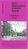

Castleton 1908
Castleton in 1908 in a fascinating series of reproductions of old Ordnance Survey plans in the Alan Godfrey Editions, ideal for anyone interested in the history of their neighbourhood or family. Selected towns in Great Britain and Ireland are covered by maps showing the extent of urban development in the last decades of the 19th and early 20th century.In this title: the map covers Castleton, just south of Rochdale, with features including the massive Globe Works (for textile machinery), railway station, Arrow Mill, Harp Mill, tramway along the Manchester Road, Globe leather works, Castleton iron works, Bluepits Mill, Linden Mill, Albion Mill, Westbrooke Mill, St Martin's church, railway junctions with a portion of the line to Heywood, Manchet Hall, Marland Mill, Castleton
Moor Mill. On the south side of the town are Trub, Fox Hill, Castleton Works (disused), Royle Hill, Royle, Trows Farm. On the reverse is a directory of Castleton in 1918 plus a railway timetable for the Manchester-Rochdale-Todmorden line in 1914. About the Alan Godfrey Editions of the 25
Moor Mill. On the south side of the town are Trub, Fox Hill, Castleton Works (disused), Royle Hill, Royle, Trows Farm. On the reverse is a directory of Castleton in 1918 plus a railway timetable for the Manchester-Rochdale-Todmorden line in 1914. About the Alan Godfrey Editions of the 25
Product Description
Reviews/Comments
Add New
Intelligent Comparison
Archived Product

Castleton 1908 Stanfords
£3.50
Archived Product

Castleford 1905 Stanfords
£3.50
Archived Product
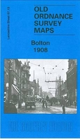
Bolton 1908 Stanfords
£3.50
Vouchers
No voucher codes found.
Do you know a voucher code for this product or supplier? Add it to Insights for others to use.
Do you know a voucher code for this product or supplier? Add it to Insights for others to use.
 Denmark