
 United Kingdom
 France
 Germany
 Netherlands
 Sweden
 USA
USA
 Italy
Italy
 Spain
Spain
More From Contributor


Bulgaria Michelin
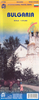
Bulgaria at 1:700, 000 on an indexed road map from Michelin, with street plans of central Sofia, Plovdiv and Varna, a distance table, plus basic traffic regulations. Names of towns and villages are given in both Cyrillic and Latin alphabet.Road network is presented graded according to the width and the number of lanes, indicating full/limited interchanges, toll barriers, driving distances, steep sections, seasonal closures, fords, etc. The map also shows scenic routes. Railway lines are included and local airports are marked. Locations of particular interest are highlighted and symbols mark sites such as wooden churches and historic buildings, antiquities, rock carvings, viewpoints, etc.The map also shows internal administrative boundaries. Names of towns and villages are
given in both Cyrillic and Latin alphabets; names of provinces and of geographical features are in Latin alphabet only. Topography is indicated by relief shading with colouring for the forested areas. National parks are highlighted. Latitude and longitude lines are drawn at intervals of 30’. The index is next to the map. Multilingual map legend includes English.Also provided are street plans of central Sofia, Ploviv and Varna. Street names are in both scripts – names of important buildings are in French.
given in both Cyrillic and Latin alphabets; names of provinces and of geographical features are in Latin alphabet only. Topography is indicated by relief shading with colouring for the forested areas. National parks are highlighted. Latitude and longitude lines are drawn at intervals of 30’. The index is next to the map. Multilingual map legend includes English.Also provided are street plans of central Sofia, Ploviv and Varna. Street names are in both scripts – names of important buildings are in French.

Product Description
Reviews/Comments
Add New
Intelligent Comparison
Archived Product
Austria Michelin Stanfords
£5.99
Archived Product
Hungary Michelin Stanfords
£5.99
Archived Product
Australia Michelin Stanfords
£5.99
Archived Product

Cuba Michelin Stanfords
£5.99
Archived Product

Croatia Michelin Stanfords
£5.99
Archived Product
Romania Michelin Stanfords
£5.99
Archived Product
Tunisia Michelin Stanfords
£5.99
Archived Product
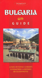
Bulgaria Guide Stanfords
£13.95
Vouchers
No voucher codes found.
Do you know a voucher code for this product or supplier? Add it to Insights for others to use.
Do you know a voucher code for this product or supplier? Add it to Insights for others to use.
 Denmark