More From Contributor
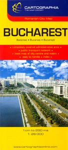
£6.99
Sailing across the Caribbean, Hector Lynch falls into the hands of the notorious buccaneer, Captain John Coxon. Hector's two friends, Dan & Jacques, are released when Coxon mistakes Hector as the nephew of Sir Thomas Lynch the Governor of Jamaica
- an error that Hector encourages. Coxon delivers Hector to Sir Henry Morgan, a bitter enemy of Governor Lynch. The captain is expecting to curry favour with Henry Morgan but is publicly humiliated at a Christmas ball held in Morgan's grand Jamaican home when it is revealed that Hector is not a member of the Governor's family. From then on, Coxon seeks to revenge himself on Hector & the young seafarer finds himself on the run again. On his new journey he falls in love for the first time, gets caught in a deadly hurricane & merely survives another shipwreck. Eventually he teams up again with his old friends Dan, Jacques & the group joins an expedition along the Panama coast. Their aim is to raid one of the biggest Spanish gold mines, but their plans are soon interfered by some angry Spaniards & their clash has even more dramatic consequences.
...
Archived Product
£8.50
This map of the Selkirk & Hawick areas
- the heart of Britain's horse-riding country
- has been specially produced for horse

...
Archived Product
£6.00
Bucegi Mountains at 1:50, 000 on a contoured map highlighting hiking routes, with a street plan of Sinaia showing tourist accommodation. Topography is shown by contours at 100m intervals with additional colouring for woodlands. An overprint highlights hiking routes, indicating their waymarking signs. Also marked are mountain huts. The map has no geographical coordinates. Map legend

Includes::
English. On the reverse are notes on the area, lists of mountain shelters, plus descriptions of 33 routes
- all in Romanian only.


...
Archived Product
£6.00
Bucegi Mountains at 1:50, 000 on a contoured map from Bel Alpin, highlighting local waymarked hiking routes, listed on the reverse side with markings & timings, plus a street plan of Sinaia showing locations of hotels. The map shows the topography by contours at 100m intervals & additional colouring for woodlands. An overprint highlights hiking routes, indicating their waymarking signs & cross-referencing them to a list of 47 routes on the reverse side. Also marked are mountain huts, churches & monasteries, etc. The map has no geographical coordinates. Map legend

Includes::
English. Half of the reverse side it taken by English language information about the area, including lists of accommodation facilities. 47 routes are listed with their marking signs & timings, including where appropriate warnings against attempting the route in bad weather conditions or in winter.

...
Archived Product
£8.50
The city with its suburbs & an enlargement for the centre. Coverage extends from Lacul Pantelimon in the east to Lacul Moril in the west, & from Lacul Grivita in the north to the Buna Vestire cemetery in the south. Detail

Includes::
car parks, petrol stations, metro & railway lines & stations, parks, cemeteries, police stations, hospitals, monuments, museums, public buildings industrial areas & places of worship. An inset at 1:10, 000 shows the city centre in greater detail. Map legend

Includes::
English. Street index is on the reverse of the map.


...
Archived Product
£4.99
Handy size plan of the city with its inner suburbs at 1:20, 000 & an enlargement for the central part at 1:15, 000. Underground & tram lines & stations are highlighted, alongside notable buildings & places of interest. A range of symbols denotes many specific features e.g. churches, hotels, markets, filling stations, museums, car parks, hospitals. Many locations are numbered & listed, together with the street index, on the reverse. Map legend

Includes::
English.

...
Archived Product
£6.99
This is the savvy city breakers' pocket guide to seeing & doing more in the Romanian capital
- with a fun-seeking & cost-conscious
...
Archived Product
£4.99
The city with its suburbs & an enlargement for the centre. Coverage extends from Lacul Pantelimon in the east to Lacul Moril in the west, & from Lacul Grivita in the north to the Buna Vestire cemetery in the south. Detail

Includes::
car parks, petrol stations, metro & railway lines & stations, parks, cemeteries, police stations, hospitals, monuments, museums, public buildings industrial areas & places of worship. An inset at 1:10, 000 shows the city centre in greater detail. Map legend

Includes::
English. Street index is on the reverse of the map.


...
Archived Product
£16.95
Spiral-bound, indexed street atlas of the city & the surrounding districts, with lists of public transport lines, hotels, museums, theatres, hospitals, etc. Municipal boundaries are drawn, notable buildings, parks & places of interest are marked & a range of symbols denotes specific features e.g. hotels & campsites, museums & monuments, bus terminals, hospitals, etc. The plan also shows public transport lines (rail, metro, tram, trolleybus, bus) & stations are marked The city centre is shown in greater detail & clarity at 1:10, 000, & there are also plans of the Romexpo centre & the city Metro network. Bus, tram & trolleybus routes are listed, also addresses of many other useful locations, e.g. embassies, hotels, public offices & hospitals. Street index lists locations outside the city’s administrative area separately. Map legend

Includes::
English.

...
Archived Product
£12.99
Map No. 1135, Buchs, in the topographic survey of Switzerland at 1:25, 000 from Bundesamt für Landestopographie (swisstopo), covering the whole country on 247 small format sheets, with special larger maps published for popular regions including some titles now available in hiking versions. Highly regarded for their superb use of graphic relief & hill shading, the maps give an almost 3-D picture of Switzerland`s mountainous terrain. Contours are at 10 m intervals, with 20m intervals in the mountainous areas. All the maps have a 1-km grid for Swiss national coordinates (datum CH 1903). * Small format sheets (Nos. 1011
- 1374)* Map legend in the language of the area covered by the map. Additional margin ticks show latitude & longitude in steps of 2`. The area covered by each map is 17 x 12 km (11 x 7 miles approx). * Special larger sheets (Nos. from 2501 onwards) – STANDARD editions:* No map legend is included but a separate leaflet can be provided instead. The area covered by each map is 25 x 17 km (15 x 11 miles approx).* Special larger sheets (Nos. from 2501 onwards) – HIKING editions:* An overprint highlights hiking, mountain & alpine paths, including regional & national long-distance trails. The maps also show bus routes with bus stops, plus inns in remote locations. The area covered by each map is 25 x 17 km (15 x 11 miles approx).
...
Archived Product

Bucharest

Plan of the city with its outer suburbs, showing administrative districts. An enlargement at 1:10, 000 shows the centre, a diagram shows the metro network, and a road map at 1:300, 000 covers the environs of the capital. Both the main plan and the enlargement show bus, trolleybus, tram, metro and railway lines. A range of symbols denotes important buildings, churches, hotels, shopping centres, museums, campsites, police stations, hospitals, etc. Street index is on the reverse. Map legend includes English.
RIP - This product is no longer available on our network. It was last seen on 25.09.2019

This page now acts as a permanent archive for this product. Add more information using the comments box below to ensure it can still be found by future generations.

Use our search facility to see if it is available from an alternative contributor.
  • Availability: Out Of Stock
  • Supplier: Stanfords
  • SKU: 9789633527535
Availability: In Stock
£7.99

Product Description

Plan of the city with its outer suburbs, showing administrative districts. An enlargement at 1:10, 000 shows the centre, a diagram shows the metro network, & a road map at 1:300, 000 covers the environs of the capital. Both the main plan & the enlargement show bus, trolleybus, tram, metro & railway lines. A range of symbols denotes important buildings, churches, hotels, shopping centres, museums, campsites, police stations, hospitals, etc. Street index is on the reverse. Map legend

Includes::
English.

Reviews/Comments

Add New

Price History

Vouchers

No voucher codes found.
Do you know a voucher code for this product or supplier? Add it to Insights for others to use.

Facebook

Jargon Buster

police - Persons empowered to reduce civil disorder and enforce the law.
Network - A link and communication between things. Often computers or people.
Road - a manmade lane or a path that is used to speed up travel.
Tram - A large vehicle common in cities for public transport, also known as a cable car.

Supplier Information

Stanfords
Stanfords was established in 1853 and opened their iconic Covent Garden flagship store in 1901. They have become the top retailer of maps, travel books and accessories in the UK and arguably offer the largest selection of maps and travel books worldwide. Famous names such as Captain Robert Falcon Scott, Ranulph Fiennes and Michael Palin have purchased from Stanfords. They now have a shop in Bristol and both stores together with other venues operate a calendar of events including talks, book signings and exhibitions. As a specialist map retailer, the map selection is comprehensive and includes road maps, street maps and walking maps from worldwide destinations, as well as a selection of world atlases and wall maps. Books include travel guides and travel literature. Stanfords also stock globes, from miniatures made of blue marble to magnificent floor-standing globes. The website features a selection of interesting articles on travel topics.
Page Updated: 2023-11-12 20:15:36

Community Generated Product Tags

Oh No! The productWIKI community hasn't generated any tags for this product yet!
Menu