More From Contributor

£6.00
Bucegi Mountains at 1:50, 000 on a contoured map highlighting hiking routes, with a street plan of Sinaia showing tourist accommodation. Topography is shown by contours at 100m intervals with additional colouring for woodlands. An overprint highlights hiking routes, indicating their waymarking signs. Also marked are mountain huts. The map has no geographical coordinates. Map legend

Includes::
English. On the reverse are notes on the area, lists of mountain shelters, plus descriptions of 33 routes
- all in Romanian only.


...
Archived Product
£6.00
Bucegi Mountains at 1:50, 000 on a contoured map from Bel Alpin, highlighting local waymarked hiking routes, listed on the reverse side with markings & timings, plus a street plan of Sinaia showing locations of hotels. The map shows the topography by contours at 100m intervals & additional colouring for woodlands. An overprint highlights hiking routes, indicating their waymarking signs & cross-referencing them to a list of 47 routes on the reverse side. Also marked are mountain huts, churches & monasteries, etc. The map has no geographical coordinates. Map legend

Includes::
English. Half of the reverse side it taken by English language information about the area, including lists of accommodation facilities. 47 routes are listed with their marking signs & timings, including where appropriate warnings against attempting the route in bad weather conditions or in winter.

...
Archived Product
£8.50
The city with its suburbs & an enlargement for the centre. Coverage extends from Lacul Pantelimon in the east to Lacul Moril in the west, & from Lacul Grivita in the north to the Buna Vestire cemetery in the south. Detail

Includes::
car parks, petrol stations, metro & railway lines & stations, parks, cemeteries, police stations, hospitals, monuments, museums, public buildings industrial areas & places of worship. An inset at 1:10, 000 shows the city centre in greater detail. Map legend

Includes::
English. Street index is on the reverse of the map.


...
Archived Product
£7.99
Plan of the city with its outer suburbs, showing administrative districts. An enlargement at 1:10, 000 shows the centre, a diagram shows the metro network, & a road map at 1:300, 000 covers the environs of the capital. Both the main plan & the enlargement show bus, trolleybus, tram, metro & railway lines. A range of symbols denotes important buildings, churches, hotels, shopping centres, museums, campsites, police stations, hospitals, etc. Street index is on the reverse. Map legend

Includes::
English.

...
Archived Product
£4.99
Handy size plan of the city with its inner suburbs at 1:20, 000 & an enlargement for the central part at 1:15, 000. Underground & tram lines & stations are highlighted, alongside notable buildings & places of interest. A range of symbols denotes many specific features e.g. churches, hotels, markets, filling stations, museums, car parks, hospitals. Many locations are numbered & listed, together with the street index, on the reverse. Map legend

Includes::
English.

...
Archived Product
£4.99
The city with its suburbs & an enlargement for the centre. Coverage extends from Lacul Pantelimon in the east to Lacul Moril in the west, & from Lacul Grivita in the north to the Buna Vestire cemetery in the south. Detail

Includes::
car parks, petrol stations, metro & railway lines & stations, parks, cemeteries, police stations, hospitals, monuments, museums, public buildings industrial areas & places of worship. An inset at 1:10, 000 shows the city centre in greater detail. Map legend

Includes::
English. Street index is on the reverse of the map.


...
Archived Product
£16.95
Spiral-bound, indexed street atlas of the city & the surrounding districts, with lists of public transport lines, hotels, museums, theatres, hospitals, etc. Municipal boundaries are drawn, notable buildings, parks & places of interest are marked & a range of symbols denotes specific features e.g. hotels & campsites, museums & monuments, bus terminals, hospitals, etc. The plan also shows public transport lines (rail, metro, tram, trolleybus, bus) & stations are marked The city centre is shown in greater detail & clarity at 1:10, 000, & there are also plans of the Romexpo centre & the city Metro network. Bus, tram & trolleybus routes are listed, also addresses of many other useful locations, e.g. embassies, hotels, public offices & hospitals. Street index lists locations outside the city’s administrative area separately. Map legend

Includes::
English.

...
Archived Product
£12.99
Map No. 1135, Buchs, in the topographic survey of Switzerland at 1:25, 000 from Bundesamt für Landestopographie (swisstopo), covering the whole country on 247 small format sheets, with special larger maps published for popular regions including some titles now available in hiking versions. Highly regarded for their superb use of graphic relief & hill shading, the maps give an almost 3-D picture of Switzerland`s mountainous terrain. Contours are at 10 m intervals, with 20m intervals in the mountainous areas. All the maps have a 1-km grid for Swiss national coordinates (datum CH 1903). * Small format sheets (Nos. 1011
- 1374)* Map legend in the language of the area covered by the map. Additional margin ticks show latitude & longitude in steps of 2`. The area covered by each map is 17 x 12 km (11 x 7 miles approx). * Special larger sheets (Nos. from 2501 onwards) – STANDARD editions:* No map legend is included but a separate leaflet can be provided instead. The area covered by each map is 25 x 17 km (15 x 11 miles approx).* Special larger sheets (Nos. from 2501 onwards) – HIKING editions:* An overprint highlights hiking, mountain & alpine paths, including regional & national long-distance trails. The maps also show bus routes with bus stops, plus inns in remote locations. The area covered by each map is 25 x 17 km (15 x 11 miles approx).
...
Archived Product
£12.99
Get up close with the hippogriff from the Harry Potter films in this exciting customisable book & model set. This book provides a behind-the-scenes look at how Buckbeak was imagined, designed & brought to life for the Harry Potter films. Readers will learn how the film-makers crafted Buckbeak`s magnificent appearance & how Harry was able to take flight during Hagrid`s first Care of Magical Creatures class. You`ll even get to participate in the magic by building your own Buckbeak with the included do-it-yourself wood model & painting it any way you like! Features easy-to-assemble laser-cut wood pieces, step-by-step instructions, colouring & crafting ideas, & a character guide book featuring interviews from cast & crew of the Harry Potter films, plus film-making & special effects secrets. ...
Archived Product
£3.50
Buckhurst Hill in 1914 in a fascinating series of reproductions of old Ordnance Survey plans in the Alan Godfrey Editions, ideal for anyone interested in the history of their neighbourhood or family. About the Alan Godfrey Editions of the 25” OS Series: Selected towns in Great Britain & Ireland are covered by maps showing the extent of urban development in the last decades of the 19th & early 20th century. The plans have been taken from the Ordnance Survey mapping & reprinted at about 15 inches to one mile (1:4, 340). On the reverse most maps have historical notes & many also include extracts from contemporary directories. Most maps cover about one mile (1.6kms) north/south, one & a half miles (2.4kms) across; adjoining sheets can be combined to provide wider coverage.FOR MORE INFORMATION & A COMPLETE LIST OF ALL AVAILABLE TITLES PLEASE CLICK ON THE SERIES LINK. ...
Archived Product

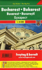
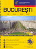
Bucharest City Spot Guide SUPERCEDED

This is the savvy city breakers' pocket guide to seeing and doing more in the Romanian capital - with a fun-seeking and cost-conscious slant. It features practical accommodation, restaurant and nightlife listings to suit varied budgets and tastes. This book features imaginative suggestions that reveal each city's hidden gems. It has a compact format which quickly locates the top must-see and do attractions. It contains 6 full-color maps and 35 photographs. It presents foreign language phrases on inside front and back covers for ease of use.
RIP - This product is no longer available on our network. It was last seen on 25.09.2019

This page now acts as a permanent archive for this product. Add more information using the comments box below to ensure it can still be found by future generations.

Use our search facility to see if it is available from an alternative contributor.
  • Availability: Out Of Stock
  • Supplier: Stanfords
  • SKU: 9781848480780
Availability: In Stock
£6.99

Product Description

This is the savvy city breakers' pocket guide to seeing & doing more in the Romanian capital
- with a fun-seeking & cost-conscious slant. It features practical accommodation, restaurant & nightlife listings to suit varied budgets & tastes. This book features imaginative suggestions that reveal each city's hidden gems. It has a compact format which quickly locates the top must-see & do attractions. It contains 6 full-color maps & 35 photographs. It presents foreign language phrases on inside front & back covers for ease of use.

Reviews/Comments

Add New

Intelligent Comparison

Oooops!
We couldn't find anything!
Perhaps this product's unique.... Or perhaps we are still looking for comparisons!
Click to bump this page and we'll hurry up.

Price History

Vouchers

No voucher codes found.
Do you know a voucher code for this product or supplier? Add it to Insights for others to use.

Facebook

Jargon Buster

compact - Carefuly designed to ensure an item has a minimal physical size
Fun - Something that provides amusement or enterainment
Language - the method of communication used in different areas. Humans and computers have many different languages.
Compact - something that has a lot combined within a small space.
Accommodation - A room in which someone can live in, for example in a hotel
Practical - Weather a task is easy to carry out and realistically succeed.
Pocket - A bag shaped insert in clothing used to carry items
Language - The way humans communicate either written and spoken.

Supplier Information

Stanfords
Stanfords was established in 1853 and opened their iconic Covent Garden flagship store in 1901. They have become the top retailer of maps, travel books and accessories in the UK and arguably offer the largest selection of maps and travel books worldwide. Famous names such as Captain Robert Falcon Scott, Ranulph Fiennes and Michael Palin have purchased from Stanfords. They now have a shop in Bristol and both stores together with other venues operate a calendar of events including talks, book signings and exhibitions. As a specialist map retailer, the map selection is comprehensive and includes road maps, street maps and walking maps from worldwide destinations, as well as a selection of world atlases and wall maps. Books include travel guides and travel literature. Stanfords also stock globes, from miniatures made of blue marble to magnificent floor-standing globes. The website features a selection of interesting articles on travel topics.
Page Updated: 2023-11-12 20:15:36

Community Generated Product Tags

Oh No! The productWIKI community hasn't generated any tags for this product yet!
Menu