
 United Kingdom
 France
 Germany
 Netherlands
 Sweden
 USA
USA
 Italy
Italy
 Spain
Spain
More From Contributor


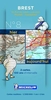
Brest
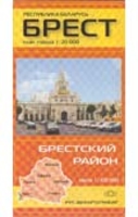
Indexed streetmap of the whole city. Detail includes unsurfaced roads, tracks, railways, post offices, hospitals, places of worship, car parks, petrol stations, mechanics.On the reverse is a 1:100, 000 road map of the province around the city.All text is in Belarussian.

Product Description
Reviews/Comments
Add New
Intelligent Comparison
Archived Product

Brest Stanfords
£8.50
Archived Product

Brent Stanfords
£12.99
Archived Product

Beast Stanfords
£7.99
Archived Product

Breath Stanfords
£8.99
Archived Product

Bereft Stanfords
£10.99
Archived Product

Breath Stanfords
£8.99
Archived Product
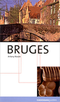
Bruges Stanfords
£10.99
Archived Product
Bucharest Stanfords
£7.99
Vouchers
No voucher codes found.
Do you know a voucher code for this product or supplier? Add it to Insights for others to use.
Do you know a voucher code for this product or supplier? Add it to Insights for others to use.
 Denmark