More From Contributor

£8.99
Indexed streetmap of the whole city. Detail

Includes::
unsurfaced roads, tracks, railways, post offices,

...
Archived Product
£8.50
Street plan of Brest at 1:13, 000 in extensive series of street plans of French towns from Blay-Foldex, the country’s largest, oldest & most experienced publisher of urban mapping. Blay plans include outer suburbs &, where appropriate, adjoining localities forming part of the urban agglomeration & provide brief descriptions of the town’s main sights, contact details for hotels & other places of interest, etc. The plans show one way streets, car parks & pedestrian zones. Important public buildings are clearly marked & identified. Blay street maps are usually double-sided & include an enlargement for the town centre & a street index with separate lists of “edifices publics”: main public buildings, places of worship, schools, sport facilities, stations, etc. Each of the outer suburbs or the adjoining localities, identified with its postcode, has a separate index. Many titles also provide a road map of the environs. All the text is in French only.PLEASE NOTE: to see the list of Blay-Foldex street plans of French towns & cities please click on the series link – the series description also

Includes::
a comparison between Blay & IGN street plans.

...
Archived Product
£12.99
Topographic survey of France at 1:25, 000 in IGN`s excellent TOP25 / Série Bleue series. All the maps are GPS compatible, with a 1km UTM grid plus latitude & longitude lines at 5’ intervals. Contours are at 5m intervals except for mountainous areas where the maps have contours at 10m intervals, vividly enhanced by hill shading & graphics for rocky terrain. Colouring with graphics indicates different types of vegetation or land use (deciduous or coniferous forests, moors, orchards, vineyards, etc). PLEASE NOTE: coverage of France at this scale is currently being revised – the format & the presentation of each title are indicated by the letters at the end of its Sheet Reference number (e.g. 0416ET, 3531ETR, 1923SB, etc.)MAPS WITH FULL TOURIST OVERPRINT & AN ENGLISH MAP LEGEND: all TOP25 maps & the SB editions of Série Bleue have an overprint highlighting waymarked walking trails including long-distance GR routes &, where appropriate, ski routes. Symbols indicate campsites, gîtes d’etape, refuges, equestrian centres & other recreational facilities or sites, tourist information centres, cultural heritage, etc. Towns & locations of particular interest are highlighted.- ET or OT = single-sided TOP25 map covering approx. 29x 21 km / 18x 13 miles.- ETR or OTR = waterproof & tear resistant TOP25 map covering the same area as the corresponding ET or OT number, but double-sided, printed on a smaller size sheet with a good overlap between the sides.- SB = Série Bleue map with full tourist overprint; these maps, first introduced in summer 2014, each cover approx. 29x 24km / 18x 15 miles.SÉRIE BLEUE maps with numbers ending in E (Est) or O (Ouest): most editions now indicate the GR routes, but do not show any other tourist information. Map legend is in French only. Each map covers approx. 14x 20km / 9x 12 miles. ...
Archived Product
£6.99
Brest Michelin Centenary Map-Pack, a set of two maps showing the area at 1:200, 000: a current road map from 2014 plus a reproduction from Michelin’s very first series of regional maps published between 1910 & 1924. The combination of the two maps shows not only how this area & its road network have developed but also provides an interesting comparison of the changes in the cartographic presentation over the past 100 years. The maps cover the northern coastline of Western Brittany, including St-Pol-de-Léon, Lannion, Morlaix, Perros-Guirec & Guingamp. The 2014 map is indexed & has a map legend in French only. To see the full list of the titles available in this series please click on the series link. ...
Archived Product
£10.99
Le Carnet is a new Michelin collection that makes travel a unique experience. This guide gives the traveler the possibility to create their stay according to their wishes, to personalize their trip, to adapt the program along the way. The Michelin Carnet has chosen the essential of each region: the must-have, but also, for those who have already seen everything or want to taste more unusual, original experiences. ...
Archived Product
£15.99
Bretagne Sud Guide Vert *FRENCH Edition* in Michelin’s Green Guide series covering France, with all the regions available either in English editions or in French versions. Drawing on Michelin’s long experience, the guides are renowned for their individual ‘star rating’ of sights & attractions. Listings in each guide are organized alphabetically, allowing readers to access information quickly. Towns are given overall star rating, with their sights & attractions also rated individually. Where appropriate, a street plan of the town centre is provided, indicating car parks & accompanied by an index of main streets & a list of sights highlighted on it. For many towns a recommended sightseeing tour is also marked on the plan. Entries for important churches are accompanied by detailed plans. Recommended car tours have overview maps showing road numbers & locations of the sights. Where necessary, the guides give opening hours & contact details. Many entries have an “ Address Book” section with Michelin’s recommendations for where to stay & where to eat. Each guide has a very extensive introductory section with practical information & pre-trip tips, chapters on history, art & culture (particularly strong on architectural styles, explained by excellent drawings), fauna & flora, etc. Fold-out flaps in the book covers provide an overview of the recommended sights and/or car tours.* * French language guides* have a larger number of individual entries than included in the corresponding English titles, as well as more exhaustive descriptions, with wider coverage of local history and/or famous people connected with a given location.* * English language guides* have more recommendations for car tours. The “ Address Book” sections often include shopping suggestions. ...
Archived Product
£11.50
Topographic survey of France at 1:25, 000 in IGN`s excellent TOP25 / Série Bleue series. All the maps are GPS compatible, with a 1km UTM grid plus latitude & longitude lines at 5’ intervals. Contours are at 5m intervals except for mountainous areas where the maps have contours at 10m intervals, vividly enhanced by hill shading & graphics for rocky terrain. Colouring with graphics indicates different types of vegetation or land use (deciduous or coniferous forests, moors, orchards, vineyards, etc). PLEASE NOTE: coverage of France at this scale is currently being revised – the format & the presentation of each title are indicated by the letters at the end of its Sheet Reference number (e.g. 0416ET, 3531ETR, 1923SB, etc.)MAPS WITH FULL TOURIST OVERPRINT & AN ENGLISH MAP LEGEND: all TOP25 maps & the SB editions of Série Bleue have an overprint highlighting waymarked walking trails including long-distance GR routes &, where appropriate, ski routes. Symbols indicate campsites, gîtes d’etape, refuges, equestrian centres & other recreational facilities or sites, tourist information centres, cultural heritage, etc. Towns & locations of particular interest are highlighted.- ET or OT = single-sided TOP25 map covering approx. 29x 21 km / 18x 13 miles.- ETR or OTR = waterproof & tear resistant TOP25 map covering the same area as the corresponding ET or OT number, but double-sided, printed on a smaller size sheet with a good overlap between the sides.- SB = Série Bleue map with full tourist overprint; these maps, first introduced in summer 2014, each cover approx. 29x 24km / 18x 15 miles.SÉRIE BLEUE maps with numbers ending in E (Est) or O (Ouest): most editions now indicate the GR routes, but do not show any other tourist information. Map legend is in French only. Each map covers approx. 14x 20km / 9x 12 miles. ...
Archived Product
£12.99
Topographic survey of France at 1:25, 000 in IGN`s excellent TOP25 / Série Bleue series. All the maps are GPS compatible, with a 1km UTM grid plus latitude & longitude lines at 5’ intervals. Contours are at 5m intervals except for mountainous areas where the maps have contours at 10m intervals, vividly enhanced by hill shading & graphics for rocky terrain. Colouring with graphics indicates different types of vegetation or land use (deciduous or coniferous forests, moors, orchards, vineyards, etc). PLEASE NOTE: coverage of France at this scale is currently being revised – the format & the presentation of each title are indicated by the letters at the end of its Sheet Reference number (e.g. 0416ET, 3531ETR, 1923SB, etc.)MAPS WITH FULL TOURIST OVERPRINT & AN ENGLISH MAP LEGEND: all TOP25 maps & the SB editions of Série Bleue have an overprint highlighting waymarked walking trails including long-distance GR routes &, where appropriate, ski routes. Symbols indicate campsites, gîtes d’etape, refuges, equestrian centres & other recreational facilities or sites, tourist information centres, cultural heritage, etc. Towns & locations of particular interest are highlighted.- ET or OT = single-sided TOP25 map covering approx. 29x 21 km / 18x 13 miles.- ETR or OTR = waterproof & tear resistant TOP25 map covering the same area as the corresponding ET or OT number, but double-sided, printed on a smaller size sheet with a good overlap between the sides.- SB = Série Bleue map with full tourist overprint; these maps, first introduced in summer 2014, each cover approx. 29x 24km / 18x 15 miles.SÉRIE BLEUE maps with numbers ending in E (Est) or O (Ouest): most editions now indicate the GR routes, but do not show any other tourist information. Map legend is in French only. Each map covers approx. 14x 20km / 9x 12 miles. ...
Archived Product
£9.99
Towards the end of the war as the Germans are in their final retreat in November 1918, a British raiding party stumbles across a strange & eerie scene in a ruined chateau, under fire. Following the strains of a familiar tune, & understandably perplexed as to who would be playing the piano in the midst of shellfire, they discover a German officer lying dead at the keys, next to a beautiful woman in full evening dress, also deceased. But the officer is the spitting image of G B Bretherton, a British officer missing in action... So follows a tale of mystery & identity, first published in 1930, which is not only an authentic account of conditions at the Front, but also a remarkable thriller, with a highly unusual plot, which won Bretherton comparisons to John Buchan & the best of the espionage writers. John Squire, the influential editor of the London Mercury said `of the English war-books, undoubtedly the best is Bretherton.` The Morning Post thought it `one of the best of the English war novels. I do not expect anything much better.` The Sunday Times pinpointed its dual attraction: it was both `a mystery as exciting as a good detective story & an extraordinarily vivid account of trench-warfare`. ...
Archived Product
£9.95
Breuil-Cervinia
- Matterhorn
- Zermatt area straddling the border of Italy & Switzerland on a GPS compatible hiking & recreational

...
Archived Product

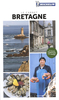
Bretagne Nord Guide Vert Michelin - FRENCH Edition

Bretagne Nord Guide Vert *FRENCH Edition* in Michelin’s Green Guide series covering France, with all the regions available either in English editions or in French versions. Drawing on Michelin’s long experience, the guides are renowned for their individual ‘star rating’ of sights and attractions. Listings in each guide are organized alphabetically, allowing readers to access information quickly. Towns are given overall star rating, with their sights and attractions also rated individually. Where appropriate, a street plan of the town centre is provided, indicating car parks and accompanied by an index of main streets and a list of sights highlighted on it. For many towns a recommended sightseeing tour is also marked on the plan. Entries for important churches are accompanied
by detailed plans. Recommended car tours have overview maps showing road numbers and locations of the sights. Where necessary, the guides give opening hours and contact details. Many entries have an “Address Book” section with Michelin’s recommendations for where to stay and where to eat. Each guide has a very extensive introductory section with practical information and pre-trip tips, chapters on history, art and culture (particularly strong on architectural styles, explained by excellent drawings), fauna and flora, etc. Fold-out flaps in the book covers provide an overview of the recommended sights and/or car tours.* *French language guides* have a larger number of individual entries than included in the corresponding English titles, as well as more exhaustive descriptions,
with wider coverage of local history and/or famous people connected with a given location.* *English language guides* have more recommendations for car tours. The “Address Book” sections often include shopping suggestions.
RIP - This product is no longer available on our network. It was last seen on 25.09.2019

This page now acts as a permanent archive for this product. Add more information using the comments box below to ensure it can still be found by future generations.

Use our search facility to see if it is available from an alternative contributor.
  • Availability: Out Of Stock
  • Supplier: Stanfords
  • SKU: 9782067206892
Availability: In Stock
£15.99

Product Description

Bretagne Nord Guide Vert *FRENCH Edition* in Michelin’s Green Guide series covering France, with all the regions available either in English editions or in French versions. Drawing on Michelin’s long experience, the guides are renowned for their individual ‘star rating’ of sights & attractions. Listings in each guide are organized alphabetically, allowing readers to access information quickly. Towns are given overall star rating, with their sights & attractions also rated individually. Where appropriate, a street plan of the town centre is provided, indicating car parks & accompanied by an index of main streets & a list of sights highlighted on it. For many towns a recommended sightseeing tour is also marked on the plan. Entries for important churches are accompanied by detailed plans. Recommended car tours have overview maps showing road numbers & locations of the sights. Where necessary, the guides give opening hours & contact details. Many entries have an “ Address Book” section with Michelin’s recommendations for where to stay & where to eat. Each guide has a very extensive introductory section with practical information & pre-trip tips, chapters on history, art & culture (particularly strong on architectural styles, explained by excellent drawings), fauna & flora, etc. Fold-out flaps in the book covers provide an overview of the recommended sights and/or car tours.* * French language guides* have a larger number of individual entries than included in the corresponding English titles, as well as more exhaustive descriptions, with wider coverage of local history and/or famous people connected with a given location.* * English language guides* have more recommendations for car tours. The “ Address Book” sections often include shopping suggestions.

Reviews/Comments

Add New

Intelligent Comparison

Oooops!
We couldn't find anything!
Perhaps this product's unique.... Or perhaps we are still looking for comparisons!
Click to bump this page and we'll hurry up.

Price History

Vouchers

No voucher codes found.
Do you know a voucher code for this product or supplier? Add it to Insights for others to use.

Facebook

Jargon Buster

star - A giant ball of plasma held together by gravity.
France - A state situated in Western Europe with several overseas territories.
strong - A descriptive word for an item that has physical strength
History - Anything that happens in the past. An acedemic subject.
Car - A machine used for transport which runs on roads
Language - the method of communication used in different areas. Humans and computers have many different languages.
Road - a manmade lane or a path that is used to speed up travel.
Practical - Weather a task is easy to carry out and realistically succeed.
Experience - To gain further knowledge by practising.
Individual - A single separate item or person.
Language - The way humans communicate either written and spoken.

Supplier Information

Stanfords
Stanfords was established in 1853 and opened their iconic Covent Garden flagship store in 1901. They have become the top retailer of maps, travel books and accessories in the UK and arguably offer the largest selection of maps and travel books worldwide. Famous names such as Captain Robert Falcon Scott, Ranulph Fiennes and Michael Palin have purchased from Stanfords. They now have a shop in Bristol and both stores together with other venues operate a calendar of events including talks, book signings and exhibitions. As a specialist map retailer, the map selection is comprehensive and includes road maps, street maps and walking maps from worldwide destinations, as well as a selection of world atlases and wall maps. Books include travel guides and travel literature. Stanfords also stock globes, from miniatures made of blue marble to magnificent floor-standing globes. The website features a selection of interesting articles on travel topics.
Page Updated: 2023-11-12 20:15:36

Community Generated Product Tags

Oh No! The productWIKI community hasn't generated any tags for this product yet!
Menu