
 United Kingdom
 France
 Germany
 Netherlands
 Sweden
 USA
USA
 Italy
Italy
 Spain
Spain
More From Contributor
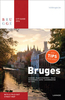


Bruges Flexi Map
Bruges on a laminated, tear-resistant Insight Flexi Map with an indexed street plan of the city, a street plan of Ghent, a road map of West Flanders highlighting places of interest and WWI battlefields, plus extensive tourist information.DESCRIPTION OF THE PREVIOUS EDITION:The main plan covers Bruges with its outer districts, clearly showing access to its historic centre, one way streets and car parks. Main public buildings, places of interest and selected hotels are prominently highlighted and named. A similar plan covers the historic centre of Ghent. Both plans are indexed for streets, points of interest and public buildings, plus in Bruges parks and hotels. An indexed map of West Flanders at 1:300, 000 shows the area
Product Description
Reviews/Comments
Add New
Intelligent Comparison
Archived Product
Budapest Flexi Map Stanfords
£4.99
Archived Product
Cyprus Flexi Map Stanfords
£4.99
Archived Product
Warsaw Flexi Map Stanfords
£4.99
Archived Product
Turkey Flexi Map Stanfords
£4.99
Archived Product
Baltimore Flexi Map Stanfords
£5.99
Archived Product
Marrakesh Flexi Map Stanfords
£4.99
Archived Product
Buenos Aires Flexi Map Stanfords
£4.99
Archived Product
Bahamas Flexi Map Stanfords
£4.99
Vouchers
No voucher codes found.
Do you know a voucher code for this product or supplier? Add it to Insights for others to use.
Do you know a voucher code for this product or supplier? Add it to Insights for others to use.
 Denmark