
 United Kingdom
 France
 Germany
 Netherlands
 Sweden
 USA
USA
 Italy
Italy
 Spain
Spain
More From Contributor


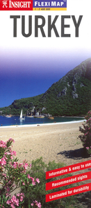
Turkey Flexi Map
Turkey on a laminated, tear-resistant Insight Flexi Map, with a road map of the country, a street plan of central Istanbul, an enlargement for the south-eastern part of the Turkish coast, plus extensive tourist information. On one side is a road map of Turkey at 1:2, 400, 000. Topography is shown by bold relief shading with names of various mountain ranges and spot heights. National parks are highlighted. The map presents the country’s road and rail networks, including selected local roads, with driving distance shown on main routes. Interesting towns and villages are highlighted and symbols mark locations of other sights. The map has no geographical coordinates and is indexed. On the reverse is an indexed street plan of central Istanbul. Public buildings, places of interest and
selected hotels are prominently highlighted. Metro stations are marked and the plan also shows the tram line linking the city’s historic heart with the northern side of the Golden Horn. Also included is and indexed road map at 1:900, 000 covering the south-western corner of the country along the Aegean coast around Bodrum, Marmaris and Fethiye.A special feature of the Insight Flexi series are panels with additional tourist information:- 19 main sights are given brief descriptions and are prominently highlighted on the relevant maps.- Further panels provide information on Getting Around and Facts for Visitors, including tourist information offices, public holidays, opening times, money, telecommunication and monthly climate charts.To see other titles in this series please click on
the series link.

Product Description
Reviews/Comments
Add New
Intelligent Comparison
Archived Product
Jersey Flexi Map Stanfords
£4.99
Archived Product
Phuket Flexi Map Stanfords
£4.99
Archived Product
Crete Flexi Map Stanfords
£4.99
Archived Product
Sydney Flexi Map Stanfords
£4.99
Archived Product
Taipei Flexi Map Stanfords
£4.99
Archived Product
France Flexi Map Stanfords
£6.99
Archived Product
Bruges Flexi Map Stanfords
£4.99
Archived Product
Dubrovnik Flexi Map Stanfords
£4.99
Vouchers
No voucher codes found.
Do you know a voucher code for this product or supplier? Add it to Insights for others to use.
Do you know a voucher code for this product or supplier? Add it to Insights for others to use.
 Denmark