
 United Kingdom
 France
 Germany
 Netherlands
 Sweden
 USA
USA
 Italy
Italy
 Spain
Spain
More From Contributor


Turkey F&B
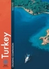
Turkey on a large, double-sided map from Freytag & Berndt, with a generous overlap between the two sides. A booklet attached to the map cover contains an index and a street plan of central Istanbul. Bold relief shading with colouring for wooded areas, names of mountain ranges and spot heights provide an effective picture of the country’s topography. Salt lakes and flats, swamps and protected areas are marked.The map shows the country’s rail and road networks, with selected secondary roads and tracks. Symbols highlight various places of interest, including archaeological sites, spas, etc. Internal administrative boundaries are prominently marked. The map has latitude and longitude lines at intervals of 1º. Map legend includes English.A booklet attached to the map cover contains
an index, with separate lists locations in the adjoining areas of the neighbouring countries, plus a street plan of central Istanbul.
an index, with separate lists locations in the adjoining areas of the neighbouring countries, plus a street plan of central Istanbul.

Product Description
Reviews/Comments
Add New
Intelligent Comparison
Archived Product

Turkey ITMB Stanfords
£9.99
Archived Product
Turkey Stanfords
£9.50
Archived Product
Turkey Stanfords
£5.50
Archived Product
Turkey Stanfords
£5.99
Archived Product
Turkey Stanfords
£14.39
Archived Product
Turkey Stanfords
£12.79
Archived Product
Turkey Stanfords
£5.99
Archived Product
Turkey Stanfords
£4.99
Vouchers
No voucher codes found.
Do you know a voucher code for this product or supplier? Add it to Insights for others to use.
Do you know a voucher code for this product or supplier? Add it to Insights for others to use.
 Denmark