
 United Kingdom
 France
 Germany
 Netherlands
 Sweden
 USA
USA
 Italy
Italy
 Spain
Spain
More From Contributor

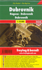
Dubrovnik Flexi Map
Dubrovnik on a laminated, tear-resistant Insight Flexi Map with an indexed street plan of the city, a detailed enlargement of its historic Old Town, a plan of the nearby Cavtat, a road map of the environs, plus extensive tourist information.The street plan of Dubrovnik is supplemented by a very clear and detailed enlargement at 1:3, 000 of its historic Old Town. Main public buildings, places of interest and selected hotels are prominently highlighted and named. The plan is indexed for streets, districts, parks, hotels, points of interest and public buildings. Also provided is a diagram of bus routes across the city.On the reverse, the coastal area around Dubrovnik is shown at 1:300, 000 on an indexed road map, with an additional street plan of Cavtat. Another road map shows the
wider part of the region, with the coastal area from Zadar to Tirana and inland beyond Sarajevo.A special feature of the Insight Flexi series are panels with additional tourist information: 33 main sights, neatly grouped into sections covering Major Attractions, Beaches, Shopping and Strolling, plus Day Trips and Boat Trips, are given brief descriptions and are prominently highlighted on the relevant maps. Further panels provide information on Getting Around and Facts for Visitors, including tourist information offices, public holidays, opening times, money, tipping, telecommunications and monthly climate charts.
wider part of the region, with the coastal area from Zadar to Tirana and inland beyond Sarajevo.A special feature of the Insight Flexi series are panels with additional tourist information: 33 main sights, neatly grouped into sections covering Major Attractions, Beaches, Shopping and Strolling, plus Day Trips and Boat Trips, are given brief descriptions and are prominently highlighted on the relevant maps. Further panels provide information on Getting Around and Facts for Visitors, including tourist information offices, public holidays, opening times, money, tipping, telecommunications and monthly climate charts.
Product Description
Reviews/Comments
Add New
Intelligent Comparison
Archived Product
Dubrovnik Flexi Map Stanfords
£4.99
Archived Product
Dubai Flexi Map Stanfords
£4.99
Archived Product
Dubai Flexi Map Stanfords
£4.99
Archived Product
Dubai Flexi Map Stanfords
£5.99
Archived Product
Dublin Flexi Map Stanfords
£4.99
Archived Product
Dublin Flexi Map Stanfords
£3.74
Archived Product
Umbria Flexi Map Stanfords
£4.99
Archived Product
Turkey Flexi Map Stanfords
£4.99
Vouchers
No voucher codes found.
Do you know a voucher code for this product or supplier? Add it to Insights for others to use.
Do you know a voucher code for this product or supplier? Add it to Insights for others to use.
 Denmark