
 United Kingdom
 France
 Germany
 Netherlands
 Sweden
 USA
USA
 Italy
Italy
 Spain
Spain
More From Contributor


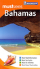


Bahamas Flexi Map
Durable, laminated tourist map with street plans and tourist information - one of the many handy-sized Flexi Maps by this publisher, impressive for the amount of information packed in a small format. The main map is at 1:1.7 million, showing the whole of the Bahamas, including the eastern coast of Florida, from Key Largo to Palm Beach. The reefs, Bahamas on a laminated, tear-resistant Insight Flexi Map, with additional, more detailed maps of New Providence, Eleuthera and Grand Bahama, street plan of Nassau and Freeport, all indexed, plus extensive tourist information.On one side an overview map shows the whole of the Bahamas at 1:1, 700, 000. The map is indexed for places, islands and points of interest. More detailed maps cover New Providence (1:155, 000), Eleuthera (1:500,
000) and Grand Bahama. The maps show the islands
000) and Grand Bahama. The maps show the islands
Product Description
Reviews/Comments
Add New
Intelligent Comparison
Archived Product
Barbados Flexi Map Stanfords
£4.99
Archived Product
Macau Flexi Map Stanfords
£4.99
Archived Product
Malta Flexi Map Stanfords
£4.99
Archived Product
Paris Flexi Map Stanfords
£4.99
Archived Product
Budapest Flexi Map Stanfords
£4.99
Archived Product
Thailand Flexi Map Stanfords
£4.99
Archived Product
Warsaw Flexi Map Stanfords
£4.99
Archived Product
Bruges Flexi Map Stanfords
£4.99
Vouchers
No voucher codes found.
Do you know a voucher code for this product or supplier? Add it to Insights for others to use.
Do you know a voucher code for this product or supplier? Add it to Insights for others to use.
 Denmark