More From Contributor

£3.50
A h&-drawn pre-Battle of the Somme map from the Royal Engineers of Thiepval Wood in a series of British Army trench maps from the ...
Archived Product
£6.99
The Alpine areas of Europe on a large overview road map at 1:800, 000 from Marco Polo Travel Publishing with special features to ...
Archived Product
£10.99
The Arran Coastal Way is one of Scotland`s newest long-distance walks, running around the coast of the Isle of Arran for 65 miles. ...
Archived Product
£13.10
A large 117x 72cm wall map of the world, with the world`s time zones are shown in stripes of alternating colour. International borders ...
Archived Product
£18.00
Tuscany in the Blue Guides series focuses primarily on cultural tourism for the visitor who wishes to understand more of what they ...
Archived Product
£14.99
The first one-volume walking guide in English to the most popular long-distance route in Europe walked by British tourists. With the ...
Archived Product
£11.99
The Valleys of the Meuse & the Chiers in a series of cycling maps from Sportoena covering Belgium & the adjoining regions of the neighbouring ...
Archived Product
£7.99
Twenty safe walks in the glorious Chiltern countryside. Simple routes with not too many hills, the walks are between 1 & 5 miles ...
Archived Product
£8.25
Map No. 59, Tipperary North-Central in the Discovery series from the OSI, the Ordnance Survey of Irel&, which presents the country ...
Archived Product
£8.25
Map No. 74, Tipperary South in the Discovery series from the OSI, the Ordnance Survey of Irel&, which presents the country on detailed ...
Archived Product

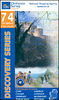
Bolzano Vignetei E Dolomiti / Southern South Tyrol Kompass 74

Map No. 74, Termeno/Tramin - Cavalese - with a panorama map on the reverse, from Kompass in a series of walking maps of selected areas of Italy at 1:50, 000, with hiking routes on a topographic base, various types of accommodation, recreational facilities,
RIP - This product is no longer available on our network. It was last seen on 25.09.2019

This page now acts as a permanent archive for this product. Add more information using the comments box below to ensure it can still be found by future generations.

Use our search facility to see if it is available from an alternative contributor.
  • Availability: Out Of Stock
  • Supplier: Stanfords
  • SKU: 9783854910848
Availability: In Stock
£9.99

Product Description

Map No. 74, Termeno/ Tramin
- Cavalese
- with a panorama map on the reverse, from Kompass in a series of walking maps of selected areas of Italy at 1:50, 000, with hiking routes on a topographic base, various types of accommodation, recreational facilities, places of interest, etc. Kompass are Europe’s largest publishers of walking maps, with extensive coverage of hiking areas in other countries, all listed on our website. The series covers the northern part of the Italian Alps, the lake region of Lombardy, the Dolomites, Italian Riviera, selected parts of Tuscany & Umbria, the Sorrento Peninsula, & the islands of the Tyrrhenian Sea.* Coverage of the Dolomites by Kompass at more detailed scales (mainly 1:25, 000) is listed on our website in a separate series.* Cartography:* contour interval varies from 100 metres in mountainous areas to 25 metres in the hills around Florence & Siena. All the maps highlight local hiking paths &, where appropriate, long-distance routes or _via ferrata_ trails, & show various types of accommodation such as selected inns & hotels, campsites, mountain huts & refuges, etc. Some titles also highlight cycle or mountain bike trails or ski routes. Selected titles include on the reverse panorama drawings of the area, as indicated in the individual descriptions.* Geographical coordinates:* most maps covering the Dolomites are now GPS compatible – coverage of other areas varies. Titles without geographical coordinates are annotated to that effect in their individual description.* Map legend

Includes::
English.**PLEASE NOTE BEFORE ORDERING!* * Booklets:* many titles come with booklets describing the area and/or various hiking routes. These booklets are in * Italian & German only*, apart from a handful of titles where an English language booklet is specifically indicated in the individual description. So, unless English language booklet is actually mentioned, the map can only be supplied with an Italian/ German booklet. These booklets are not necessary to use the maps since, as stated above, full English language map legend is provided.

Reviews/Comments

Add New

Intelligent Comparison

Oooops!
We couldn't find anything!
Perhaps this product's unique.... Or perhaps we are still looking for comparisons!
Click to bump this page and we'll hurry up.

Price History

Vouchers

No voucher codes found.
Do you know a voucher code for this product or supplier? Add it to Insights for others to use.

Facebook

Jargon Buster

GPS - Global Positioning System - Global position using satellites
Hiking - An outdoor activity envolving walking in nature
Italian - A word used ot descibe something from Italy
Metres - A unit of measure, one metre equals 100 centimetres
Italy - a country in Europe.
Language - the method of communication used in different areas. Humans and computers have many different languages.
Accommodation - A room in which someone can live in, for example in a hotel
Individual - A single separate item or person.
Language - The way humans communicate either written and spoken.

Supplier Information

Stanfords
Stanfords was established in 1853 and opened their iconic Covent Garden flagship store in 1901. They have become the top retailer of maps, travel books and accessories in the UK and arguably offer the largest selection of maps and travel books worldwide. Famous names such as Captain Robert Falcon Scott, Ranulph Fiennes and Michael Palin have purchased from Stanfords. They now have a shop in Bristol and both stores together with other venues operate a calendar of events including talks, book signings and exhibitions. As a specialist map retailer, the map selection is comprehensive and includes road maps, street maps and walking maps from worldwide destinations, as well as a selection of world atlases and wall maps. Books include travel guides and travel literature. Stanfords also stock globes, from miniatures made of blue marble to magnificent floor-standing globes. The website features a selection of interesting articles on travel topics.
Page Updated: 2023-11-12 20:15:36

Community Generated Product Tags

Oh No! The productWIKI community hasn't generated any tags for this product yet!
Menu